Flyability Inspector 4.0
Visualize, localize and document your inspections with Inspector 4.0. An easy-to-use software solution that enables asset operators to make quick data-driven decisions with a whole new level of accuracy.
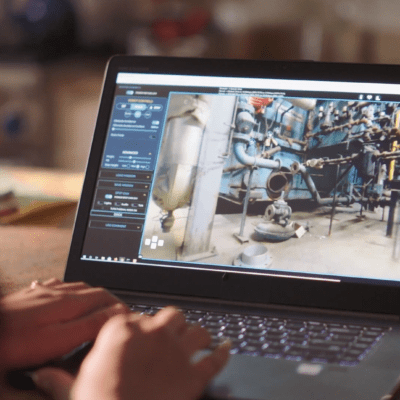
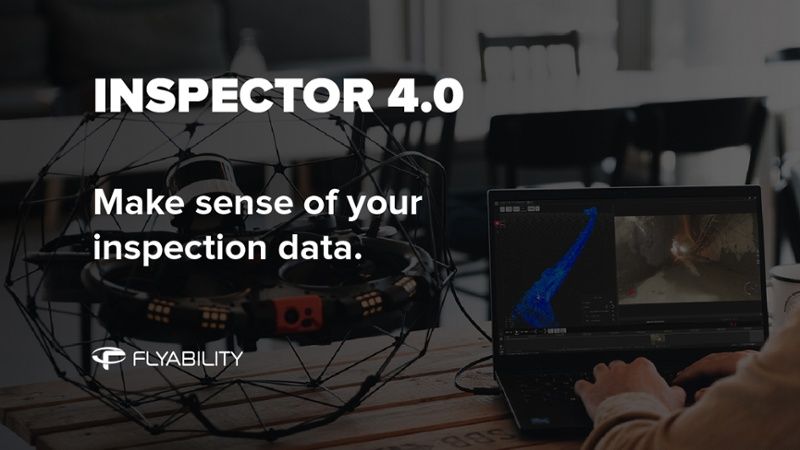
Inspector 4.0 turning raw data into valuable insights
Thanks to the Elios 3 LiDAR sensor, inspection data is now reported in a high-density point cloud of your asset, providing a whole new level of data accuracy and reliability.

Visualize data on a 3D map.
Navigate through a 3D model representation of your asset using pan, rotate and zoom functions. Click on a point of interest to bring up the corresponding frame in your mission video.

Analyze points of interest
In the video player, look through the video frames to choose the one that best shows your point of interest. Enhance your smaller visual features by zooming in and adjusting light and contrast. Capture its dimensions with the 2D Measure Tool.

Document and organize
Report your findings directly in the video player. Give your POI a name and a description. Sort them by criticality and organize them with custom tags.


Inspector 4.0 Shareable Report
Export your analysis and POI information to a PDF or Word document. Easily share it within your company or with your customers.
Downloading Inspector 4.0 for your Elios 3
Inspector 4.0 can be downloaded from Flyabilitys website and is free of charge for everyone. For Elios 2 users, Inspector 4.0 requires the purchase of an Inspector Premium license to create inspection maps using the mapping algorithm embedded in Inspector.