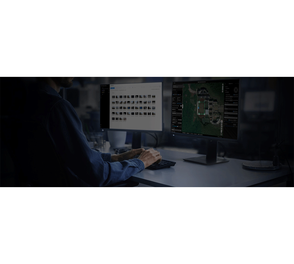
DJI FlightHub 2 is a comprehensive cloud-based drone operations management platform that provides real-time situational awareness.
FlightHub 2 supports mission planning, fleet management, and data synchronization across multiple devices. Key features include 2.5D mapping, live streaming, and remote maintenance, enhancing the efficiency and security of drone operations.
Equipment Type: Remote Operations Software
Benefits
Cloud-based platform for managing drone operations and data
Used for real-time fleet management, mission planning, and data analysis
Provides an integrated solution for industrial drone operations
Drone flights (real-time monitoring)
Construction sites
Bridges
Power lines
Wind turbines
Agricultural fields
Critical infrastructure
Large event venues
Industrial facilities (oil, gas, mining)
Coastal areas
Ports
Environmental monitoring zones
Geological survey sites
Natural resource management areas
Agriculture
Emergency response
Environmental
Oil & gas
Power & utilities
Public safety
Research & development
Urban planning
Construction
For Sale
Request a Quote
DJI FlightHub 2: 2.5D Base Map
DJI FlightHub 2 enhances operational planning by integrating elevation data with satellite maps, offering critical terrain awareness. It also displays GEO Zones, helping users navigate airspace restrictions and ensure safe, compliant flights. This advanced platform streamlines mission planning and execution for drone teams.
DJI FlightHub 2: Panorama Sync
DJI FlightHub 2 allows users to create a 360° overview and upload it to the cloud with just one tap. You can place these panoramas on a 2.5D base map, complete with the exact coordinates where they were captured, giving all team members instant situational awareness and improving coordination during missions.
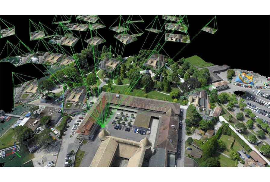
DJI FlightHub 2: Cloud Mapping
With the DJI M30 Series, up to 370 acres of visual mapping can be completed in a single flight. DJI FlightHub 2 supports 2D visual and thermal mapping, offering real-time area imaging. Images are automatically uploaded to FlightHub 2 during a mapping mission for seamless processing and analysis, ensuring up-to-date data for your operations.
DJI FlightHub 2: Mission Live Streaming
DJI FlightHub 2 enables low-latency, high-quality streaming from the M30 Series, H20 Series, and first-person camera views. It also allows you to display multiple drone streams simultaneously, enhancing real-time situational awareness for your entire team during missions.
DJI FlightHub 2: Mission Management
Create flight missions directly from your computer using the 2.5D Base Map.
Preview results for each mission point to ensure the flight route and quality of the data.
Pin photos to the 2.5D Base Map
Enable auto-synchronization of media to FlightHub2
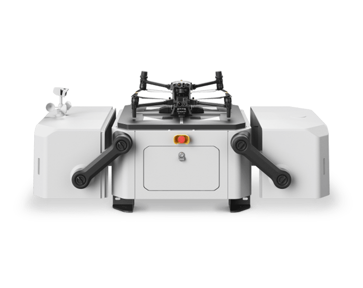
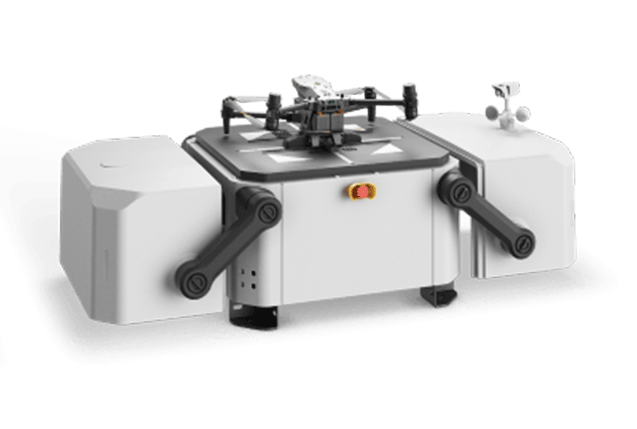
DJI Dock & the Matrice 30
For fully autonomous operations FlightHub2 Pairs with DJI Dock and the Matrice 30 where the drone can autonomously deploy, land, recharge and execute programmed missions.