Drone inspections are any inspection performed with a drone.
In a drone inspection, a drone collects inspection data remotely, allowing the inspector to get the data they need without having to collect it in person.
Visual inspections are by far the most common type of drone inspection.
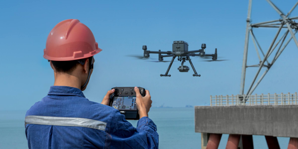
Using a drone, an inspector can fly to the top of a cell tower, deep inside a sewer system, or wherever it is that they need to collect visual inspection data.
Without the drone, the inspector would have to climb the cell tower, or enter the system system to get the data they need, which would be more dangerous, not to mention more complicated and expensive.
[Related read: The DJI Ban Explained—What You Need to Know]
But there are other types of drone inspections beyond visual inspections. These days, thermal sensors, LiDAR sensors, and other types of highly specialized sensors, like sensors for testing ultrasonic thickness, can all be used with drone technology for remote data collection.
In this in-depth guide to drone inspections we’ll cover the best inspection drones on the market, all the sensors inspectors use in their drone inspection work, how to decide whether to rent or buy an inspection drone, and several other topics to help you learn all there is about drone inspections.
See the menu to the right for everything we cover in this guide.
The Top 6 Inspection Drones on the Market [New for 2026]
When looking for an inspection drone you should start with your specific use case in mind:
- What are you inspecting?
- What kind of data do you need?
- Will you need any specialized drone software to get the outputs you need from your inspection data?
The answers to these questions will help you identify the technology you need.
For example, if you need visual data from inside a giant boiler, a professional indoor drone like Flyability’s Elios 3 may be the right platform. But if you need to do a cell tower inspection and collect both thermal and visual data, the Mavic 3 Thermal may be the right platform.
[Related read: Green UAS—The Full Green UAS Cleared List]
Here are our recommendations for the top inspection drones on the market for 2026:
- Flyability Elios 3—Indoor inspections
- Skydio X2 Enterprise—Outdoor inspections
- DJI Matrice 350 RTK—Outdoor inspections with an emphasis on mapping
- DJI Mavic 3 Thermal—Thermal inspections
- Voliro T Ultrasonic—UT inspections
- DJI Mavic 3 Multispectral—Agriculture inspections
Keep reading to learn more about each of these drones.
1. Flyability Elios 3
Main use case: Indoor inspections
Flyability’s Elios 3 is a game-changer in the realm of indoor inspections.
Made for operating particularly in challenging, hard-to-reach areas, the Elios 3’s core strengths lie in its collision-tolerant design and its integration of LiDAR technology for real-time 3D mapping, making it an powerful tool for industries that need to inspect confined spaces.
With its ability to generate survey-grade 3D models and provide comprehensive situational awareness, the Elios 3 significantly reduces the complexity and risks associated with traditional inspection methods.
Standout Features and Specs:
- LiDAR technology. Equipped with an Ouster OS0-32 LiDAR sensor, the Elios 3 can create detailed 3D models of the inspected area in real time, facilitating precise data collection for survey-grade mapping.
- FlyAware™ SLAM engine. This proprietary engine combines computer vision, LiDAR data, and a powerful NVidia graphic engine to offer centimeter-accurate indoor positioning, enabling the drone to navigate complex environments with unprecedented stability.
- Modular payload bay. Allows for the integration of various payloads, including a dedicated LiDAR payload and the ability to add another payload, making the Elios 3 adaptable to a wide range of inspection needs and future applications.
- Collision-tolerant design. Features a unique cage and reversing motors that allow the drone to recover from flipping upside down (called Turtle mode in consumer drones), ensuring uninterrupted operation in challenging environments.
- Ease of use. Designed to be user-friendly, the Elios 3 enables pilots of all skill levels to perform complex missions with minimal training, thanks to its advanced stabilization and intuitive control system.
2. Skydio X2 Enterprise
Main use case: Outdoor inspections
The Skydio X2 stands out for its ability to provide comprehensive insights and enhance operational safety, making it a top choice for inspectors seeking to leverage drone technology for efficient and precise evaluations.
The Skydio X2 comes with best-in-class autonomy, making it an indispensable tool for professionals in fields that require detailed, reliable data collection in challenging environments.
Standout Features and Specs:
- Dual camera system. Combines a 4K60P HDR color camera with a FLIR® 320p thermal sensor, enabling a broad spectrum of inspection capabilities from infrastructure health to heat signature detection.
- Advanced autonomy. Powered by Skydio Autonomy Engine, it features six 4K 200° navigation cameras for 360° obstacle avoidance, ensuring safe operation in complex environments.
- Rugged design. Constructed with magnesium and carbon fiber composites for durability, with foldable arms ensuring portability and rapid deployment.
Extended operational capabilities. Offers up to 35 minutes of flight time, with options for both 5GHz and 1.8GHz wireless communication, extending operational reach up to 6.2 miles (10km). - Night operations. Equipped with GPS night flight capabilities and strobing lights, the X2 is operational in low-light conditions, expanding the window for critical inspection tasks.
- Security and compliance. Emphasizes cybersecurity with encrypted firmware and data links, and adheres to the highest standards of supply chain security, being NDAA compliant. (Three versions of the Skydio X2 are on the Pentagon’s Blue UAS list: The X2D Color 1.8 GHz, X2D Color 5 GHz, and the X2D Multiband.)
Learn more about the Skydio X2 Enterprise.
3. DJI Matrice 350 RTK
Main use case: Outdoor inspections
The DJI Matrice 350 RTK elevates the standards for commercial drone operations with its state-of-the-art design and technological advancements.
This drone is engineered to deliver superior performance across a wide range of commercial applications, particularly in inspection tasks where precision and reliability are paramount.
With an upgraded IP55 rating, the Matrice 350 RTK offers enhanced protection against dust and water, making it suitable for challenging environments. Its integration with advanced DJI payloads and support for third-party accessories further extends its versatility in the field.
Standout Features and Specs:
- Max flight time. 55 minutes, providing extended periods of operation for comprehensive inspections without frequent landings for battery changes.
- Payload capacity. Capable of carrying up to 6 pounds (2.7 kg), allowing for the attachment of various inspection tools and sensors to meet specific operational needs.
- IP 55 rating. Offers a high level of protection against dust and water, ensuring reliable performance in adverse environmental conditions.
- Enhanced night vision. Equipped with a night vision FPV camera, enhancing operational capabilities in low-light conditions and ensuring safer navigation during night-time inspections.
- Advanced sensing and positioning. Features a 6-directional sensing system, providing exceptional situational awareness and obstacle avoidance to ensure safe flight operations in complex environments.
- O3 enterprise transmission. Offers a max transmission range of 12.4 miles (20 km) with upgraded O3 enterprise transmission, ensuring stable and clear video feeds even at extended distances.
- Dual-battery system. Includes a new TB65 dual-battery system that supports hot swapping, reducing downtime and increasing efficiency in the field.
Learn more about the DJI Matrice 350 RTK.
4. DJI Mavic 3 Thermal
Main use case: Thermal inspections
The DJI Mavic 3 Thermal (Mavic 3T) drone is a versatile and advanced tool designed for a wide range of applications, from infrastructure inspections to environmental monitoring.
Its integrated thermal imaging capabilities, combined with a high-resolution visual camera, allow for detailed and precise data collection in various conditions. Compact and foldable, the Mavic 3T is built for portability and ease of use, making it an essential tool for professionals requiring thermal insights on the go.
Standout Features and Specs:
- Thermal imagingThermal imaging. Equipped with a high-quality thermal camera, the Mavic 3T can detect heat signatures and provide critical data for emergency responders, wildlife conservationists, and infrastructure inspectors.
- Dual camera system. Features a dual camera setup that includes a thermal sensor for temperature measurement and a standard RGB camera for capturing high-resolution images and videos.
- Extended flight time. Offers up to 45 minutes of flight time, ensuring ample time to cover large areas or conduct thorough inspections without the need for frequent landings to recharge.
- Advanced obstacle avoidance. Integrates an omnidirectional obstacle sensing system, enhancing flight safety by automatically detecting and avoiding obstacles in its path, even in complex environments.
- High-resolution zoom. RGB camera includes a high-resolution zoom capability, allowing operators to closely inspect areas of interest without getting too close, preserving the safety of both the drone and the surrounding environment.
- RTK compatibility. Supports Real-Time Kinematic (RTK) positioning for enhanced accuracy in geotagging data, crucial for detailed mapping and precision inspections.
Learn more about the DJI Mavic 3 Thermal.
5. Voliro T Ultrasonic NDT Drone
Main use case: Ultrasonic thickness testing
The Voliro T is an advanced drone designed to perform ultrasonic non-destructive testing (NDT) inspections at heights that would otherwise require scaffolding or rope access for a person to reach them.
It’s equipped with a range of inspection sensors, making it highly capable of providing detailed insights into critical infrastructure. The drone’s design allows for physical interaction with structures, enabling precise measurements and the detection of corroded or eroded surfaces from a single side.
Standout Features and Specs:
- NDT payload bundle. Includes an Electromagnetic Acoustic Transducer (EMAT), Ultrasonic Transducer (UT), and a Dry Film Thickness (DFT) sensor, offering a comprehensive solution for wall thickness measurements and surface corrosion detection.
- Physical performance. Capable of applying a maximum force of 30N and various torques to structures, allowing for effective physical interaction.
- Flexibility. Features the ability to tilt up to +-90°, enabling interaction with structures in any orientation.
- Stability. Utilizes thrust-vectoring and 6DoF control for reliable interactions, even in challenging conditions.
- Autonomy. Offers semi-autonomous flight modes and advanced pilot assistance for a user-friendly flying experience, even in GPS-denied environments.
- Workflow integration. Designed with open interfaces for seamless communication with humans and machines, facilitating easy integration into existing workflows.
- Modular payloads. Supports custom payloads up to 2.2 pounds (1 kilogram), including two 4K cameras and a depth camera, for versatile application in inspections.
Learn more about the Voliro T Ultrasonic drone.
6. DJI Mavic 3 Multispectral
Main use case: Environmental monitoring
The DJI Mavic 3 Multispectral drone is engineered to bring advanced multispectral imaging capabilities into a compact and user-friendly platform.
Designed for precision agriculture, environmental monitoring, and land management, this drone integrates a powerful imaging system that includes a 20MP RGB camera and four 5MP multispectral sensors. This combination allows for detailed analysis of crop health, vegetation indices, and more, making it an invaluable tool for environmental scientists, agronomists, farmers, and civil engineers doing environmental monitoring.
Standout Features and Specs:
- Multispectral imaging system. Houses one 20MP RGB camera and four 5MP multispectral cameras (green, red, red edge, and near-infrared), enabling high-precision aerial surveys and detailed crop monitoring.
- RTK module. Includes an RTK module for centimeter-level positioning accuracy, enhancing the precision of aerial surveys and mapping without the need for ground control points.
- Extended flight time. Offers up to 43 minutes of flight time, allowing for comprehensive coverage of large areas up to 200 hectares in a single flight, maximizing efficiency in data collection.
- Sunlight sensor. Features a built-in sunlight sensor that captures solar irradiance, ensuring accurate light compensation for multispectral data and improving the consistency of imaging over time.
- Omnidirectional obstacle sensing. Equipped with multiple wide-FOV vision sensors for accurate obstacle detection in all directions, ensuring safe operation even in complex environments.
- Open ecosystem compatibility. Supports integration with third-party cloud platforms via DJI Cloud API and Mobile SDK 5, offering flexibility in data management and application development.
Learn more about the DJI Mavic 3 Multispectral.
Want to see more inspection drones? See our full list of industrial inspection drones.
Types of Sensors Used in Drone Inspections
As we covered above, visual sensors are by far the most common type of sensor used in drone inspections.
However, as drone technology and sensor technology develops, we’re seeing more and more uses for other types of sensors.
Here are the most common sensors used in drone inspections, listed roughly in order from the most to least common:
- Visual sensors
- Thermal sensors
- LiDAR sensors
- Multispectral Sensors
- Ultrasonic (UT) Sensors
- Gas Sensors
Keep reading to learn more about each of these sensors, including drones that support them and the industries in which they’re commonly used for inspections.
Visual Sensors
High-resolution inspection cameras capture detailed imagery, essential for visual assessments and general inspections.
Drones typically come equipped with visual sensors, but specialized high-resolution cameras may be added as an upgrade. After collecting raw visual data, some inspectors use video maker tools process it into a clean finished product.
Drones commonly used for visual inspections:
- The Matrice 350 RTK
- The Flyability Elios 3
Industries that do visual drone inspections:
- Oil and Gas
- Energy
- Infrastructure
Thermal Sensors
Infrared cameras detect heat variations, identifying energy leaks, moisture, and electrical issues.
A thermal sensor can be quite useful when looking for energy leakage in old buildings, and is also a common add-on for precision inspections that require thermal imaging.
Drones commonly used for thermal inspections:
- The DJI Mavic 3 Thermal
Industries that do thermal drone inspections:
- Energy
- Building inspections
- Infrastructure
LiDAR Sensors
LiDAR sensors use laser light to create detailed 3D maps, measuring distances accurately. LiDAR data can also be used in combination with SLAM (Simultaneous Localization and Mapping) to create 3D maps in real-time, as the Elios 3 indoor drone can.
LiDAR sensors are generally an add-on due to their specialized nature and the high precision required—but a LiDAR sensor comes with the Elios 3.
Drones commonly used for LiDAR inspections:
- The Flyability Elios 3
- The DJI Matrice 350 RTK
Industries that use LiDAR sensing for drone inspections:
- Oil and Gas
- Energy
- Infrastructure
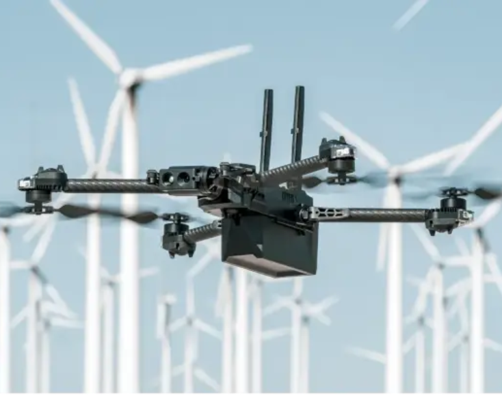
Multispectral Sensors
Multispectral sensors capture data across multiple wavelengths and are used for crop health analysis and environmental monitoring.
These sensors are often an add-on, and are tailored for agricultural and environmental applications. That being said, there are some drones made specifically for multispectral sensing, like the DJI Mavic 3 Multispectral.
Each sensor type equips drones with capabilities tailored to specific inspection needs, enhancing their utility across a broad range of industries.
Drones commonly used for collecting multispectral data:
- DJI Mavic 3 Multispectral
Industries that use multispectral sensors for drone inspections:
- Environmental Monitoring
- Agriculture
- Land Management
- Forestry
Ultrasonic (UT) Sensors
UT sensors employ sound waves to detect material flaws. They’re crucial for pipeline and structural inspections.
Given their specific application in industrial inspections, not to mention the complexity of performing ultrasonic thickness testing remotely, these types of sensors are typically an add-on to a drone platform.
But the Voliro T is a drone made specifically to enable UT testing, and both the best and only option for that type of drone inspection on the market that we know of.
Drones commonly used for UT testing:
- Voliro T Ultrasonic NDT Drone
Industries that use drones for UT testing:
- Oil & Gas
- Maritime
- Infrastructure
Gas Sensors
Gas sensors measure gas concentrations and are vital for air quality monitoring and leak detection.
Due to the specialized nature of gas detection tasks, these types of sensors are usually an add-on when it comes to drone payloads.
Drones commonly used for gas testing:
- DJI Matrice 350 RTK (with a custom add-on)
Industries that use drones for gas testing:
- Environmental Monitoring
- Chemical Manufacturing
- Energy
Should You Buy or Rent Your Inspection Drone?
When thinking about using drones for inspections, one of the first questions that comes up is: Should I buy or rent?
Deciding whether to buy or rent a drone for inspections hinges on your business’s specific requirements, frequency of use, and financial capacity.
For those engaged in regular inspection activities, purchasing might offer better long-term value. On the other hand, for businesses with sporadic needs or those keen on leveraging the latest technology without a hefty investment, renting could be the more strategic choice.
Here are the pros of each option:
Pros for Buying a Drone
- Long-term cost efficiency. Although the upfront cost is higher, owning a drone eliminates ongoing rental fees, making it a more economical choice for frequent use over several years.
- Tax deductions. Buying a drone for business purposes often qualifies for tax deductions, reducing the overall cost of acquisition through depreciation.
- Asset resale. As technology advances, you may decide to upgrade your equipment. Owning your drone gives you the flexibility to sell it, potentially recouping some of your initial investment.
Pros for Renting a Drone
- Reduced initial expense. Renting a drone minimizes the initial financial burden, making cutting-edge technology accessible without a significant investment.
- Flexibility. Rental agreements allow businesses to choose the latest models suited for specific projects without being tied to a single piece of equipment. This is particularly beneficial for one-off projects or infrequent inspection needs.
- No depreciation concerns. Renting avoids the pitfalls of equipment depreciation and obsolescence, ensuring you always have access to the latest technology without worrying about resale value.
Ultimately, the decision should align with your operational demands and financial considerations, ensuring that your investment in drone technology effectively supports your business objectives.
The 7 Benefits of Using Drones for Inspections
Why should you do drone inspections? This list of benefits presents seven compelling reasons.
1. Safety
A traditional visual inspection can put members of your team at risk. For example, performing roof inspections exposes your team to slip and fall hazards. You may also need to send an inspection team into a cramped, narrow space or up a tall building.
The use of commercial drones allows you to avoid sending team members into confined spaces or areas where they could face hazards. Instead, a drone operator remotely flies the machine, taking all the pictures and videos you want.
2. Savings
Many companies worry that the use of drone technology may increase inspection costs. However, a drone inspection costs less than in-person assessments in many cases, and typically leads to significant savings for most organizations.
Savings come from:
- Speeding up the inspection process, leading to savings in personnel costs.
- Avoiding the need for temporary structures like scaffolding, which can cost tens or even hundreds of thousands of dollars to erect and take down for a single inspection.
- Reducing downtimes, leading to savings from faster turnaround times.
3. Time Savings
Traditional methods for a manual inspection often consume a lot of time.
Performing a thorough inspection requires your team members to pause their other essential jobs, slowing down the overall flow of work.
Drone inspections help you save time, giving you more opportunities to work on other parts of your project. Drones cut down on time by allowing you to inspect large areas or difficult to access structures quickly.
4. Increased Frequency of Inspections
The cost of in-person traditional inspections can be so high that most companies only elect to do inspections as often as required by law.
But drone inspections lower costs so much that it can be possible for companies to make more frequent inspections, allowing you to surface potential issues earlier, and potentially prolonging the life of your assets.
5. Access to Confined, Hard-to-Reach Areas
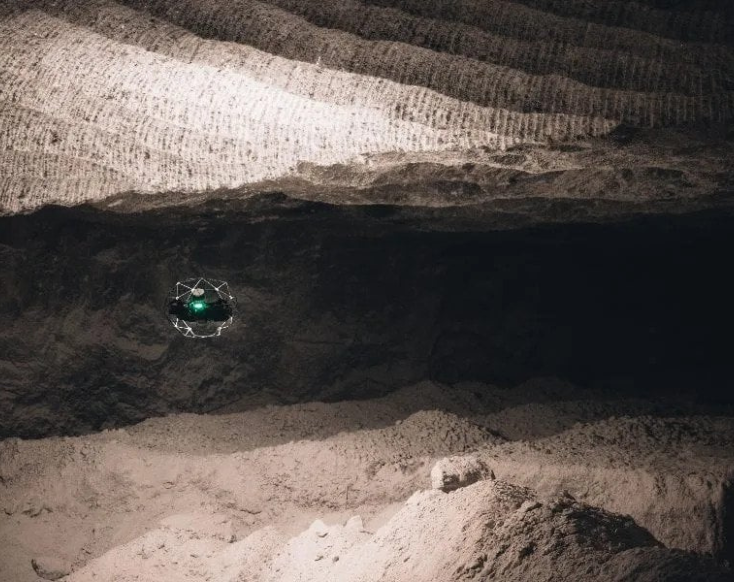
Drones made for indoor inspections like Flyability’s Elios 3 can give you access to structures and locations that are challenging or impossible to reach with traditional methods, letting you collect inspection data remotely that could be hard or even impossible to obtain otherwise.
6. Reduced Environmental Impact
Because they can collect data remotely, drones are less intrusive than in-person inspection methods, and often come with a smaller carbon footprint.
Drone inspections can also help the environment by increasing the frequency of inspections. When inspections are done more often, dangerous industrial assets are less likely to leak toxic substances, leading to a positive secondary impact on the environment.
7. Comprehensive Reporting
Drones facilitate detailed analysis and documentation of an inspection through advanced data capture and processing capabilities.
The comprehensive reporting you get from drone data can act as a snapshot in time of an asset’s condition, providing detailed images, video, and georeferenced 3D models that can serve as a reference for future maintenance efforts.
Legal Considerations for Doing Drone Inspections in the U.S.
If you decide to start a drone program at your company, you’ll need to navigate the rules for operating drones commercially in your country.
Here’s an overview of what you need to know:
- Follow the FAA’s Part 107 rules
- Do your research
- Look into local and state regulations
Follow the FAA’s Part 107 Rules
The FAA’s sUAS* Rules, commonly called the Part 107 rules, establish all of the rules a drone pilot needs to follow when flying a drone for work in the U.S.
(A drone inspection of any kind, even if performed as a favor or for an in-kind transaction, would be considered “work” in the eyes of the FAA.)
- Obtain a Remote Pilot Certificate, also called a Part 107 certificate, by passing an FAA-administered aeronautical knowledge test.
- Register the drone with the FAA, receiving a unique identification number that must be visibly labeled on the aircraft. Learn more about registering your drone.
- Operate the drone in Class G airspace unless authorized by the FAA to operate in controlled airspace.
- Keep the drone within visual line-of-sight (VLOS) at all times during the flight.
- Fly the drone at or below 400 feet above ground level (AGL) to avoid potential conflicts with manned aircraft.
- Ensure the drone does not fly over people or moving vehicles, maintaining a safe distance from populated areas.
*sUAS stands for small uncrewed aerial system.
Do Your Research
Before conducting a drone inspection, it’s crucial to research and understand the specifics of the airspace where the operation will occur.
- Airspace research. Use tools like the FAA’s B4UFLY app to look at the airspace where you plan to fly.
- Determine whether you need airspace authorization. Based on your airspace research you may find that you need airspace authorization. In some instances, you can get it instantly using an app that provides LAANC (Low Altitude Authorization and Notification Capability). Here are all the LAANC service providers (scroll down to the section titled “Approved LAANC UAS Service Suppliers).
- Look for TFRs. Temporary Flight Restrictions are temporary restrictions on certain types of flights, including drone operations, from specific areas due to events, security concerns, or other reasons. Always check for active TFRs in your intended area of operation to avoid inadvertently violating these restrictions. Check for TFRs.
Look into Local and State Regulations
Beyond federal regulations, drone pilots must also be mindful of state and local laws that may impose additional restrictions on drone operations.
These can vary widely and might include privacy laws, specific no-fly zones not covered by federal regulations, and additional registration or permitting requirements.
Our partner UAV Coach put together a master list of all state and local drone laws—check it out here.