
The Best Drones for Creating 3D Models [New for 2026]
1. Skydio X10
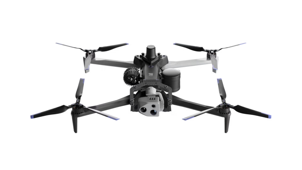
Flight time . 40 minutes Transmission range . 7.5 miles (12 km) Weight . 4.65 pounds (2.11 kg) Sensors . RGB camera, LiDAR sensor (Velodyne Puck Lite) LiDAR/Photogrammetry . Supports both LiDAR and photogrammetry
2. DJI Matrice 4
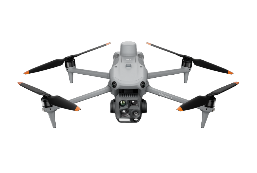
Flight time . 50 minutes Transmission range . 9.3 miles (15 km) Weight . 8.38 pounds (3.8 kg) Sensors . High-resolution RGB camera, supports LiDAR sensors LiDAR/Photogrammetry . Supports both LiDAR and photogrammetry
3. DJI Mavic 3 Enterprise

Flight time . 45 minutes Transmission range . 9.3 miles (15 km) Weight . 2.65 pounds (1.2 kg) Sensors . 20MP camera, optional LiDAR compatibility LiDAR/Photogrammetry . Primarily used for photogrammetry, but compatible with LiDAR
4. DJI Matrice 350 RTK
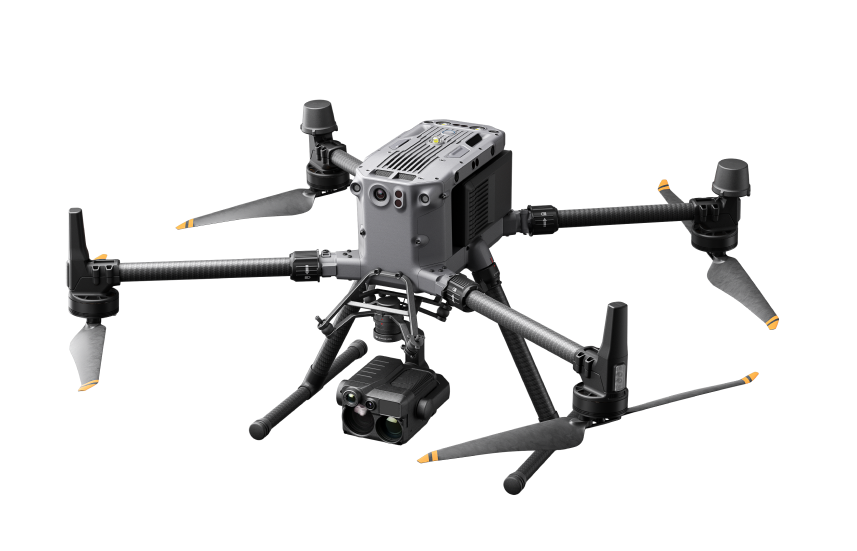
Flight time . 55 minutes Transmission range . 9.3 miles (15 km) Weight . 8.38 pounds (3.8 kg) Sensors . 45MP camera, RTK module, LiDAR compatibility (supports Zenmuse L1) LiDAR/Photogrammetry . Supports both LiDAR (Zenmuse L1) and photogrammetry
5. Flyability Elios 3
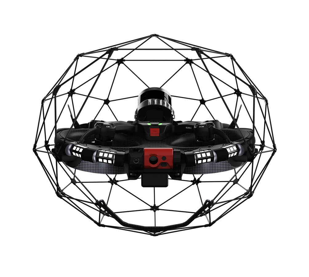
Flight time . 12 minutes Transmission range . 328 feet (100 m) Weight . 4.18 pounds (1.9 kg) Sensors . 4K camera, thermal camera, LiDAR compatibility LiDAR/Photogrammetry . Supports photogrammetry; LiDAR-compatible with external sensor
How to Make a Drone 3D Model: LiDAR vs. Photogrammetry vs. SLAM
Deciding how you’ll capture your 3D model data (in this case, it will be by drone). Capturing the data that will be turned into the 3D model. Processing that data using special software
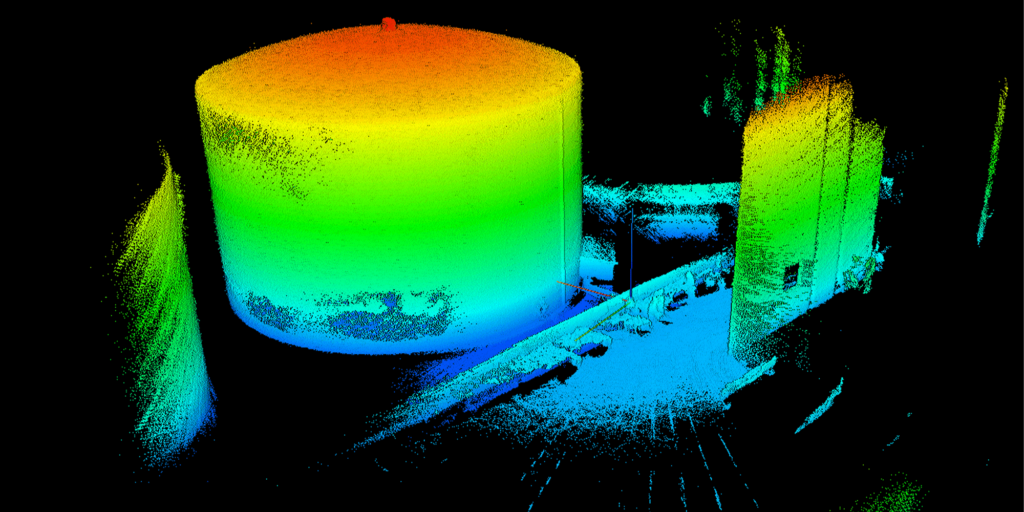
Choosing the Right Method for Your Drone 3D Model
Use LiDAR if: You need high precision, are working in dense vegetation, or need to map large areas or complex terrain. Use Photogrammetry if: You’re focusing on surface textures, need detailed models of buildings or structures, or are working in environments with clear weather and controlled lighting. Use SLAM if: You need real-time mapping, are working indoors, in GPS-denied environments (like tunnels or dense forests), or require adaptive navigation for fast-changing or cluttered spaces
What Is LiDAR?
What Is Photogrammetry?
What Is SLAM?
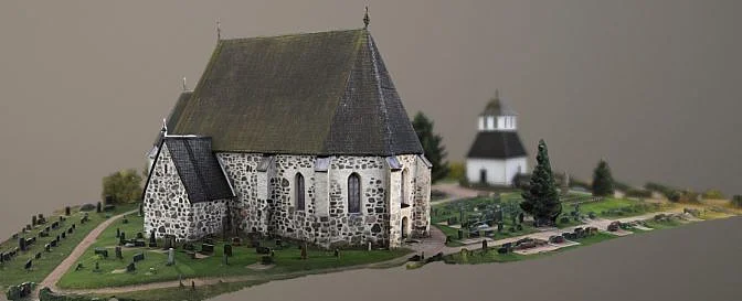
How To Make A Drone 3D Model with Photogrammetry
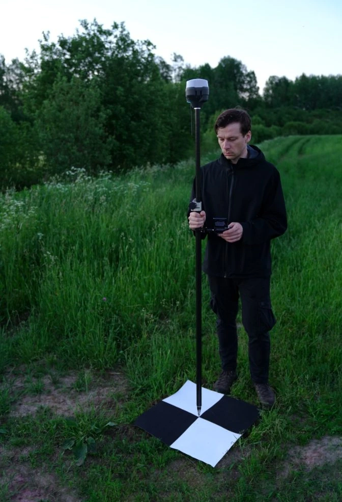
Get a drone with a high-quality camera . Professional drones like the SenseFly eBee Classic are often used for aerial photogrammetry. Set your ground control points (GCPs) . GCPs are black and white square markers placed on the ground around your survey area. These reference points help reduce errors and improve the accuracy of your 3D model by providing known coordinates. Set up your drone camera and automate flight paths . Ensure you have enough battery life and memory for the mission. Calibrate your drone’s camera settings, such as aperture and shutter speed, and confirm that the automated flight path is set up correctly. Conduct the survey on a clear day . To get the best data for your model, survey on a day with clear weather and avoid cloudy conditions to ensure quality images and data capture. Process your data with drone 3D modeling software . After data collection, use photogrammetry software like Pix4Dmapper to process your images into a 3D model. You may need a GIS specialist for complex tasks.
Getting the Right Data for Your Drone 3D Model
Ensure a 60-70% overlap between images to allow for accurate triangulation. Fly your drone at an altitude of 150ft to 200ft for optimal straight-down images. Capture images from a high altitude (30º camera angle) to get wide coverage of the subject. Lower your altitude to a middle range (45º camera angle) for better detail. Use a low altitude (70º camera angle) to capture fine details and close-up views. Adjust your radius to keep the subject in frame at all times.
Tips for Photogrammetry Data Collection
Ensure sufficient image overlap (60-70%) for accurate triangulation and model generation. Capture photos from various angles to ensure comprehensive coverage of the subject. Double-check your camera settings before flying, especially aperture, shutter speed, and white balance, to ensure optimal lighting and exposure. Maintain consistent flight altitudes to avoid scale discrepancies between images. If surveying large areas, use a grid flight pattern to ensure no areas are missed.
Processing Photogrammetry Data into a 3D Model
Upload your images to photogrammetry software like Pix4Dmapper or Agisoft Metashape to stitch them together into a 3D point cloud. Georeference the point cloud with your ground control points (GCPs) to ensure accurate scaling and location within real-world coordinates. Optimize the 3D model in the software, adjusting texture, meshing, and other parameters for clarity and detail. Export the model in the desired format (e.g., .obj, .fbx) for further analysis or integration into other platforms.
How to Make a Drone 3D Models with LiDAR
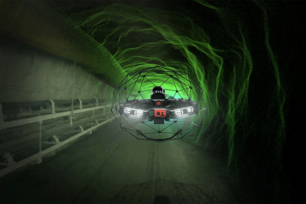
Get a drone with LiDAR capability . LiDAR-equipped drones like the DJI Matrice 350 RTK or Flyability’s Elios 3 are commonly used for high-precision mapping and modeling. These drones are equipped with LiDAR sensors that emit laser pulses to measure distances and create 3D point clouds of the environment. Set your ground control points (GCPs) . GCPs are crucial for georeferencing the LiDAR data, ensuring accurate scale and alignment. These points are placed on the ground and have known geographic coordinates. Make sure to distribute these GCPs throughout the area you are surveying to minimize errors and improve the overall accuracy of the 3D model. Plan your flight mission . Set up your drone to fly at the appropriate altitude, typically between 100 and 200 meters, depending on the resolution you require. Ensure your drone is set to cover the survey area systematically, with flight paths that overlap slightly to improve data accuracy. The LiDAR sensor should be calibrated for the proper settings, such as scanning frequency and laser intensity. Choose the right weather and environmental conditions . Like other aerial surveys, it’s best to perform the LiDAR survey in clear weather conditions. Avoid flying in rainy, foggy, or windy conditions that could interfere with the quality of the data. Ideal conditions include dry, clear days with minimal wind. Process your LiDAR data in specialized software . Once you’ve gathered the data, you’ll need to process it into a 3D model using specialized software. Popular platforms for LiDAR processing include Autodesk ReCap, Pix4Dmapper, or Bentley ContextCapture. These programs help you turn raw LiDAR data into a usable 3D point cloud, which can then be meshed to create a detailed 3D model of the area or structure.
Getting the Right Data for Your Drone 3D Model Using LiDAR
Ensure adequate point density—higher point density provides more detailed and accurate 3D models. Aim for a minimum of 8-12 points per square meter for high-resolution data. Flight height should be adjusted based on the level of detail needed. For larger areas, a higher altitude is acceptable, but for smaller, more detailed scans, a lower flight height is preferred. Overlap between flight lines is critical. A 30% overlap between adjacent passes helps ensure continuous coverage and more precise point cloud alignment. Use proper LiDAR sensor settings, including scan frequency and pulse rate. Make sure the settings are optimized for the type of terrain you are scanning (e.g., forests, urban areas, or open fields). Monitor GPS accuracy to ensure that the LiDAR data is correctly georeferenced, especially for large areas or when precise measurements are critical.
Tips for LiDAR Data Collection
Fly the drone in a grid pattern to ensure full coverage of the target area. Adjust flight paths based on the terrain and ensure overlap for better point cloud generation. Make sure the drone’s LiDAR sensor is properly calibrated before every mission to avoid inaccuracies in the data. For complex environments, such as densely forested areas, consider using multiple flight passes at different altitudes to capture a complete dataset. Check the data quality during the flight. If you notice any gaps or discrepancies, adjust the flight path in real-time to capture missing data.
Processing LiDAR Data into a 3D Model
Importing the LiDAR point cloud data into software like Autodesk ReCap or Pix4Dmapper, where the data is cleaned, filtered, and transformed into a 3D mesh. Georeferencing the point cloud data using the ground control points (GCPs) you set up earlier, ensuring the model is scaled correctly and aligned to real-world coordinates. Optimizing the mesh for visualization or further analysis, including adding textures or merging point clouds from different passes to create a complete model. Exporting the 3D model into a file format (e.g., .obj, .fbx, or .las) that can be used for further analysis, visualization, or integration into other digital platforms.
How to Make a Drone 3D Model with SLAM
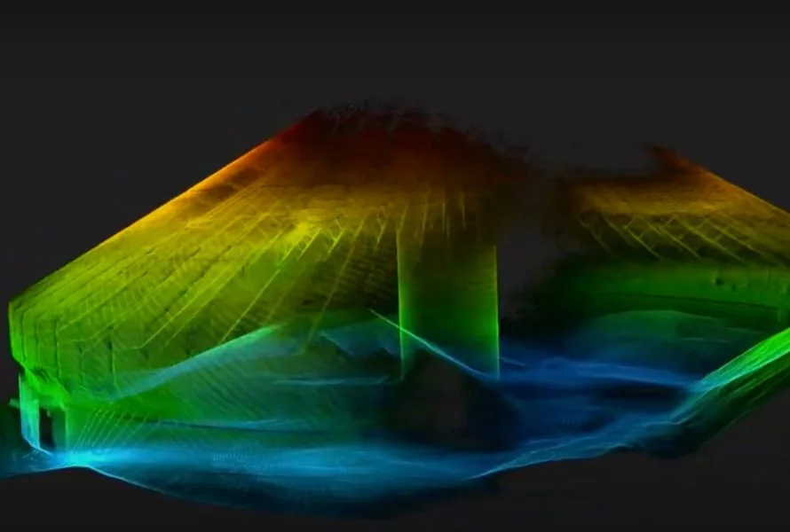
Choose a drone with SLAM capability. Select a drone equipped with SLAM-compatible sensors, such as the Flyability Elios 3 or a similar model with onboard LiDAR or stereo cameras. These drones are specifically designed for indoor or GPS-denied mapping and real-time 3D modeling. Plan your mission and configure your sensors. Before flying, set up your SLAM system by calibrating the sensors and configuring the mapping parameters in the SLAM software. Unlike traditional photogrammetry or LiDAR mapping, SLAM does not require ground control points (GCPs), but you should ensure the environment is safe and accessible for the drone. Fly the drone and capture data in real time. Operate the drone manually or with assisted navigation, allowing it to explore and scan the environment. As the drone flies, the SLAM system will simultaneously build a 3D map and track the drone’s position, updating the model in real time. For best results, fly slowly and steadily, and ensure all areas of interest are scanned from multiple angles. Monitor the mapping progress live. Use the SLAM software’s live visualization to check for coverage gaps or areas needing more detail. If necessary, adjust your flight path or revisit sections to ensure a complete dataset. Export and refine your 3D model. Once the mission is complete, export the 3D map or point cloud from the SLAM software. You can further process or clean the model in specialized 3D editing or point cloud software, and export it in formats like .las, .obj, or .ply for analysis, visualization, or integration into other workflows.
Getting the Right Data for Your Drone 3D Model Using SLAM
Tips for SLAM Data Collection
Fly at a steady speed and maintain a clear line of sight to avoid losing tracking or missing areas. Scan complex environments from different perspectives to capture all surfaces and features. Use the live map view to identify and revisit missed sections during the flight. Avoid sudden movements or rapid changes in direction, which can disrupt SLAM tracking. Ensure your sensors are clean and properly calibrated before each mission.
Processing SLAM Data into a 3D Model
Export the point cloud or mesh from your SLAM software for further editing or analysis. Optionally, clean up noise or fill small gaps in specialized 3D modeling software. Export the final model in a standard format (.las, .obj, .ply) for use in CAD, GIS, or visualization tools.
Industries That Use Drone 3D Models
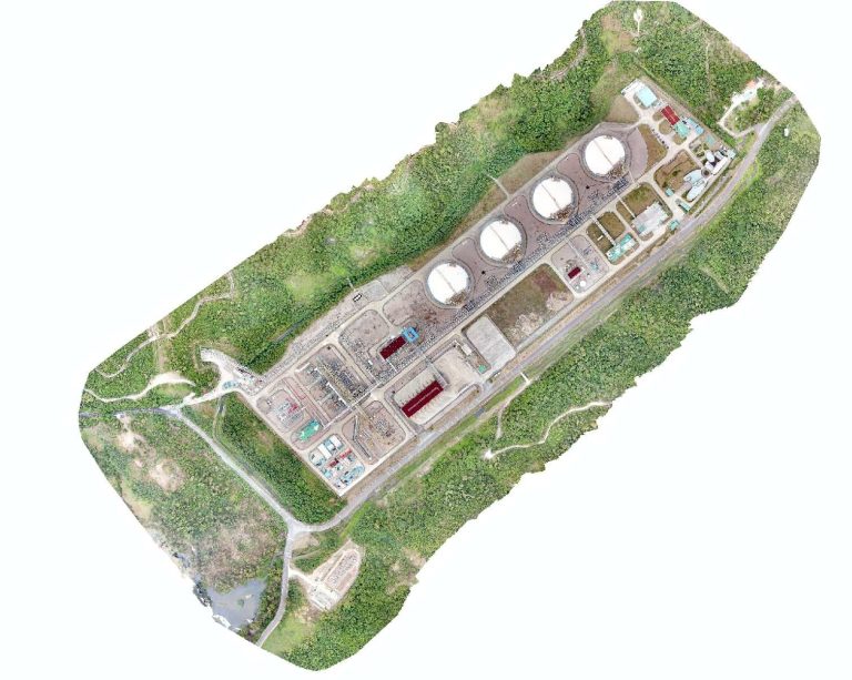
1. Oil & Gas
Pipeline inspections . Drone 3D models are used to inspect miles of pipelines, detecting issues like leaks, corrosion, and defects without the need for hazardous on-site inspections. Rig inspections . Create 3D models of offshore or onshore rigs, enabling virtual inspections of hard-to-reach areas, reducing the risk to personnel. Mapping & monitoring . Use drones to map oil fields and drilling sites for resource management, operational planning, and environmental assessments. Facility inspections . Drones perform detailed inspections of storage tanks, processing facilities, and refineries to ensure safety and regulatory compliance.
2. Power Generation
Turbine inspections . Inspect wind turbines, solar panel arrays, and hydroelectric plants, identifying wear and tear, cracks, or defects. Facility maintenance . Create 3D models of power plants, substations, and grid infrastructure to monitor maintenance needs and ensure structural integrity. Safety assessments . Assess high-risk areas such as power lines, electrical grids, and nuclear power plants using drone-generated 3D models. Environmental impact studies . Track environmental changes related to power generation, ensuring compliance with environmental regulations and monitoring operational impact.
3. Petrochemical & Chemical Industries
Tank inspections . Inspect storage tanks for cracks, corrosion, and leaks, using drones to provide detailed 3D models of internal and external surfaces. Facility mapping . Create comprehensive 3D maps of chemical processing plants for maintenance, planning, and regulatory purposes. Pipeline integrity checks . Monitor the condition of pipelines, especially those running through hazardous environments, using drone-created 3D models to detect weaknesses and prevent failures. Compliance & safety . Ensure adherence to industry safety standards and regulations by using drone 3D models to identify problem areas and mitigate risks before they escalate.
4. Mining
Pit & quarry mapping . Generate 3D models of open-pit mines, quarries, and excavation sites for volume measurements, land analysis, and topographic mapping. Geological surveys . Use drones to map geological features and create models that support mineral exploration and resource extraction. Environmental monitoring . Monitor land restoration, tailings management, and the environmental impact of mining activities using accurate drone-based 3D models. Safety monitoring . Conduct regular inspections of mining operations to ensure worker safety and compliance with environmental regulations.
5. Pharmaceuticals
Cleanroom inspections . Inspect cleanroom environments using drone 3D models to maintain hygiene standards and meet regulatory requirements. Manufacturing facility inspections . Use drone 3D models to inspect pharmaceutical manufacturing equipment, ensuring that they are functioning properly and safely. Storage facility mapping . Create detailed 3D models of storage facilities to track inventory, monitor conditions, and ensure compliance with pharmaceutical regulations. Regulatory compliance . Use drone 3D models to ensure all processes and equipment are compliant with industry regulations, reducing the risk of fines and non-compliance.
6. Construction
Project monitoring . Monitor construction progress by creating 3D models that track site changes over time and identify potential issues early. Site surveying . Use drones to conduct topographic surveys of construction sites, providing accurate data for project planning and design. Building inspections . Inspect large and complex buildings and infrastructure using drone-generated 3D models, improving safety and reducing downtime. Material quantity verification . Ensure accurate material quantities on construction sites by using drones to generate 3D models for volume calculations.
7. Water and Wastewater Utilities
Water treatment plant inspections . Use drone 3D models to inspect water treatment facilities, identifying structural issues and ensuring compliance with health and safety regulations. Pipelines & reservoir mapping . Map pipelines and reservoirs, using drones to monitor for leaks, sediment buildup, or other issues that could compromise water quality or infrastructure integrity. Environmental monitoring . Track environmental changes and potential risks to water resources, ensuring the ongoing health of water ecosystems and compliance with regulations. Asset management . Use drone 3D models to create accurate inventories of water assets, facilitating maintenance and repairs while improving operational efficiency.