Guide

RTK, PPK & GCP: Precision Mapping Explained

A Guide to High-Accuracy Drone Survey Methods and When to Use Each

What Are RTK, PPK, and GCP—and Why Do They Matter?

If you’ve spent any time researching drone mapping or surveying, you’ve probably run into a wall of acronyms: RTK, PPK, and GCP. They sound complicated, but understanding them can help you choose the right tools and avoid costly errors in your projects.

Let’s break them down:

  • RTK (Real-Time Kinematic) is a GPS correction method that helps a drone pinpoint its exact location while it’s flying. It’s fast and highly accurate, perfect for jobs that need real-time data.
  • PPK (Post-Processed Kinematic) also improves positioning accuracy, but it does the correction after the flight, using recorded data. This is ideal for projects in remote areas or where a live signal isn’t reliable.
  • GCPs (Ground Control Points) are physical markers placed on the ground with known coordinates. They serve as reference points that “anchor” your drone’s map to the real world with survey-grade precision.

Each method has its strengths, and in many cases, combining them leads to even better data. Whether you’re flying over a tight construction site or mapping hundreds of acres, knowing how these tools work will help you get the job done faster and more accurately

Step-by-Step Breakdown: How Each Method Works

Let’s break down how RTK, PPK, and GCP work—what they do, how they differ, and where each one shines. Whether you’re surveying a job site, mapping agricultural fields, or inspecting infrastructure, understanding the strengths and limitations of each method will help you choose the right approach, save time in the field, and ensure your data is as accurate as it needs to be.

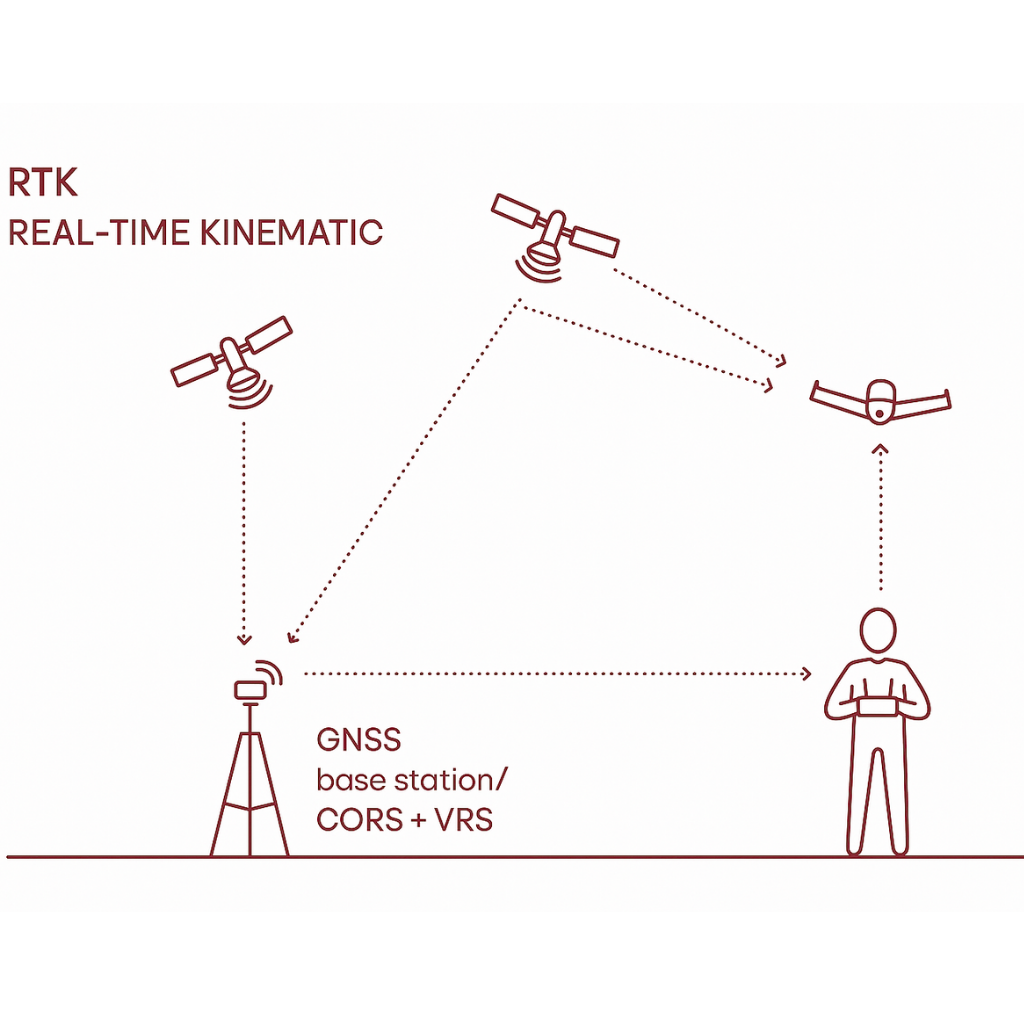
RTK–Real-Time Kinematic

How It Works:
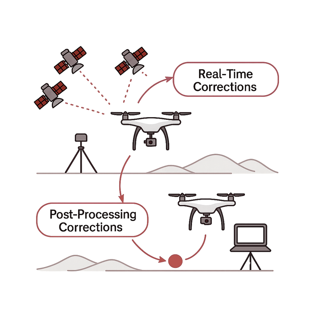
RTK uses a live signal from a base station or a Continuously Operating Reference Station (CORS) network—permanent GPS station that provides real-time correction data—to improve the drone’s GPS accuracy while it’s flying.

Analogy:
Think of it like using GPS with live traffic updates. As you move, your position is constantly corrected and adjusted to stay accurate.

When to Use It:

  • You need results quickly
  • You’re flying in a location with a reliable signal
  • Your project benefits from live accuracy (e.g., construction sites)

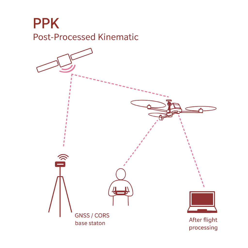
PPK–Post-Processed Kinematic

How It Works:
Instead of relying on live signals, PPK records GPS data during the flight. Afterward, that data is corrected using information from a ground-based station or CORS network.

Analogy:
It’s like reviewing a security camera after an event to get all the details right, a bit slower but reliable.

When to Use It:

  • You’re mapping large or remote areas
  • The signal isn’t stable during flight
  • You can wait a little longer for even better accuracy

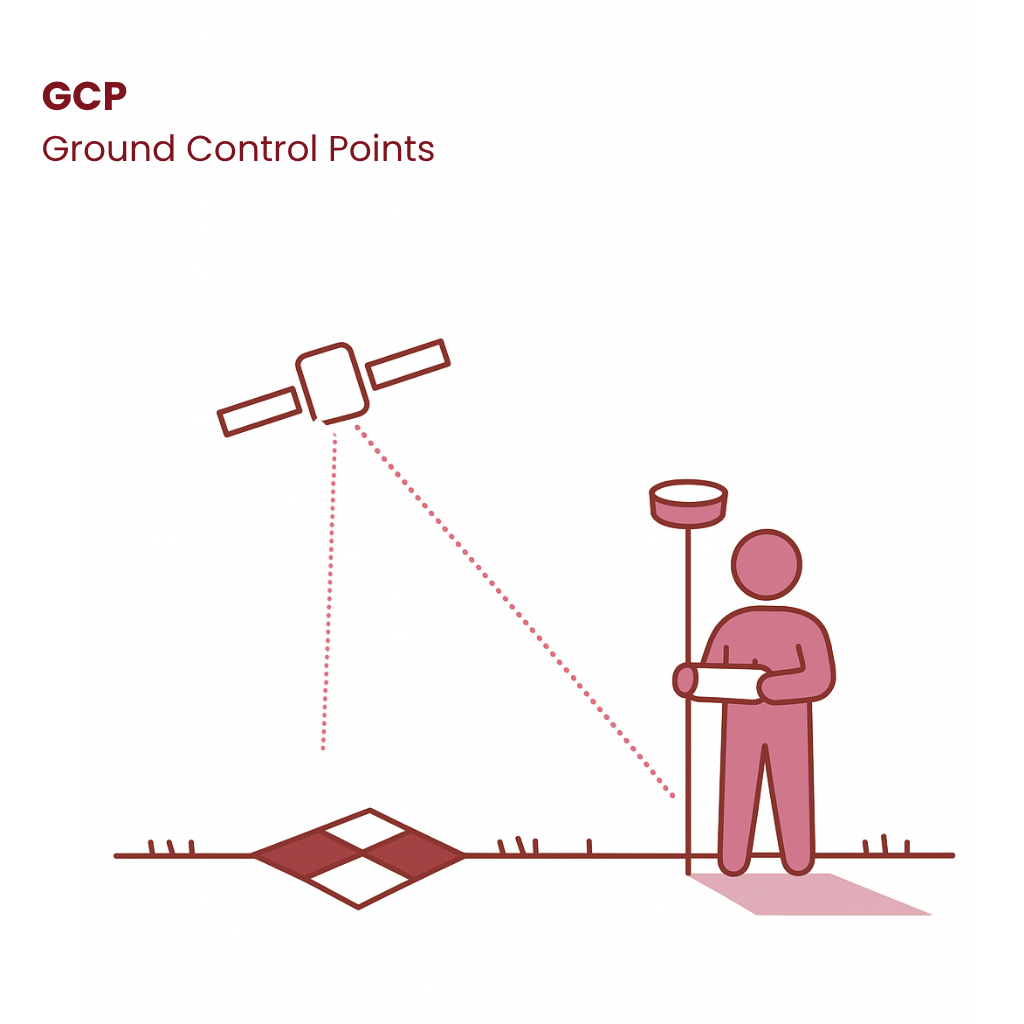
GCP–Ground Control Points

How It Works:
GCPs are physical markers placed on the ground with known coordinates. During processing, they help align and verify your drone imagery with real-world accuracy.

Analogy:
Imagine laying a transparent map over a city and pinning it at known landmarks so it lines up perfectly, that’s what GCPs do.

When to Use Them:

  • You need the highest accuracy (survey-grade)
  • You’re validating RTK/PPK data
  • You’re working in areas where legal or contractual precision is critical

How RTK and PPK Complement Each Other for Precision Mapping

RTK and PPK aren’t competing technologies, they’re complementary tools that, when used together, enhance the reliability and precision of drone mapping.

RTK delivers real-time corrections during flight, providing immediate, accurate positioning that’s perfect for fast-paced environments. But when real-time signals become unreliable, due to obstructions like buildings or tree cover, PPK steps in to fill the gaps.

PPK processes the same GPS data after the flight, correcting any inaccuracies that occurred during real-time transmission. This dual-layered approach ensures high-precision results even in challenging conditions.

Together, RTK and PPK offer a balanced, fail-safe mapping workflow that combines speed with accuracy, making them a powerful pair for survey-grade deliverables.

RTK vs. PPK vs. GCP at a Glance

Each method brings something different to the table, depending on your project’s size, location, and accuracy needs. This quick comparison chart shows how RTK, PPK, and GCP stack up across key features—so you can quickly see which one best fits your workflow.


FEATURERTKPPKGCP
AccuracyHighHigher (especially vertical)Highest (ground truth)
Needs Live Signal✅ Yes❌ No❌ No
Post-Processing Required❌ No✅ Yes✅ Yes
Best forFast-paced, real-time workLarge areas, signal-challenged sitesLegal-grade accuracy, validation

Industry Applications for RTK, PPK, and GCP

RTK, PPK, and GCP aren’t just technical options, they’re tools that serve different industries in unique ways. Here’s how each method aligns with real-world needs across construction, agriculture, infrastructure, and more.

Construction & Earthworks

  • RTK is ideal for real-time site monitoring, grading, and checking that structures are built to spec. Fast, accurate data helps keep schedules tight and rework minimal.
  • PPK works well for documenting progress over large or complex job sites, especially when reliable signal isn’t guaranteed.
  • GCPs are often used to validate deliverables, critical for as-builts or legal surveys, where ultra-precise measurements are essential. As-builts capture the exact, real-world conditions of a project post-construction, ensuring the final documentation reflects what was actually built rather than what was planned.

Agriculture

  • RTK helps guide tractors, drones, and equipment with pinpoint accuracy for spraying, planting, and harvesting.
  • PPK is perfect for mapping large fields and analyzing terrain without worrying about maintaining a connection in remote areas.
  • GCPs can serve as reference points to verify long-term data accuracy across seasons.

Infrastructure & Civil Engineering

  • RTK supports real-time inspections of roads, utilities, and urban developments.
  • PPK excels in corridor mapping and topographic surveys across extended stretches—like highways or pipelines, where signal consistency drops.
  • GCPs are key for anchoring maps in large-scale development and planning efforts.

Environmental & Land Surveying

  • RTK offers speed and efficiency for tracking changes in terrain, water levels, or erosion.
  • PPK is favored for remote forests, wetlands, and Beyond Visual Line of Sight (BVLOS) operations.
  • GCPs provide trusted control for long-term studies and highly precise land boundary measurements.

Energy, Mining & Utilities

  • RTK helps crews perform inspections and detect equipment issues during flights.
  • PPK is useful for remote or hazardous sites where data must be collected safely and without live connections.
  • GCPs verify outputs in high-stakes environments where accuracy must be independently confirmed.

Leading Tools for Drone Mapping Accuracy

Achieving precise aerial data starts with selecting the right combination of drone hardware, payloads, and software. RTK-capable drones provide real-time positioning accuracy, while high-resolution mapping payloads ensure detailed image capture suitable for photogrammetry and topographic modeling.

When paired with advanced processing software, these tools enable users to generate accurate volume calculations, 3D terrain models, and georeferenced orthomosaics, streamlining workflows across industries.

RTK-Enabled Drones Available for Rent
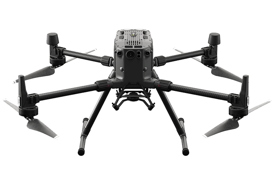
DJI Matrice 300 RTK

A leading platform for drone mapping and inspection, the Matrice 300 RTK supports advanced payloads like the Zenmuse P1 to deliver survey-grade photogrammetry with real-time positioning accuracy.

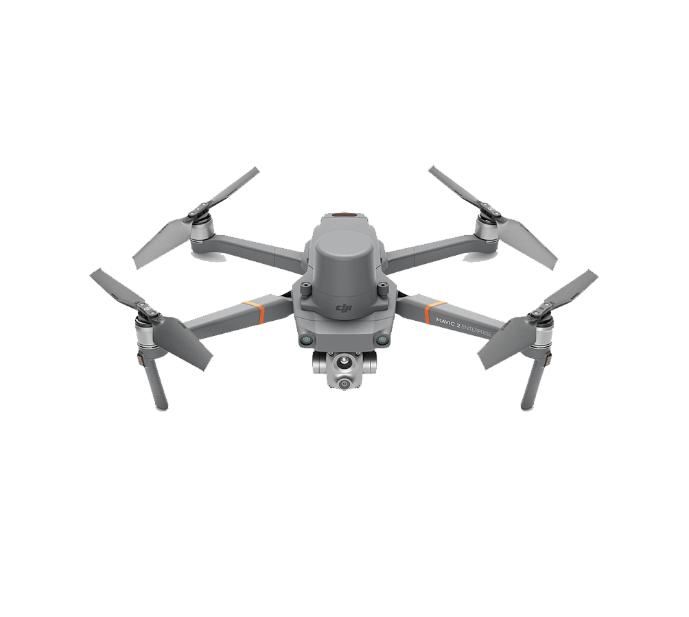
DJI Mavic 2 Enterprise Advanced with RTK Module

A compact, reliable option for small-area mapping or supplemental ground truthing. Its optional RTK module enables centimeter-level accuracy in tight or dynamic environments.

Mapping Drones For Sale
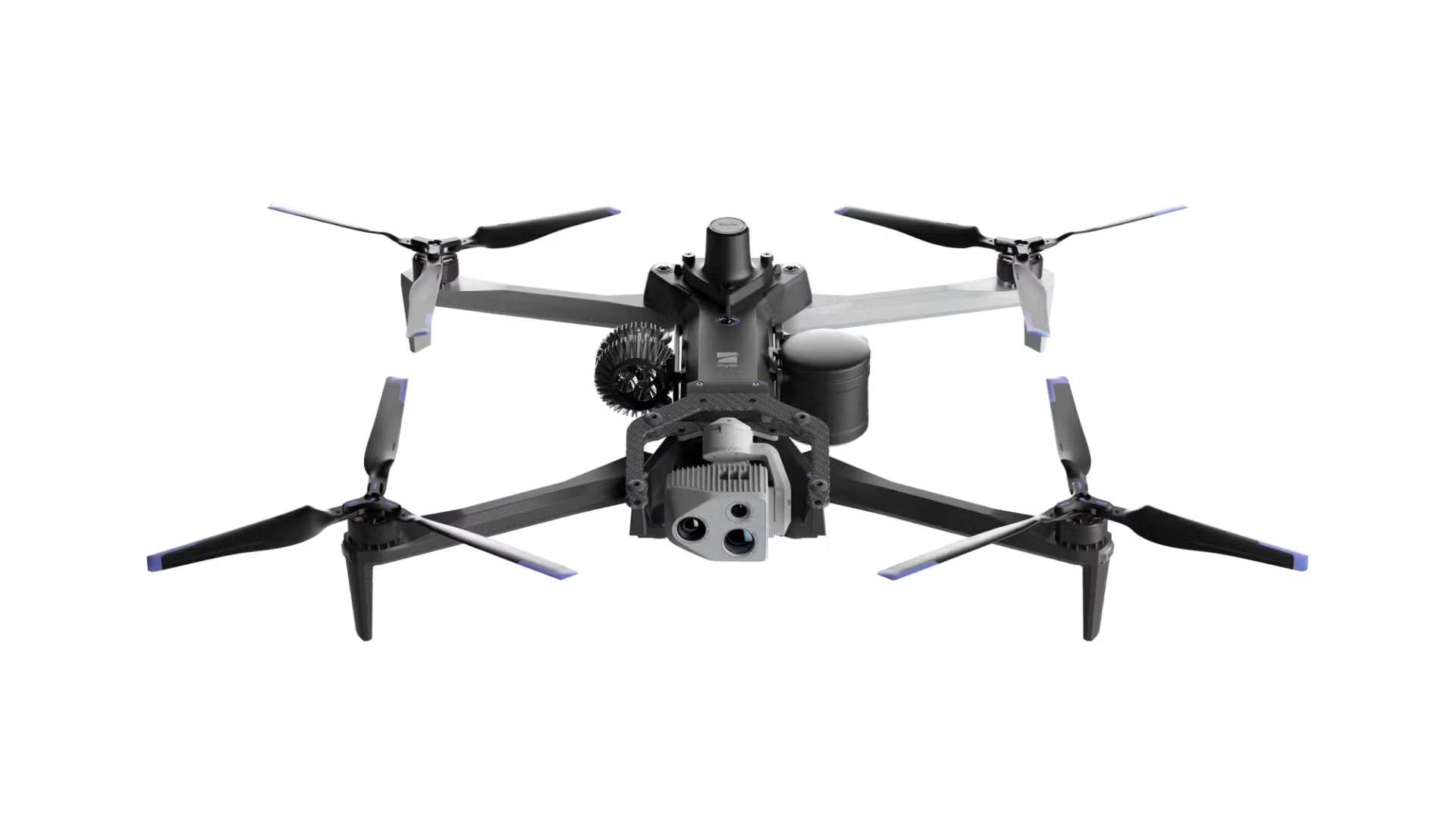
Skydio X10

An advanced autonomous drone built for precision mapping in GPS-denied or complex environments. Equipped with a powerful RTK/PPK module, rolling shutter correction, and native integration with tools like DroneDeploy and Pix4D, the X10 is ideal for infrastructure inspections, volumetric modeling, and high-accuracy 3D reconstructions, even where traditional drones can’t fly.
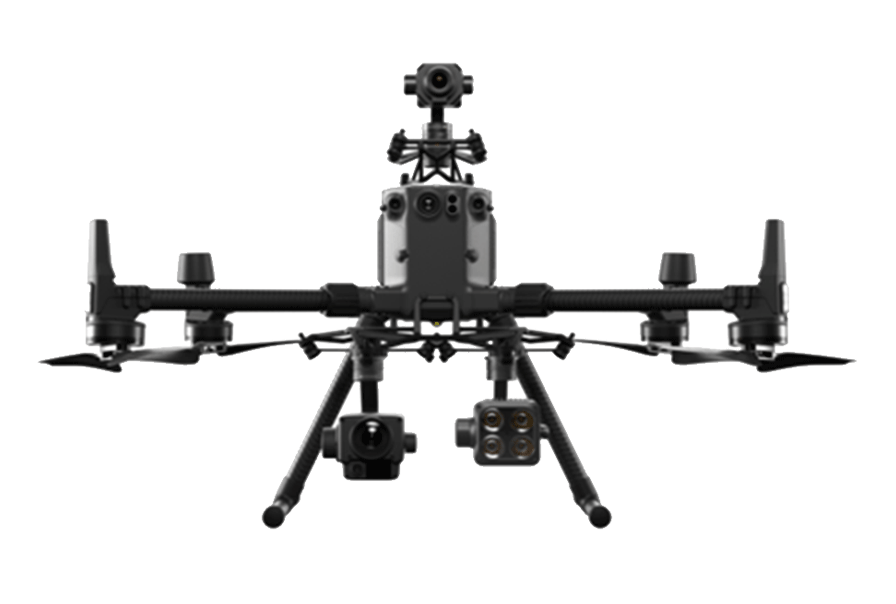
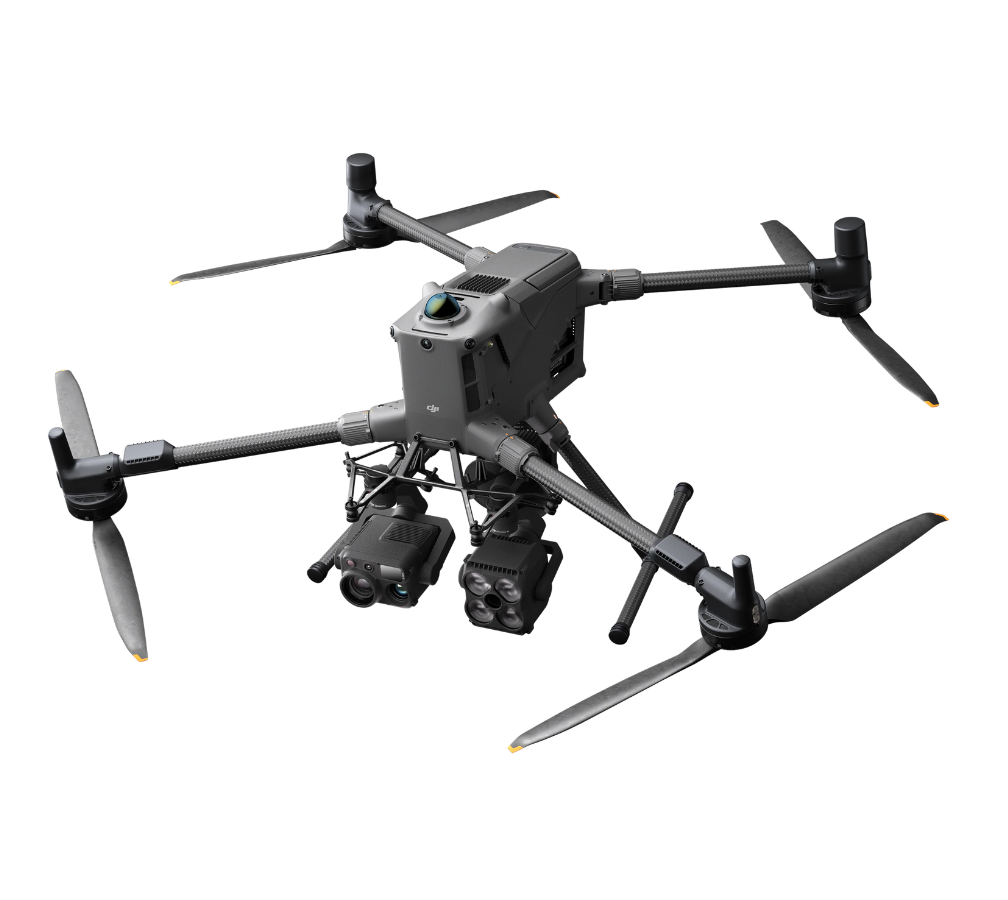
DJI Matrice 400 RTK

A rugged, next‑generation workhorse built for enterprise-grade mapping and inspection. Equipped for high-precision mapping, it offers extended flight endurance—up to 59 minutes in the air and 53 minutes hovering with the H30T payload—plus support for up to 6 kg of combined equipment, enabling multi-sensor payloads and more efficient data capture

DJI Matrice 350 RTK

An advanced platform with improved GNSS, battery system, and payload support. Perfect for survey professionals looking for flexible, long-term RTK-capable hardware.

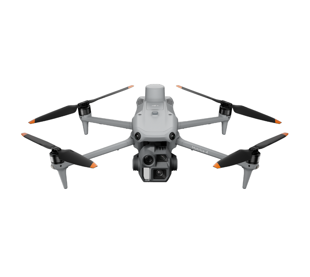
DJI Matrice 4 Series

Versatile platforms for high-performance mapping and inspection, with enhanced AI features and payload support for large-scale or multi-purpose operations.

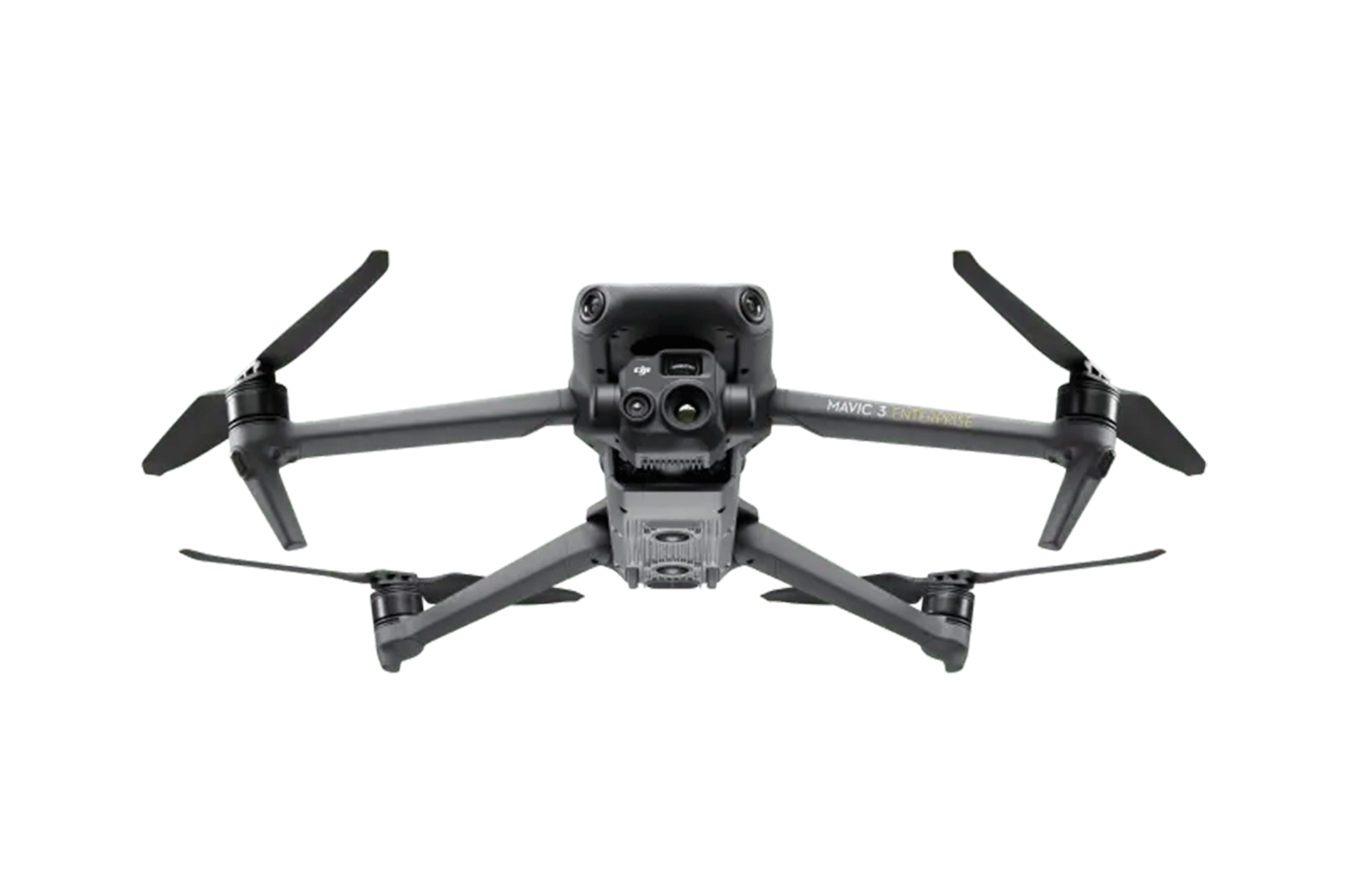
DJI Mavic 3 Enterprise Series

Lightweight, affordable RTK-capable drones ideal for first-time mapping teams or compact survey missions. Combines portability with precision.

Mapping Payloads (Rental & Integration)
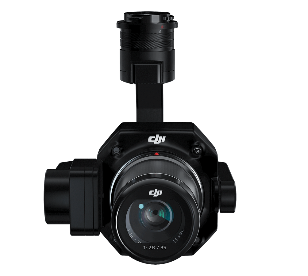
Zenmuse P1

A full-frame camera designed for photogrammetry and large-area surveys. Pairs with the Matrice 300/350 RTK to deliver ultra-accurate geospatial data.


Software Solutions

Pix4D

Advanced photogrammetry software compatible with RTK/PPK and GCP workflows for creating high-resolution maps and 3D models.
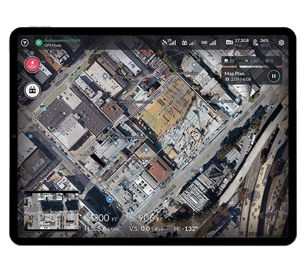
DroneDeploy

Cloud-based mission planning and data processing platform. Supports real-time RTK flights and GCP-tagged outputs for field teams and survey firms.

Case Studies: RTK, PPK, and GCP in Action

These real-world projects showcase how professionals are using RTK, PPK, and GCPs to solve high-stakes challenges across construction, agriculture, mining, infrastructure, and public safety, saving time, increasing precision, and reducing costs.

Accelerating Construction Surveys with DroneDeploy + RTK

Platform: DJI Matrice 350 RTK + DroneDeploy

Challenge: Traditional construction surveying using total stations and manual methods is slow, costly, and prone to delays, especially on large, fast-paced projects. Project managers lack quick, reliable insights into site progress, grading, and layout accuracy.

Solution: Construction firms used DroneDeploy (a drone mapping software) with the DJI Matrice 350 RTK, a drone equipped with RTK technology. RTK improves GPS accuracy by using live correction data, which was delivered through DroneDeploy’s NTRIP network (an internet-based GPS correction system).

If the signal dropped during flight, the system automatically switched to PPK mode, which corrects the drone’s GPS data after the flight. This ensured that maps remained highly accurate, even in areas with poor connectivity.

By using automated flights and cloud-based processing, construction teams were able to replace full days of manual surveying with 15-minute drone scans, capturing:

  • High-resolution orthomosaics
  • 3D terrain models
  • Cut/fill reports
  • Progress photos aligned with CAD overlays
 

Results:

  • 60% reduction in survey time
  • < 3 cm horizontal accuracy without full GCP coverage
  • Used just 4–5 checkpoints for final validation
  • Eliminated costly rework and improved coordination for subs, crane placement, and logistics
  • Enabled near real-time access to updated visuals and topographic data from anywhere
 

Construction teams began using drone mapping not just for documentation, but as a central tool for planning and coordination. On one project, scans were used to monitor milestones, verify deck progress, and plan underground work. In fact, missing a scan raised internal questions, showing just how critical aerial data had become across multiple phases of construction.

Read the full story → DroneDeploy Construction Case Study

Skydio X10: High-Accuracy Mapping in GPS-Challenged Environments

Platform: Skydio X10 + RTK/PPK module + DroneDeploy

Challenge: Many mapping jobs take place in areas where GPS signals are unreliable or unavailable, like under bridges, near large steel structures, or in dense construction zones. Traditional drones struggle in these conditions, and the resulting data often lacks the accuracy needed for progress tracking, volume estimates, or legal-grade documentation.

Solution: The Skydio X10, equipped with a RTK and PPK module, was built specifically to solve this challenge. The drone uses RTK to get centimeter-level GPS accuracy during flight. If it flies into a location where GPS is lost, such as a Global Navigation Satellite System or GNSS-denied zone—it switches to PPK mode, correcting the location data after the flight.

This dual system was tested across multiple industries, including construction, mining, utilities, and public safety. One contractor, Maple from Canada, used the system to overlay Building Information Modeling (BIM) data on site scans, identifying costly deviations early. Another test in Iowa showed horizontal accuracy within 3 centimeters, even without ground control points.

Key Use Cases:

  • Construction: Overlaying BIM models to catch mistakes early and monitor build progress
  • Mining: Accurate stockpile and earthwork volume calculations
  • Public Safety: Precise reconstructions of accident scenes for evidence documentation
  • Utilities & Infrastructure: Reliable data collection in hard-to-access or GPS-denied areas
 

Results:

  • < 3 cm horizontal and vertical accuracy even without GCPs
  • Enabled georeferenced 3D models and volumetric estimates using rolling shutter correction
  • Seamlessly integrates with industry tools like DroneDeploy and PIX4D
 

Watch the full presentation → Skydio Accuracy Panel Video

Wrapping Up: The Role of RTK, PPK, and GCP in Smarter Drone Mapping

RTK, PPK , and GCPs are core technologies that define the precision, speed, and reliability of modern drone mapping. Each offers distinct advantages based on your project’s environment, scale, and accuracy requirements.

Whether you’re surveying infrastructure, modeling terrain, or managing progress on a construction site, understanding how these positioning systems work empowers you to make better decisions and streamline your workflows.

Pairing the right correction methods with the right drone hardware can reduce time in the field, improve data accuracy, and increase confidence in your deliverables. Mastering these tools doesn’t just elevate your output, it prepares your operations for long-term success.

Get Expert Support From MFE Inspection Solutions

From mapping-ready drones to RTK/PPK software and GCPs, MFE provides end-to-end solutions backed by hands-on expertise. Whether you’re just getting started or leveling up your workflows, we’re here to help you find the best-fit tools for your job.

Get personalized solutions → Request a Demo from MFE

Table of Contents