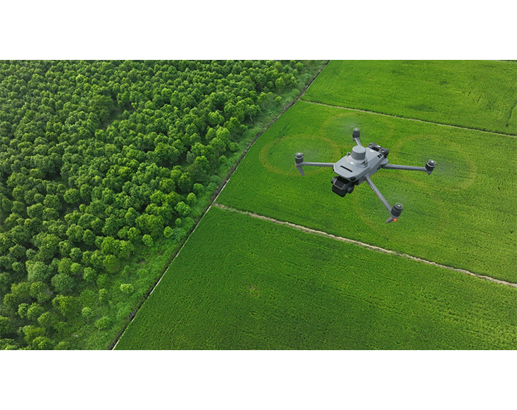
The DJI Mavic 3 Multispectral features integrated multispectral sensors for precision agriculture and environmental monitoring, enabling detailed analysis and informed decision-making.
Equipment Type: Drone
Request a Quote
Efficient surveying from the air requires seeing the invisible. For this reason, the DJI Mavic 3 Multispectral offers two forms of sight. It combines an RGB camera with a multispectral camera to clearly scan and analyze plant growth.
Agricultural production management requires precision and data, and the Mavic 3 Multispectral delivers both featuring an obstacle avoidance and RTK system for safe and precise navigation.

Newly improved imaging system with one 20MP RGB camera and four 5MP multispectral cameras (green, red, red edge, and near-infrared).
The Mavic 3 Multispectral enables applications such as high-precision aerial surveying, plant growth monitoring, and surveying of natural resources.
The Mavic 3 Multispectral features a 4/3-inch CMOS sensor with 20 MP resolution, while the flight control, camera, and RTK module synchronize in microseconds for highly accurate performance.

A built-in sunlight sensor helps create more accurate NDVI results improving accuracy and consistency by capturing solar irradiance for light compensation of image data for 2D reconstruction.
In addition, a support calibration panel can be purchased separately to be utilized with DJI terra to obtain a single-band reflectance value.

The Mavic 3 Multispectral features a four antenna design, two transmitters, and four receivers with a range of 3 to 5 1/2 miles with low interference and 1 to 2 miles with strong interference.
In addition, multiple wide-angle vision sensors work seamlessly with a high-performance vision computing engine to sense obstacles in all directions to avoid them for safer flight routes during drone inspections and other missions.
The DJI Mavic 3 Multispectral with RTK module can capture just under a square mile within a single 42-minute flight. The mapping accuracy is relative to the GSD (ground sample distance), and the Mavic 3 Multispectral GCP-free accuracy is about two times that of GSD.
In addition, the real-time terrain follow feature allows the drone to automatically adjust its flight altitude to maintain a constant altitude parallel to the terrain with a range of 262ft to 656ft.


