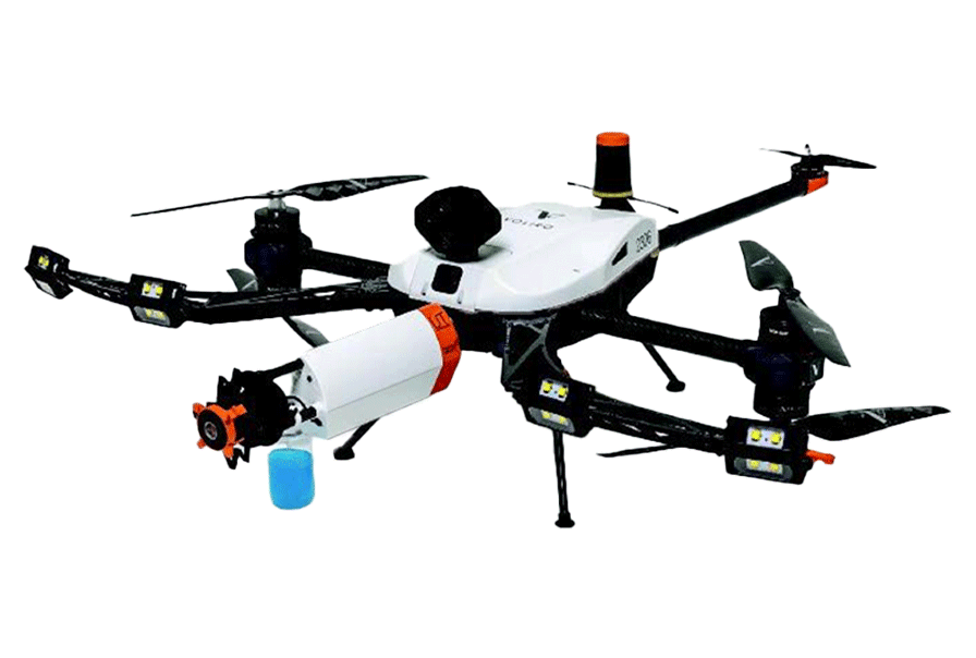
The Skydio R10 is a compact indoor drone engineered to operate in complex, GPS-denied environments such as congested industrial interiors, enclosed infrastructure, and other hard-to-access spaces. Built for missions where traditional drones can’t go, the R10 is designed to navigate confined, dark, and cluttered areas with confidence, supporting a range of industrial inspection workflows where visual access is limited.
Durability and autonomy are at the core of the R10. With a full 180° pitch gimbal and integrated high-power LED lighting, it delivers clear, actionable visuals in low or zero light. Its onboard intelligence assists the operator by actively avoiding obstacles and maintaining stability in tight, confined environments, helping reduce risk in complex interior flights.
With the R10, you’re sending in a drone that’s built to do the dirty, dangerous work—relentlessly, reliably, and with minimal human exposure.
Equipment Type: Indoor and Confined Space Drone
Benefits of Skydio R10
Confined space inspections
Internal visual flythroughs of industrial facilities
Distribution network asset checks
Power generation asset inspections
Structural integrity assessments
Utility infrastructure condition monitoring
Utilities & power generation
Industrial inspection
Transportation & infrastructure
Construction & engineering
Oil & gas
For Sale
Request a Quote
Skydio R10: Inspect the Inaccessible
The Skydio R10 is a compact, autonomous indoor drone purpose-built to navigate confined, dark, and GPS-denied spaces where traditional inspection drones may struggle to operate. Its small size and intelligent flight systems allow it to move through congested environments with precision. The R10 excels at getting in, capturing visual data, and getting out quickly and safely, supporting faster and safer situational awareness in challenging interior spaces.
It’s not here to replace high-end NDT drones with advanced payloads, LiDAR, or reporting suites but it does offer a smart, efficient solution for complementary visual inspections.
Think of the Skydio R10 as your go-to tool for quick internal flybys, initial asset assessments, or hard-to-reach safety checks that don’t require full-scope diagnostics.
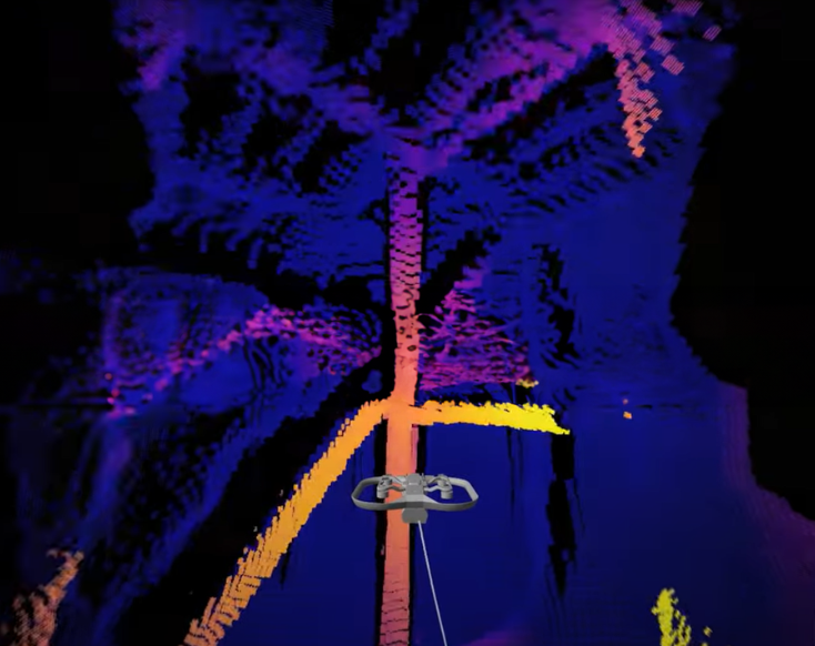
Autonomous Navigation in GPS-Denied Spaces
In industrial environments where GPS is unavailable, the Skydio R10 delivers confident, stable flight using Visual-Inertial Odometry (VIO). This advanced system combines real-time visual input with motion sensing to enable precise navigation in fully enclosed, congested, or obstructed spaces where traditional positioning systems fall short.
Operators maintain control either through Skydio Link for line-of-sight missions or via 5G/LTE connectivity for remote access in network-covered areas.
Whether you’re inspecting internal infrastructure or assessing asset conditions in hard-to-reach locations, the R10 gives you the autonomy and flexibility to capture the data without putting personnel at risk.
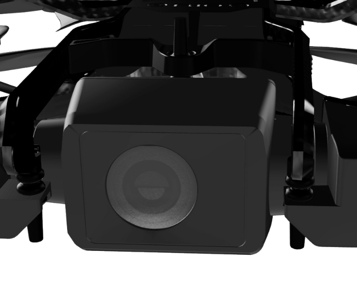
High-Performance Camera with Full-Pitch Gimbal
The Skydio R10 is equipped with a 1-inch, 12.5 MP CMOS sensor that delivers sharp, detailed visuals, ideal for close-range inspection tasks. Its camera is mounted on a 180° pitch gimbal, allowing full vertical tilt to capture what’s directly above or beneath the drone.
This means inspectors can visually assess overhead piping, structural framing, or floor-level hazards without repositioning.
Combined with electronic image stabilization and a wide 93° field of view, the R10 provides smooth, comprehensive coverage even in tight, complex environments.
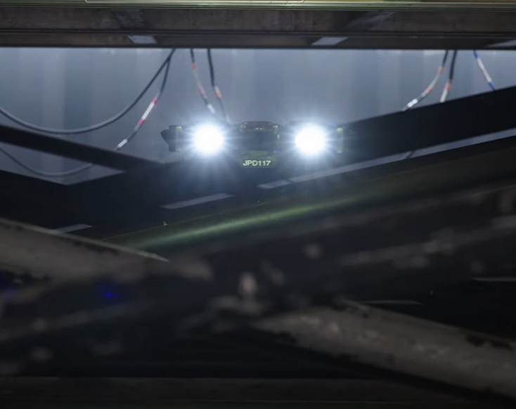
Optimized for Low-Light Environments
Confined space inspections often mean operating in near or total darkness and the Skydio R10 is built for that challenge. Its camera features a wide f/1.95 aperture and a high-sensitivity CMOS sensor with an ISO range up to 16,000, allowing it to capture clear imagery in dim or zero-light conditions.
Integrated high-power LED floodlights provide wide-beam illumination without the need for external lighting or attachments, ensuring critical infrastructure details remain visible even in the darkest environments.
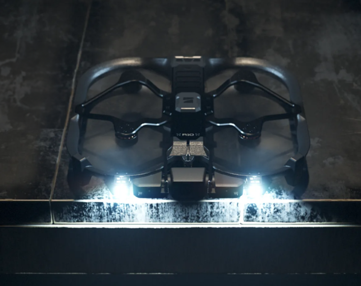
Durable Design with Smart Power Management
The Skydio R10 is built to handle the toughest indoor inspection environments—with a reinforced frame and propeller guards that protect it from bumps and impacts common in confined, cluttered spaces.
When continuous observation is needed, the R10 can safely perch on flat surfaces, maintaining a stable video stream without hovering. In Perch Mode, it delivers up to 3 hours of live video, or 2.5 hours with onboard lighting enabled.
With a 20-minute flight time and fast battery charging, the R10 gives you the flexibility to fly in, observe, and conserve power—maximizing uptime during critical missions.
The Skydio R10: Seamless Integration & Smart Complement
Already using drones for internal or external inspections with LiDAR, NDT sensors, or other advanced payloads? The Skydio R10 is designed to enhance those workflows, not replace them. Compact, autonomous, and quick to deploy, it serves as an agile visual inspection tool for fast internal flythroughs, pre-checks, or supplemental data capture.
Through Skydio Extend, the R10 integrates with platforms like DroneDeploy, ESRI Site Scan, and your existing asset management systems. It also supports live streaming into systems like Axon Fusus and operates within the same software ecosystem as the Skydio X10.
If you’re ready to expand your toolkit with a drone built for confined spaces and rapid deployment, contact MFE today to see how the R10 fits into your operation.