
- MFE Offshore Home
- /
- Geometrics G-882 Magnetometer
Geometrics G-882 Marine Magnetometer
The Geometrics G-882 Marine Magnetometer is a high-sensitivity cesium vapor magnetometer designed for marine geophysical surveys. It helps survey teams identify magnetic anomalies that may indicate buried or submerged ferrous objects before offshore construction, cable installation, dredging, and other subsea projects begin.
Used for applications ranging from cable route surveys to pipeline location, the G-882 delivers reliable magnetic survey data that helps operators better understand subsea conditions and make more informed project decisions.
Equipment Type: Marine Magnetometer
Benefits of the Geometrics G-882
- UXO detection surveys
- Cable route surveys
- Pre-lay surveys
- Pipeline location surveys
- Ferrous object detection
- Marine archaeological surveys
- Études géologiques
- Environmental geophysical surveys
- Subsea pipelines
- Câbles d'alimentation
- Telecommunications cables
- Offshore wind sites
- Marine construction corridors
- Shipwreck sites
- Ports
- Navigation channels
- Offshore wind
- Oil and gas
- Marine construction
- Hydrographic surveying
- Defense
- Marine engineering
- Environmental consulting
- Research institutions
A louer
Demande de devis
Geometrics G-882 Marine Magnetometer for Marine Geophysical Surveys
Successful offshore projects begin with a clear understanding of what lies beneath the seafloor. Buried pipelines, abandoned cables, unexploded ordnance (UXO), anchors, and other ferrous objects can create safety risks, complicate installation work, or lead to costly delays if they aren’t identified before construction begins.
The Geometrics G-882 Marine Magnetometer helps address that challenge by measuring subtle magnetic anomalies that may indicate the presence of buried or submerged ferrous objects. Rather than replacing other marine survey technologies, it complements them by providing another source of information that helps survey teams evaluate potential hazards and investigate anomalies before offshore work begins.
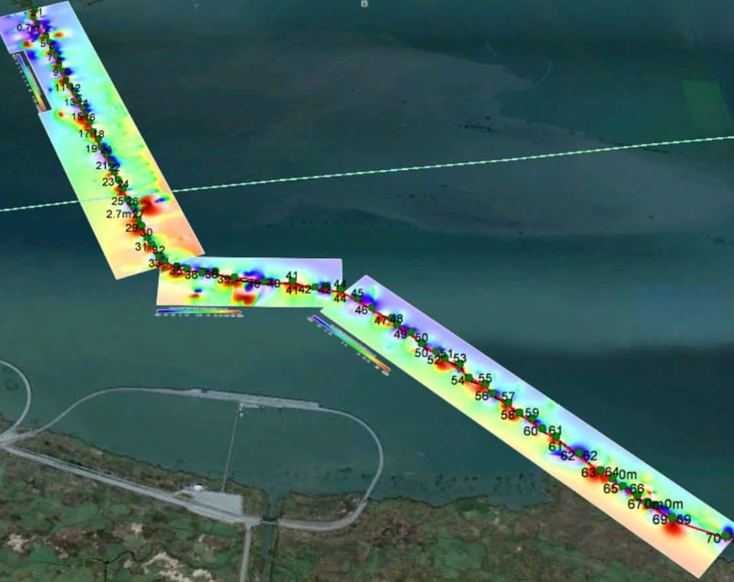
Detect Magnetic Anomalies With High-Sensitivity Cesium Vapor Technology
The Geometrics G-882 uses a self-oscillating split-beam cesium vapor sensor to measure extremely small variations in the Earth’s magnetic field. These variations, known as magnetic anomalies, can indicate the presence of buried or submerged ferrous objects that may not be visible through sonar or visual inspection alone.
High sensitivity, low sensor noise, and sampling rates of up to 20 Hz allow the G-882 to collect dense magnetic datasets throughout a survey. The result is consistent, high-quality magnetic measurements that support accurate anomaly interpretation across both shallow- and deep-water operations.
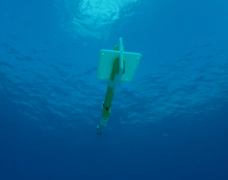
Support Offshore Projects With Reliable Magnetic Survey Data
Magnetic survey data is most valuable when it helps guide project decisions. Before cables are installed, pipelines are laid, or offshore construction begins, operators need a better understanding of potential hazards and existing infrastructure along the planned work corridor.
Complementing technologies like side-scan sonar, the Geometrics G-882 system helps survey teams develop a more complete understanding of subsea conditions before work begins.
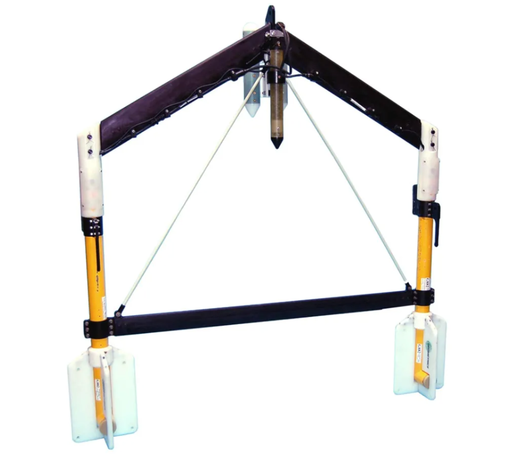
Fit the Geometrics G-882 Into Existing Marine Survey Workflows
A marine magnetometer is most effective when it’s integrated into a broader survey program. The G-882 is designed for deployment from a variety of survey vessels, and can be incorporated into both standalone magnetic surveys and larger multi-sensor campaigns.
Operators can synchronize multiple G-882 systems for expanded survey coverage or configure the system as a gradiometer when additional magnetic data is required. Compatibility with Geometrics’ acquisition and processing software further streamlines data collection and interpretation, helping survey teams move efficiently from field acquisition to final analysis.
Téléchargements
Geometrics G-882 Technical Specifications
| Type de capteur | Self-oscillating split-beam cesium vapor magnetometer |
| Operating Range | 20,000–100,000 nT |
| Sample Rate | Up to 20 Hz |
| Sensor Noise | <0.004 nT/√Hz RMS |
| Gradient Tolerance | Up to 10,000 nT/m |
| Towfish Length | 137 cm (54 in) |
| Towfish Diameter | 7 cm (2.75 in) |
| Towfish Weight | 18 kg (40 lb) |
| Standard Tow Cable | 800 m (2,625 ft) |
| Tow Cable Break Strength | 1,630 kg (3,600 lb) |
| Maximum Operating Depth | 2,730 m (4,000 psi) |
| Température de fonctionnement | -35°C to 50°C |
| Température de stockage | -45°C to 70°C |
| Data Output | RS-232 |
| Included Software | MagLogLite |
| Logiciel en option | MagLog Pro, MagMap, MagPick |
| Multi-Sensor Support | Synchronized multi-sensor configurations |
| Survey Integration | Compatible with marine geophysical survey workflows |

 English
  English (Canada)
  Français du Canada