
- MFE Offshore Home
- /
- Sonardyne SPRINT-Nav M | Hybrid Underwater Navigation System
Sonardyne SPRINT-Nav M
The Sonardyne SPRINT-Nav M is a compact, hybrid acoustic-inertial navigation system designed to provide precise underwater positioning, guidance, and control for ROVs, AUVs, USVs, and towfish.
By combining a Doppler Velocity Log (DVL), inertial navigation system (INS), attitude and heading reference system (AHRS), and depth sensor into a single instrument, the SPRINT-Nav M simplifies vehicle integration while reducing payload, cabling, and overall system complexity.
Benefits of the Sonardyne SPRINT-Nav M
- Underwater vehicle navigation
- Vehicle guidance and control
- Dynamic positioning support
- Hydrographic surveying
- Offshore inspection missions
- Oceanographic research
- Autonomous subsea operations
- Water current profiling with optional ADCP
- Remotely operated vehicles (ROVs)
- Autonomous underwater vehicles (AUVs)
- Unmanned surface vehicles (USVs)
- Towfish
- Manned submersibles
- Diver navigation boards
- Survey platforms
- Marine robotics systems
- Offshore oil and gas
- Offshore wind
- Marine construction
- Hydrographic surveying
- Oceanographic research
- Marine robotics
A louer
Talk to Wendy
Sonardyne SPRINT-Nav M Hybrid Navigation for Subsea Vehicles
Reliable underwater navigation depends on more than just knowing where a vehicle is. Operators need accurate heading, velocity, depth, altitude, and positioning information to safely guide ROVs, AUVs, USVs, and other marine robotic platforms through complex subsea environments.
The Sonardyne SPRINT-Nav M simplifies the process by combining four essential navigation systems—DVL, INS, AHRS, and a depth sensor—into a single compact instrument. With the SPRINT-Nav M, operators can install one factory-calibrated system that delivers continuous navigation and vehicle guidance data through a unified interface.
An All-in-One Underwater Navigation System
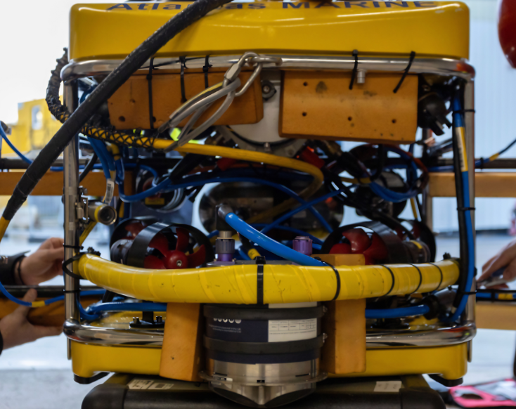
Traditionally, achieving accurate underwater navigation requires integrating multiple instruments, including a Doppler Velocity Log (DVL), inertial navigation system (INS), attitude and heading reference system (AHRS), and depth sensor. But each additional component increases payload requirements, cabling, connectors, power management, and integration effort, creating more opportunities for failure and extending vehicle build or mobilization time.
The Sonardyne SPRINT-Nav M replaces these separate systems with a single hybrid acoustic-inertial navigation instrument. By combining these core navigation functions into one compact package, it simplifies vehicle design while reducing weight and installation complexity.
Hybrid Acoustic-Inertial Navigation for Reliable Positioning
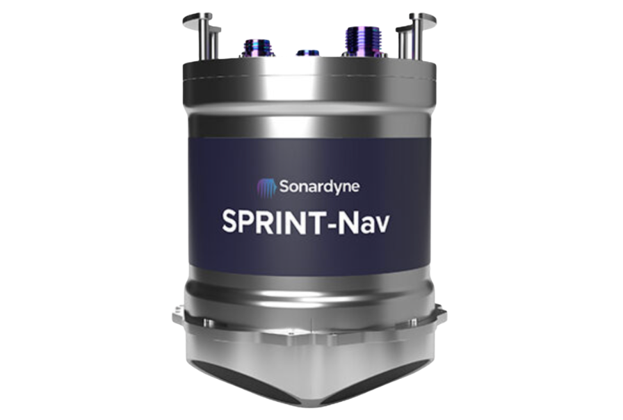
The SPRINT-Nav M is built around Sonardyne’s hybrid acoustic-inertial navigation engine, which continuously fuses data from its onboard sensors to produce accurate positioning, heading, velocity, depth, and altitude information.
Rather than relying on a single sensor, the system combines complementary data sources to provide robust navigation performance—even as underwater operating conditions change.
This hybrid approach also improves vehicle control during temporary acoustic interruptions. Combined with its true north-seeking gyrocompass—which avoids the long-term drift associated with many MEMS-based heading systems—the SPRINT-Nav M provides dependable guidance for inspection, survey, and autonomous missions in challenging GNSS-denied environments.
Compact Design for ROV, AUV, USV, and Towfish Integration
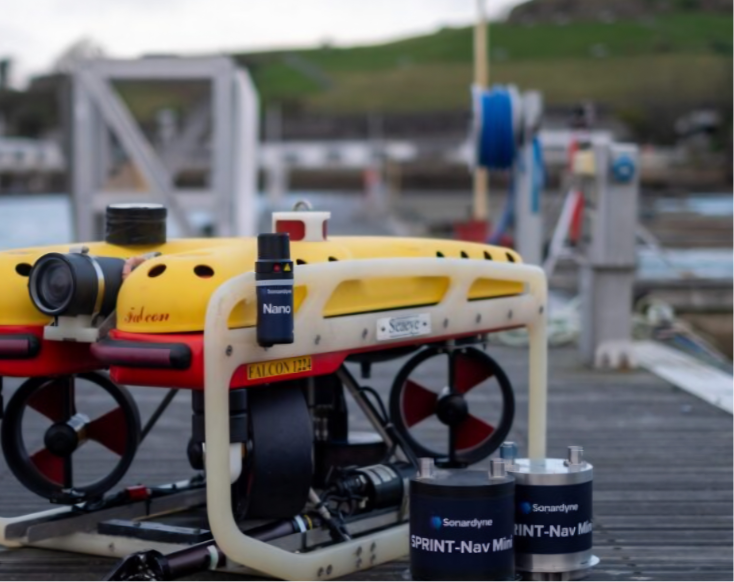
The SPRINT-Nav M was engineered specifically for subsea environments, where space is incredibly limited, delivering a complete navigation solution in a compact housing measuring as little as 187 mm (7.4 in) tall for the low-profile 300 m (984 feet) side-connector version.
Available in 300 m, 1,000 m, and 4,000 m depth-rated configurations, the system supports everything from compact observation-class ROVs to deepwater autonomous vehicles. Its compact footprint is particularly valuable for vehicles operating in GNSS-denied subsea environments, where dependable onboard navigation is essential for maintaining accurate positioning and control.
Factory-Calibrated for Faster Deployment
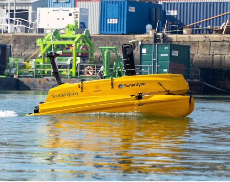
The Sonardyne SPRINT-Nav M arrives factory-calibrated, letting operators get to work right away.
The system is equally straightforward to integrate into existing vehicle control architectures. An intuitive web-based user interface simplifies configuration and diagnostics, while industry-standard outputs, Ethernet connectivity, serial communications, and a documented API make it easy to interface with both Sonardyne and third-party vehicle control software.
Additional Features of the Sonardyne SPRINT-Nav M
- Optional ADCP functionality for profiling water currents over ranges from 0.4–100 m
- Up to 200 Hz navigation outputs for responsive vehicle guidance and control
- 500 kHz DVL capable of maintaining bottom lock at altitudes up to 200 m
- 64 GB internal data storage for onboard mission logging
- Top- or side-connector configurations to simplify installation on space-constrained vehicles
Whether integrating a new platform or upgrading an existing fleet, the SPRINT-Nav M offers a practical combination of navigation performance, deployment flexibility, and long-term reliability for subsea operations.
Sonardyne SPRINT-Nav M Technical Specifications
| Typical DVL-aided survey accuracy | 0.05% distance traveled |
| Heading accuracy | 0.08° (GNSS/USBL + DVL), 0.12° (GNSS/USBL or DVL) |
| Roll and pitch accuracy | 0.02° |
| Velocity precision | <0.4 cm/s |
| Depth accuracy | 0.01% full scale |
| Output rate | Up to 200 Hz |
| Interfaces | Ethernet, UDP/TCP, Web UI |
| Communications | 3 × RS232 |
| Stockage des données | 64 GB internal memory |
| Exigences en matière d'alimentation | 24 V DC, 10 W nominal |
| Depth ratings | 300 m, 1,000 m, or 4,000 m |
| Dimensions | 148 mm diameter × 187–213 mm height (depending on configuration) |
| Poids | 3.7–7.1 kg in air |
| Logement | POM-C (300 m) or Titanium (1,000/4,000 m) |
| Connector options | Top or side connector configurations |
| Bottom-track altitude | 0.3–200 m |
| Optional ADCP profiling range | 0.4–100 m |
| Température de fonctionnement | –5°C to 40°C (300 m); –5°C to 50°C (1,000/4,000 m) |
| Température de stockage | –25°C to 55°C |
| ADCP maximum ping rate | 4 Hz |

 English
  English (Canada)
  Français du Canada