Ressources / Guide / Oil and Gas Drone Inspection: Visual to Advanced NDT
Guide
Oil and Gas Drone Inspection: Visual to Advanced NDT
Oil and gas drone inspection refers to the use of drones to collect inspection data on energy assets—often in places that are hazardous, elevated, confined, or otherwise difficult to access.
→ Jump to the best drones for oil and gas inspections
In the early days, drones in oil and gas were used primarily for remote visual inspection (RVI).
That alone represented a major shift, allowing teams to document flare stacks, tank roofs, and elevated structures without scaffolding or rope access.
Over time, capabilities expanded.
Thermal imaging added temperature-based screening to refinery and process environments. Optical gas imaging (OGI) enabled aerial methane visualization. And in select cases, specialized platforms now support targeted screening measurements such as ultrasonic thickness (UT) at elevation.
Today, oil and gas drone inspection is helping teams screen assets faster, reduce personnel exposure, and improve documentation.
This guide covers the best drones for oil and gas inspections, how to use a drone for an inspection in oil and gas, and the key assets where they’re most commonly used for inspections. Use the menu to the right to jump around, or keep reading for the full guide.
Best Drones for Oil and Gas Inspections
MFE has offices all over the world.
But we’re headquartered in Houston, Texas for a reason: we work closely with oil and gas operations, acting as trusted advisors to help them find the best inspection solutions for their specific needs.
Here are the top UAVs we recommend for oil and gas drone inspections.
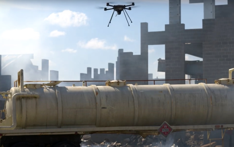
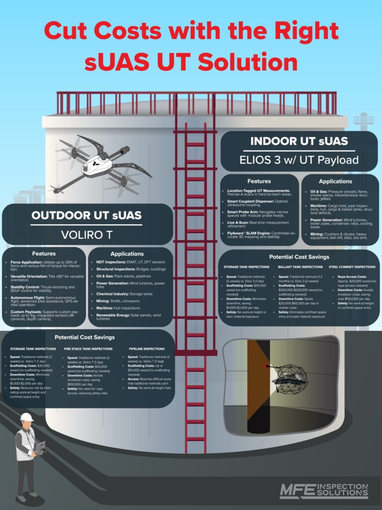
1. Voliro T
Contact NDT for targeted screening workflows
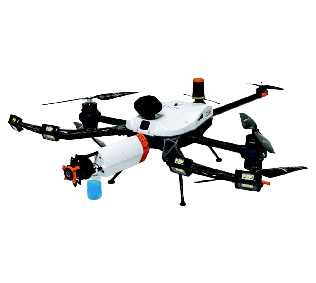
Les Voliro T is designed for close-proximity, contact-based data collection where visual inspection alone doesn’t answer the question. It’s most relevant when teams need targeted screening at elevation to help prioritize follow-up work.
- Best for: tanks, pressure vessels, piping runs, and vertical infrastructure where access is the main constraint.
- Why teams choose it: supports contact-based screening workflows as part of a larger screen → confirm process.
- Good fit when: the goal is “where do we need follow-up?” rather than “can we confirm everything remotely?”
2. Flyability Elios 3
Confined space and internal inspections
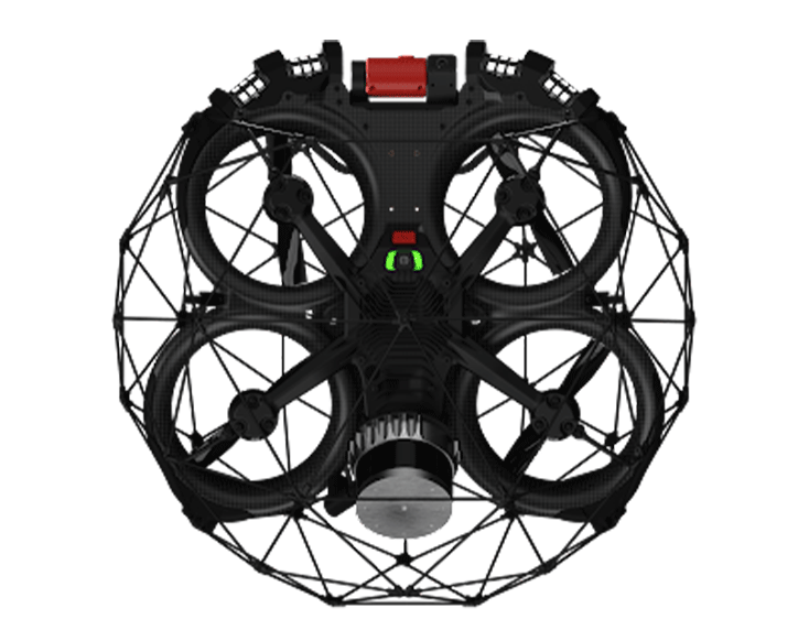
Les Flyability Elios 3 is well suited for internal and confined-space inspections where GPS is unreliable and collision tolerance matters—often the reality in tank internals and complex structures.
- Best for: internal tank inspections, confined spaces, tight corridors, and complex structures.
- Why teams choose it: designed for usable inspection documentation in GPS-denied environments.
- Good fit when: you need fast internal condition checks and clear documentation while reducing confined-space exposure during screening.
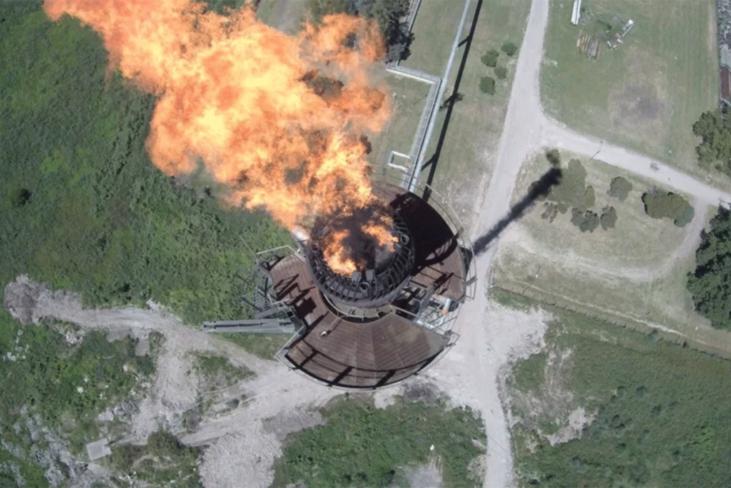
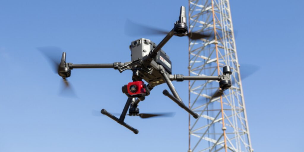
3. DJI Matrice 350 RTK
Outdoor platform for visual, thermal, and mapping workflows
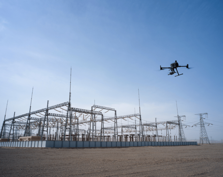
Les DJI Matrice 350 RTK is a flexible outdoor workhorse commonly used for large-area visual inspections, thermal checks, and mapping work where teams want repeatable capture and payload flexibility.
- Best for: facility surveys, flare stack externals, tank roofs, right-of-way checks, and general site documentation.
- Why teams choose it: supports recurring visual/thermal/mapping tasks with consistent data capture across large assets.
LEARN MORE ABOUT THE DJI MATRICE 350 RTK
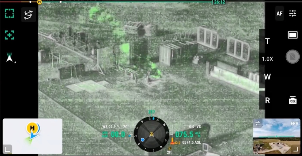
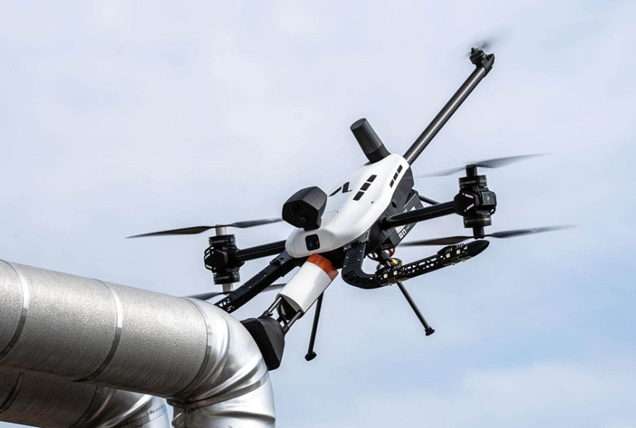
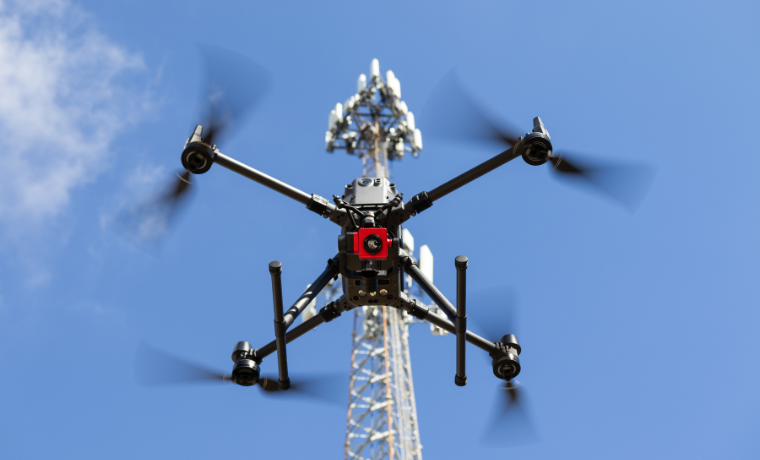
4. Skydio X10
Autonomy support for complex environments
Les Skydio X10 is often evaluated when teams want autonomy and obstacle-avoidance support to improve consistency in complex environments, especially for repeatable capture workflows.
- Best for: repeatable inspection capture where obstacles and complex geometry increase pilot workload.
- Why teams choose it: autonomy-forward approach that can help standardize data capture across sites and teams.
LEARN MORE ABOUT THE SKYDIO X10
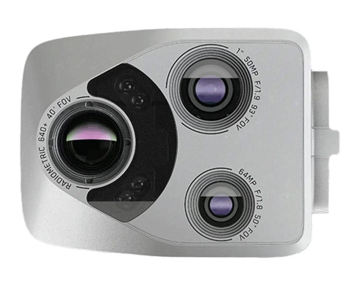
OGI Drone Inspections for Methane: MFE Detect LW Payload

If your workflow includes methane detection or emissions-focused inspections, MFE’s Detect LW is a long-wave infrared (LWIR) optical gas imaging (OGI) camera payload made for aerial methane visualization. This camera can turn a UAV into a flying OGI camera, making for an efficient gas detection drone with a straightforward integration workflow.
- Best for: methane-focused screening and documentation where drone access improves coverage and safety.
- Good fit when: you want faster leak-finding support and clearer documentation—then route findings into your site’s follow-up and repair process.
LEARN MORE ABOUT THE MFE DETECT LW
Want to see all of our drones? Here’s the full list.
What Is Oil and Gas Drone Inspection?
Oil and gas drone inspection refers to the use of uncrewed aerial vehicles (UAVs) to collect visual, thermal, gas-imaging, mapping, or—in select cases—contact-based screening data across energy assets.
In the oil and gas industry, drone inspections are commonly performed on:
- Storage tanks (external and internal)
- Piles de torche
- Piping racks and pipe bridges
- Récipients sous pression
- Refinery process units
- Offshore platforms and drilling facilities
What Drone Inspection Covers
In most programs, drone inspections are best treated as screening and documentation tools.
They help teams identify likely problem areas, improve access planning, and prioritize hands-on confirmation where required.
Here’s what drones can cover right now in oil and gas:
- Visual inspections (RVI): High-resolution imagery for corrosion and coating degradation, missing insulation, mechanical damage, structural anomalies, and general condition documentation.
- Thermal inspections: Infrared screening for temperature anomalies that may indicate insulation breakdown, abnormal heat loss, or process-related concerns requiring follow-up evaluation.
- Optical Gas Imaging (OGI): Methane and hydrocarbon plume visualization for leak-finding support and emissions documentation within LDAR or maintenance workflows.
- Ultrasonic Thickness (UT): Contact-based thickness measurements used in targeted screening workflows to help identify areas that may require confirmation by certified technicians.
- Eddy Current (EC): Surface and near-surface defect detection workflows where appropriate, typically used to support screening and prioritization.
- Pulsed Eddy Current (PEC) (where supported): Screening for corrosion under insulation (CUI) without insulation removal in select configurations.
- LiDAR and 3D Mapping: High-resolution spatial capture for facility documentation, structural modeling, volumetrics, and planning support.
Drone Inspection vs. Rope Access vs. Scaffolding
Oil and gas drone inspection is not a universal replacement for rope access or scaffolding.
Each method solves a different problem, and the right choice depends on the question you’re trying to answer.
| Factor | Drone Inspection | Rope Access | Scaffolding |
|---|---|---|---|
| Primary strength | Fast screening and documentation | Targeted hands-on inspection | Stable long-duration access |
| Mobilization time | Typically shorter | Moderate | Often longest |
| Best used for | “Is there a problem and where?” | “How severe is it?” | “Let’s fix it.” |
When Drones Make the Most Sense
- Early-stage screening and documentation before mobilizing access infrastructure
- Wide-area coverage where broad visibility matters more than close-contact measurements
- Access-constrained environments like flare stacks, pipe racks, and complex structures
- Short inspection windows where speed matters (often offshore)
When Rope Access or Scaffolding Makes More Sense
- Hands-on confirmation requiring certified technicians and approved methods
- Repair work or mechanical intervention
- Complex measurement tasks requiring surface prep, controlled probe placement, or direct access
5 Reasons Oil and Gas Teams Use Drones
Oil and gas drone inspection programs grow because many routine inspection targets are hazardous to reach and expensive to access with traditional methods.
Drones help teams get the right data earlier—with a lot less downtime, and a lot less exposure to risk.
1. Improve Safety by Reducing Exposure
Drones can reduce the need for scaffolding, climbing, and confined-space entry during the screening stage, while still reserving hands-on access for confirmation and repairs.
2. Reduce Access Time and Planning Friction
Drones shorten the “time to first look,” helping teams validate whether an issue is real, pinpoint location, and plan follow-up work more precisely.
3. Improve Documentation and Repeatability
Consistent photo logs and repeatable capture support workpack planning, coordination between teams, and condition trending over time.
4. Add Thermal Screening When Visual Alone Isn’t Enough
Thermal imaging is commonly used to flag temperature anomalies—especially in refinery environments—then route findings into the appropriate follow-up process.
[Lire aussi : Drones Improve Inspection Results For Argentina’s Oil and Gas Refineries]
5. Support Emissions Workflows with OGI and Gas Detection
OGI drone inspection can support methane-focused leak-finding and documentation workflows, helping teams prioritize follow-up action.
Common Oil and Gas Assets Inspected by Drone
Oil and gas drone inspection is most effective when applied to assets that are difficult to access, time-consuming to scaffold, or risky to inspect up close. In many programs, drones are used first to screen and document conditions, then route findings into the right confirmation method based on risk and site practice.Storage Tanks (External + Internal)
Drones are commonly used to document tank shell and roof conditions and to support internal screening where access is constrained. In methane-focused programs, OGI payloads can support emissions-related screening and documentation. [Case study: Acuren Partners with MFE for EPA-Compliant, Drone-Based Gas Leak Detection]
Flare Stacks
Drones help teams document external conditions and capture imagery that supports planning, especially when traditional access is slow to mobilize. [Case study: MFE Supports Acuren in Drone-Based Workflow for Comprehensive Stack Inspections]Pipelines and Right-of-Way (ROW)
Pipeline drone inspections often focus on coverage and documentation at scale—right-of-way observations, mapping outputs where appropriate, and situational awareness that helps prioritize follow-up.Refineries and Process Units
Refinery drone inspection workflows often combine visual documentation with thermal screening to flag temperature anomalies that may warrant closer evaluation.Pressure Vessels, Piping Racks, and Elevated Structures
Drones are frequently used to document corrosion/coating conditions, missing insulation, and mechanical damage across complex structures where access planning can be time-intensive.Offshore Facilities (Drilling and Production)
Offshore drone inspection adds marine winds, saltwater exposure, tight logistics, and limited inspection windows. Drones are often deployed to accelerate screening and reduce access buildout for documentation. [Case study: CAN USA Reduces Time for Offshore Drilling & Production Facility Inspections by 60% with the Elios 3]Infographic: UT by Drone—Matching the Right Drone with the Right Asset
This infographic covers the ways professional inspection drones can be used to collect UT data on or in different types of assets:
Oil and Gas Drone Inspection Methods and Payloads
Oil and gas drone inspection includes multiple data-collection approaches. The right choice depends on the inspection question you’re trying to answer: documentation, anomaly screening, or targeted measurements to prioritize follow-up.Visual (RVI) Drone Inspections
- Best for: corrosion and coating documentation, missing insulation, mechanical damage, structural anomalies, and general condition checks.
- Data you get: high-resolution photos and video suitable for reporting, workpack planning, and condition trending.
- Main limitation: visual data can show symptoms, but it rarely confirms severity (for example, remaining wall thickness).
Thermal Drone Inspections (Refineries and Process Assets)
- Best for: screening for temperature anomalies that may indicate insulation breakdown, abnormal heat loss, or process-related concerns requiring follow-up evaluation.
- Data you get: infrared images/video paired with visual context for interpretation and documentation.
- Main limitation: thermal findings often require engineering review and follow-up to interpret cause and confirm severity.
OGI Drone Inspections (Methane / Hydrocarbon Leak Visualization)
- Best for: methane and hydrocarbon leak-finding support, emissions documentation, and rapid screening over complex assets.
- Data you get: OGI imagery/video showing plume behavior, typically paired with a visible image stream and inspection notes.
- Main limitation: OGI is best treated as screening and documentation; follow-up actions should follow approved site procedures and workflows.
Ultrasonic Thickness (UT) by Drone (Targeted Contact Measurements)
- Best for: targeted thickness screening at elevation where access is the primary constraint and the goal is to prioritize follow-up work.
- Data you get: thickness measurements at selected locations collected via contact-based workflow (platform/payload dependent).
- Main limitation: capabilities and procedures vary by platform and application; many integrity decisions still require confirmation by certified technicians using approved methods.
Eddy Current (EC) by Drone (Where Appropriate)
- Best for: surface and near-surface defect detection workflows where EC is appropriate and the inspection question can be answered via targeted screening.
- Data you get: eddy current response data (workflow dependent) used to support screening and prioritization.
- Main limitation: strongly dependent on access, surface condition, configuration, and procedure; typically used to guide follow-up, not close out integrity decisions alone.
Pulsed Eddy Current (PEC) by Drone (Where Supported)
- Best for: screening for corrosion under insulation (CUI) without insulation removal in select configurations and workflows.
- Data you get: PEC screening data used to identify areas that may warrant insulation removal and confirmation inspection.
- Main limitation: screening method with boundaries that depend on configuration and procedure; results often require confirmation using approved follow-up methods.
Mapping, Photogrammetry, and LiDAR
- Best for: facility documentation at scale, structural modeling, change detection, volumetrics, and planning support for maintenance and inspection workpacks.
- Data you get: maps, models, point clouds, and measurements (deliverable dependent) that support coordination and planning.
- Main limitation: mapping outputs don’t inherently answer integrity questions unless paired with the right inspection method and follow-up workflow.
At-a-Glance: Which Method Fits Your Inspection Question?
| Method | Best for | Data you get | Key limitations | Typical follow-up |
|---|---|---|---|---|
| Visual (RVI) | Condition documentation and anomaly spotting | Photos / video | Does not quantify wall loss or confirm severity | Targeted hands-on inspection where needed |
| Thermal | Temperature anomaly screening (common in refineries) | IR images / video | Requires interpretation; not a standalone diagnosis | Engineering review and method-appropriate confirmation |
| OGI (Methane) | Leak-finding support and emissions documentation | OGI imagery / video | Best treated as screening/documentation; follow-up required | Confirm, repair, and re-check per site LDAR workflow |
| UT (Drone) | Targeted thickness screening at elevation | Thickness measurements (selected points) | Platform/procedure dependent; often requires confirmation | Certified confirmation where required; characterize severity |
| Eddy Current (Drone) | Targeted screening for surface/near-surface indications | EC response data (workflow dependent) | Highly application dependent; typically not a closeout method | Confirm with approved follow-up method |
| PEC (Drone) (where supported) | CUI screening without insulation removal (select workflows) | PEC screening data | Screening boundaries vary; confirmation often required | Target insulation removal and confirm using approved methods |
| Mapping / LiDAR | Site documentation and planning | Maps / models / point clouds | Not inherently an integrity answer without follow-up | Use outputs to plan and target inspection work |
Screening vs. Confirmation: How Drone Inspections Fit into Integrity Programs
One of the most important concepts in oil and gas drone inspection is understanding the difference between screening and confirmation. Drones are often excellent screening tools. They help teams identify likely problem areas quickly, document conditions clearly, and prioritize where resources should go next. But in most integrity programs, screening data is not the final answer—it’s the beginning of a structured decision process. 1. Screen → 2. Confirm → 3. Characterize → 4. Repair- Screen: Use visual, thermal, OGI, UT, PEC, or other drone-enabled methods to identify anomalies or areas of concern.
- Confirm: Deploy the appropriate access method—rope access, scaffolding, or certified NDT—to validate the finding according to site procedures.
- Characterize: Quantify severity (e.g., remaining wall thickness, defect dimensions, leak rate) using approved techniques.
- Repair: Execute corrective action based on confirmed data and engineering review.
What Screening Looks Like in Practice
- Rapid visual documentation to determine whether corrosion is isolated or widespread
- Thermal or OGI surveys to identify potential hotspots or emission sources
- Targeted drone-enabled UT or PEC checks to prioritize insulation removal or follow-up access
- Structured photo/video logs to support workpack planning
Common Failure Modes to Avoid
- Treating screening data as confirmation data. Not all drone-collected measurements close out an integrity question.
- No defined follow-up path. Screening should feed directly into a documented confirmation workflow.
- Poor documentation discipline. Images without location context or inspection notes reduce long-term value.
Offshore Oil and Gas Drone Inspection
Offshore oil and gas drone inspection operates under additional environmental and logistical constraints. Marine winds, saltwater exposure, limited deck space, and tight inspection windows all influence how inspections are planned and executed.
In these environments, drones are typically used to accelerate screening and reduce unnecessary access buildout—especially when mobilization costs and downtime are high.
What Changes Offshore
- Weather windows matter. Inspections often need to be completed within narrow operating conditions.
- Corrosion exposure is constant. Marine environments accelerate coating breakdown and structural degradation.
- Logistics are more complex. Mobilizing scaffolding or rope access offshore can require significant coordination and time.
- Space is constrained. Deck layout and safety requirements influence launch and recovery planning.
Where Drones Deliver the Most Value Offshore
- Rapid external condition checks before building access infrastructure
- Confined-space screening where reducing personnel exposure improves safety
- Clear documentation that supports engineering review and maintenance planning
- Prioritization of follow-up access based on observed severity
Used correctly, offshore drone inspection improves planning precision. Instead of sending crews into uncertain conditions, teams can use aerial data to define scope before mobilizing higher-cost access methods.
Where Drones Fit Offshore (Topside + Vessel + Confined Space)
| Offshore Asset / Area | Common Inspection Focus | Typical Inspection Technology |
|---|---|---|
| Platform topsides (modules, pipe racks, structures) | Corrosion/coating condition, missing insulation, general condition documentation | Aerial inspection drone (visual / thermal as needed) |
| Flare boom / flare stack externals | External condition documentation, corrosion indications, component visibility checks | Aerial inspection drone (high-resolution visual; thermal where appropriate) |
| Helideck and support structure | Surface condition, structural members, repeatable documentation for trending | Aerial inspection drone (visual) |
| Living quarters / EX-rated sensitive areas (external) | General condition documentation with strict operational constraints | Aerial inspection drone (site-approved ops plan; payloads as permitted) |
| Vessel / FPSO hull externals (above waterline) | Coating condition, corrosion documentation, structural anomaly spotting | Aerial inspection drone (visual) |
| FPSO cargo tanks / ballast tanks (internal) | Internal condition screening, structural members, corrosion documentation | Confined-space drone (collision-tolerant cage drone) |
| Void spaces / enclosed compartments | Internal screening, documentation for planning follow-up access | Confined-space drone (caged indoor drone) |
| Subsea pipelines | Route survey, free spans, external condition observations, seabed interaction | ROV (remotely operated vehicle) or AUV (autonomous underwater vehicle) |
| Subsea structures (manifolds, templates, wellheads) | Visual condition checks, marine growth, leaks/seeps indicators, geometry documentation | ROV (with video/stills; tooling as required) |
| Risers / subsea tie-ins / splash zone interfaces | Condition screening across transition zones (above/below waterline) | Aerial inspection drone (above-water) + ROV (below-water) |
| Moorings / chains / subsea anchors | Condition observations, wear points, configuration checks | ROV (inspection-class) |
In offshore oil and gas, aerial drones are most commonly used for topside and vessel-related inspection tasks—especially where access is at height, over water, or inside enclosed structures.
- Platform topsides and structures: general condition documentation, corrosion/coating checks, and targeted visual coverage of hard-to-reach areas.
- Flare booms / elevated assets: fast visual inspection coverage that supports planning and reduces working-at-height exposure during the screening stage.
- Helidecks and support structures: repeatable documentation for condition trending and maintenance planning.
- Vessels and FPSOs: external checks plus confined-space screening inside tanks, voids, and other complex internal spaces where traditional access is slower and higher-risk.
For FPSOs specifically, collision-tolerant confined-space drones are often used to capture usable inspection data inside cargo or ballast tanks without the same scaffolding and personnel exposure typically associated with internal tank entry.
[Case study: CAN USA reduces time for offshore drilling & production facility inspections by 60% with the Elios 3]
How Subsea Fits In (And Why It’s Often Robotics, Not Aerial Drones)
Below the surface, the inspection toolkit changes. Subsea work is typically performed with underwater robotics—such as ROVs and other subsea platforms—supported by positioning systems that help teams tie subsea observations to a known reference point for reporting, repeatability, and coordination.
In other words: aerial drones usually support topside, vessel, and confined-space screening, while subsea robotics supports underwater inspection, survey, and intervention workflows.
If your scope crosses both topside and subsea work, it helps to plan the inspection as a single operational workflow—using the right uncrewed system for each environment and ensuring the resulting data can be integrated into reporting and follow-up.
MFE Offshore: Offshore + Subsea Support Under One Division
MFE Offshore is a dedicated division built specifically for subsea and offshore operations.
The goal is to support offshore teams with the right inspection technology, training, and hands-on deployment guidance—built around the realities of harsh offshore environments, tight inspection windows, and “it has to work the first time” constraints.
Oil and Gas Drone Inspection FAQ
Here are answers to the most commonly asked questions about how drones are used for inspections in oil and gas.
Can Drones Be Used for OGI (Methane) Inspections in Oil and Gas?
Yes. OGI drone inspection is commonly used to support methane leak-finding and documentation workflows. In most programs, OGI is best treated as a screening layer that helps teams prioritize follow-up action.
What Is the Best Oil and Gas Inspection Drone?
The best platform depends on your workflow:
- Confined spaces/internal inspections: Flyability Elios 3
- Outdoor visual/thermal coverage: DJI Matrice 350 RTK
- Methane/emissions screening: Détection de l'EMF LW (payload)
- Targeted contact-based screening (select cases): Voliro T
Can Drones Replace Rope Access or Scaffolding?
Drones can reduce how often teams need to mobilize access infrastructure just to screen and document conditions. But rope access and scaffolding are still essential when the job requires hands-on confirmation, detailed NDT, or repairs.
How Are Thermal Drones Used in Refinery Inspections?
Thermal imaging is commonly used to screen for temperature anomalies that may warrant closer evaluation. Findings often require interpretation and are typically routed into the appropriate follow-up process.
How Much Does Oil and Gas Drone Inspection Cost?
Costs vary based on asset type, access constraints, offshore logistics, payload requirements (thermal/OGI/mapping), and reporting needs. Many programs justify drones by reducing unnecessary mobilization and improving planning precision.


