
- MFE Offshore Home
- /
- NORBIT WBMS X
NORBIT WBMS X
The NORBIT WBMS X is an ultra-compact multibeam bathymetric sonar system designed for high-resolution hydrographic surveying and seabed mapping.
Available in Standard and Long Range configurations, the WBMS X combines detailed bathymetric data collection with flexible swath coverage, vessel-motion compensation, and compatibility with established hydrographic software.
Benefits of the NORBIT WBMS X
- Hydrographic surveying
- Bathymetric mapping
- Seabed mapping
- Dredging surveys
- Navigation channel surveys
- Coastal surveys
- Offshore site surveys
- Marine construction surveys
- Pipeline route surveys
- Cable route surveys
- Ports
- Ports
- Navigation channels
- Coastal waterways
- Offshore energy sites
- Marine construction sites
- Subsea pipelines
- Subsea cables
- Oil and gas
- Offshore energy
- Offshore wind
- Marine construction
- Dredging
- Ports and harbors
- Coastal engineering
- Hydrography
A louer
Demande de devis
Flexible Bathymetric Surveying with the NORBIT WBMS X
Hydrographic survey requirements can change substantially from one project to the next. Vessel size, water depth, positioning equipment, and required sounding density all influence how a multibeam system should be configured.
The NORBIT WBMS X addresses these variables through a compact, modular platform rather than a single fixed package. Survey teams can configure the system around their operational environment while maintaining the bathymetric resolution, coverage, and positioning integration needed to produce usable survey data.
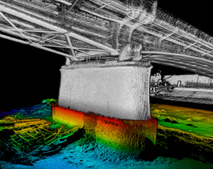
Collect High-Resolution Bathymetric Data in Shallow and Deeper Water
The NORBIT WBMS X is available in Standard and Long Range configurations for surveys across different operating depths.
- The Standard model supports a depth range of 0.2–275 meters.
- The Long Range model extends the maximum range to 600 meters.
Both configurations provide frequency agility from 200–700 kHz, allowing operators to balance range and resolution for the conditions encountered during a survey.
The system offers resolution as fine as 0.5° × 0.5° at 700 kHz, flexible swath coverage from 5°–210°, and an adaptive ping rate of up to 60 Hz.
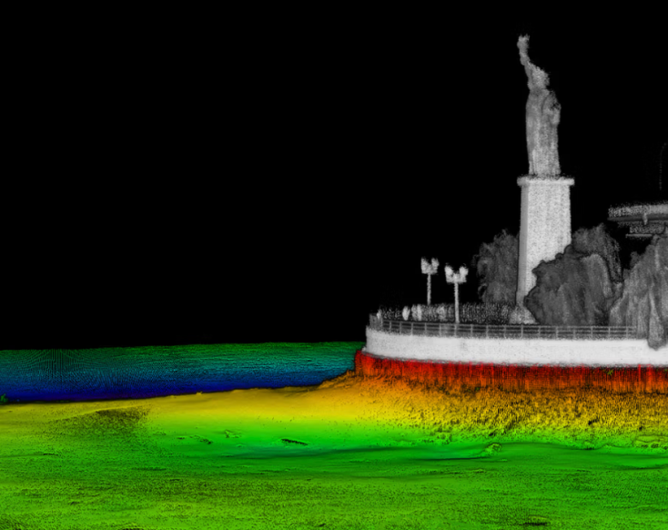
Configure the NORBIT WBMS X for Different Survey Platforms
The NORBIT WBMS X can be supplied with integrated or non-integrated GNSS/INS configurations and supports several mounting and hardware options, including NORBIT’s PORTUS carbon-fiber pole, titanium housing, protective fairing, and multiple cable lengths.
Dual-head and subsea configurations are also available for specialized deployments. This modular approach allows the system to support permanent vessel installations as well as portable or project-specific setups.
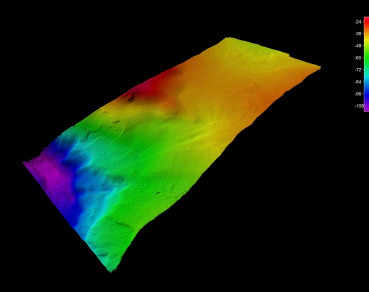
Maintain Even Sounding Density in Dynamic Conditions
The NORBIT WBMS X includes active roll stabilization, with pitch and yaw stabilization available as software options.
These functions compensate for vessel movement in real time to help maintain more consistent sounding distribution. Optional Dual Swath further increases along-track density by transmitting two swaths during each ping cycle, supporting efficient data collection when denser coverage is required.
Integrate the NORBIT WBMS X into Existing Survey Workflows
The NORBIT WBMS X supports OEM GNSS/INS integrations from Applanix and SBG. INS-integrated systems can also use NORBIT’s Data Collection Tool and real-time 3D point-cloud visualization.
Compatibility with third-party platforms—including HYPACK, QPS, BeamworX, and EIVA—allows bathymetric data to move into familiar acquisition and post-processing workflows without forcing operators into a single software ecosystem.
Téléchargements
NORBIT WBMS X Technical Specifications
| Standard depth range | 0.2–275 m |
| Long Range depth range | 0.2–600 m |
| Operating frequency | 200–700 kHz, configuration dependent |
| Best angular resolution | 0.5° × 0.5° at 700 kHz |
| Swath coverage | 5°–210° flexible sector |
| Number of beams | 256, 512, or optional 1,024 |
| Dual Swath | Optional 2 × 1,024 beams |
| Ping rate | Up to 60 Hz, adaptive |
| Acoustic depth resolution | Less than 10 mm with 80 kHz bandwidth |
| Backscatter outputs | Intensity, sidescan, snippets, and water column |
| Vessel-motion compensation | Active roll stabilization; optional pitch and yaw stabilization |
| GNSS/INS integrations | Applanix OceanMaster, WaveMaster II, SurfMaster, and SBG Ekinox |
| NORBIT software | Data Collection Tool and real-time 3D point-cloud visualization |
| Third-party software | HYPACK, QPS, BeamworX, EIVA, and others |
| Additional options | Dual Swath and STX electronic scanning |
| Weight in air | Approximately 6.6–7.9 kg, depending on configuration |
| Standard depth rating | 100m |
| Optional subsea version | Rated to 1,500 m for qualifying Standard configurations |
| Température de fonctionnement | -4°C to +40°C |
| Puissance | 10–28 VDC or 100–240 VAC; 40–85 W depending on GNSS configuration |
 English
  English (Canada)
  Français du Canada