Inersia Monitoring

Inersia is a subscription-based platform that uses advanced satellite radar (InSAR) technology to detect ground movement with millimetric precision. It enables organizations to remotely monitor subsidence, uplift, and structural shifts without the need for on-site sensors. 

Built for industries like mining, oil & gas, and infrastructure, Inersia enhances safety, ensures regulatory compliance, and supports environmental oversight. The platform offers precise deformation tracking over time, interactive 3D terrain visualization with infrastructure overlays, and satellite-based analysis of vegetation health and moisture levels.

With access to over 30 years of historical satellite data, Inersia empowers users to uncover long-term trends and forecast geotechnical risks with confidence.

Equipment Type: InSAR Ground Deformation Monitoring

Benefits of Inersia

  • Millimetric ground displacement measurement
  • Historical time-series analysis of terrain movement (since 1992)
  • 3D geospatial visualization of deformation zones
  • Integration with GIS/BIM platforms for enhanced insight
  • NDVI/NDWI-based vegetation and moisture indexing
  • Remote, sensor-free monitoring across large areas
  • Predictive analytics for long-term geotechnical risk
  • Data layers for terrain, infrastructure, and environmental overlays
  • Monitoring pit and slope stability
  • Tracking deformation in tailings dams
  • Detecting ground movement near critical infrastructure (e.g., pads, tanks, crushers)
  • Assessing terrain changes post-blasting
  • Monitoring subsidence from injection or extraction activities
  • Detecting uplift from underground fluid movement
  • Surveillance of ground stability along pipeline corridors
  • Monitoring foundations of refineries, LNG plants, and storage tanks
  • Detecting settlement under high-load structures
  • Analyzing deformation at large-scale construction sites
  • Monitoring land subsidence in urban or developing areas
  • Forecasting structural risks due to terrain shifts
  • Checking alignment and elevation of roads and railways
  • Ensuring ground stability in ports and airport zones
  • Providing early warnings for potential landslides
  • Assessing seismic-related ground deformation (before and after events)
  • Analyzing terrain bulging or uplift in volcanic regions
  • Identifying soil moisture and irrigation flow patterns
  • Monitoring vegetation stress and health conditions
  • Tracking soil erosion across time
  • Managing wetlands and hydrological zones
  • Profiling risk for regulatory compliance
  • Supporting insurance, safety, and liability assessments
  • Oil & gas
  • Mining
  • Infrastructure
  • Environmental
  • Transportation & logistics
  • Agriculture

For Sale

Request a Quote or Demo

Inersia Advanced Ground Deformation Insights

Imagine being able to spot ground shifts, structural stress, or subtle changes in terrain before they become costly or dangerous. Inersia makes this possible by turning decades of satellite data into clear, actionable insights.

Whether you’re managing a mine, pipeline, dam, or construction site, Inersia gives you the power to remotely monitor ground stability across vast areas, all without the need for boots on the ground. With intuitive visualizations and long-term trend analysis, you can catch early warning signs, make informed decisions, and stay one step ahead of risk.

Ground Displacement Analysis & 3D Visualization Platform

It starts with movement you can’t see: tiny shifts beneath the surface that, over time, can lead to serious structural risks.

Inersia’s ground displacement analysis uses advanced InSAR technology to detect these changes with millimetric precision, capturing vertical and horizontal ground motion over days, months, or even decades.

But raw data alone isn’t enough. That’s where the Inersia 3D Viewer comes in. 

Like a powerful, geospatial control center, Inseria’s 3D Viewer lets users visualize terrain changes across time in a fully interactive interface.

With layered infrastructure data, customizable views, and easy-to-read deformation maps, teams can quickly identify high-risk areas and make informed decisions without ever setting foot on-site.

Rainfall Data Correlation & Acceleration Mapping

Not all ground movement happens without a trigger and rainfall is one of the most common. Inersia’s rainfall correlation feature lets you overlay precipitation data onto your deformation timeline, revealing how major weather events align with shifts in terrain.

It’s a game-changing insight for anyone monitoring landslides, embankments, or areas prone to water infiltration. 

Paired with Inersia’s acceleration maps, which highlight zones where displacement is increasing over time, you gain a clear early warning system for identifying and prioritizing areas at risk.

Whether you’re managing a hillside, a tailings dam, or a transport corridor, these tools help you catch subtle warning signs before they escalate into costly problems.

Precision Monitoring for Critical Infrastructure

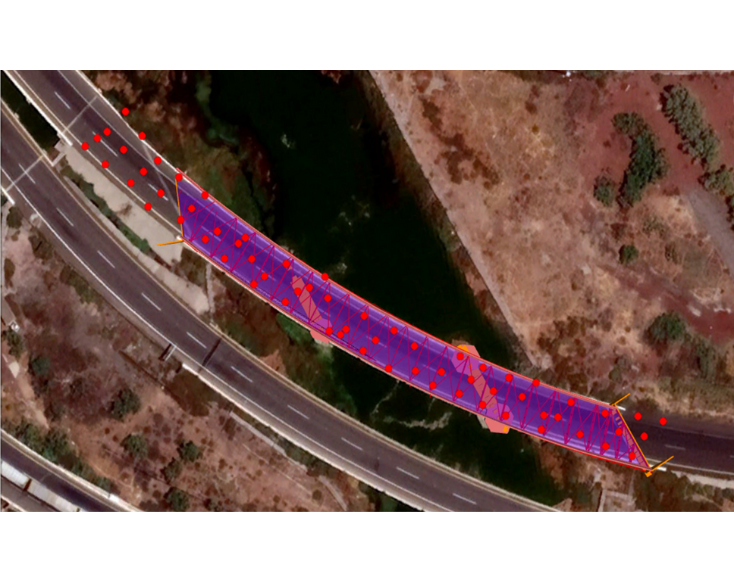
Infrastructure rarely fails without warning. You just have to know where to look. Inersia’s satellite-based monitoring detects even the smallest shifts in bridges, viaducts, and tunnels with accuracy down to 3 to 5 millimeters. 

That means you can catch tilting, stress buildup, or ground instability long before visible signs appear.

With high-resolution imagery as sharp as 30 centimeters and access to satellite archives dating back to 2001, Inersia gives you the ability to look back in time. 

Whether you’re reviewing a site’s history or planning your next inspection, you’ll see how things have changed and where attention is needed next.

Inersia’s Custom Data Integration & Coordinate-Based Point Analysis

No two sites are the same, and Inersia is built with that in mind. The monitoring platform allows you to bring all your geotechnical intelligence into one place by integrating external data sources like piezometers, ground-based radar, drone orthophotos, geological maps, and more.

Instead of juggling multiple tools, you can analyze everything together on a single, layered map. 

When precision matters most, Inersia lets you pinpoint exact locations using coordinates. Just enter the latitude and longitude, and instantly access the closest satellite measurement with its complete deformation history.

Whether you’re tracking a critical junction or reviewing site-wide trends, Inersia delivers targeted, actionable insight down to the ground’s smallest movements.

Multispectral Analysis & Historical Time-Series Data

Understanding what’s happening underground is only part of the story. With Inersia, you also gain insight into surface conditions through multispectral satellite analysis.

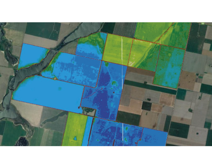
By measuring vegetation health, surface moisture, and thermal variation using NDVI (Normalized Difference Vegetation Index), NDWI (Normalized Difference Water Index), and other spectral indices, Inersia helps you monitor environmental factors that may signal or contribute to terrain instability.

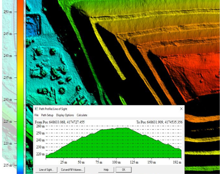
With access to more than 30 years of satellite archives, Inersia allows you to explore how a site has changed over time.

If you’re investigating a past slope failure or forecasting future risks, its historical time-series tools reveal patterns that static surveys often miss. The result is a deeper, more informed understanding of ground behavior that helps you plan, protect, and prevent with greater confidence.

Bring the Ground to Your Screen and Into the Field with Inersia

With Inersia, you do more than monitor terrain. You gain a deeper understanding of how the ground behaves, helping you plan smarter, respond faster, and reduce risk across every stage of your project. Whether you are overseeing infrastructure, mining operations, or environmental assets, Inersia gives you access to decades of satellite intelligence, powerful visualization tools, and expert-driven analysis. 

Soon, with the Augmented Reality Field Viewer, you will even be able to see satellite data overlaid on the landscape in front of you using just your phone. Start turning ground movement into ground truth. Get in touch to schedule a demo or learn how Inersia can support your next project.

Related Products