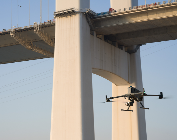
The DJI Matrice 400 represents a bold leap forward in enterprise drone technology, setting a new standard for industrial aerial solutions. Built to replace the outgoing Matrice 350 and representing DJI’s most significant release in years, this powerhouse platform is engineered to thrive in demanding environments—rain, wind, dust, or extreme temperatures.
With an IP55 rating and operational range from -20°C to 50°C, the Matrice 400 is ready for action wherever the job takes you. This next-generation aircraft is tailor-made for professionals in utilities, oil and gas, public safety, infrastructure, and construction.
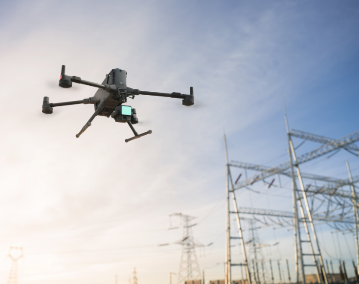
Whether it’s thermal mapping, emergency response, power line inspections, or surveying complex job sites, the Matrice 400 delivers unmatched reliability and performance. It folds down for easy transport thanks to its innovative design, which accommodates larger motors, booms, and propellers without compromising practicality or portability.
Equipment Type: Industrial Outdoor Inspection Drone
Request a Quote
The Matrice 400 is DJI’s most advanced enterprise drone yet, setting a new benchmark for aerial capability. Designed to surpass the Matrice 300 and 350, it delivers longer flight endurance, superior payload flexibility, and groundbreaking obstacle detection, including the ability to identify thin power lines at speed.
With a streamlined, single-battery system and enhanced automation, the Matrice 400 is built to take on complex missions with greater efficiency, reliability, and precision than ever before.

The Matrice 400 offers up to 59 minutes of flight time and 53 minutes of hover time when equipped with the H30T payload, almost double what’s typical from the Matrice 300 and 350 series. This added airtime supports longer missions without the constant need to swap batteries.
It also supports payloads up to 6 kg and can carry multiple devices at once, including sensors, spotlights, and payload drop systems. The platform is designed to handle a wide range of applications while keeping deployment practical and efficient.

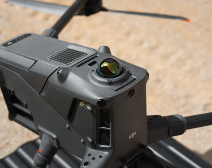
The DJI Matrice 400 features an advanced obstacle sensing system that includes LiDAR, millimeter wave radar, and multiple vision sensors. This setup allows the drone to detect objects as small as 12 mm, like power lines, even while flying at 38 mph, helping reduce risk during detailed inspections.
Paired with DJI’s O4 Enterprise transmission system, the platform supports stable video feeds at ranges up to 40 km in optimal conditions. Dual cellular dongle support and airborne relay capabilities help maintain signal in complex environments, making it well suited for large or obstructed job sites.

The Matrice 400 is equipped with intelligent flight features designed to streamline mission execution. Cruise Mode allows for hands-off inspections, letting pilots focus on real-time data capture, while Map View AR projection provides visual overlays for flight paths and checkpoints.
For mapping, the drone supports high-speed orthomosaic creation, real-time terrain following, and bidirectional oblique capture, all designed to increase coverage and efficiency.
These capabilities make the Matrice 400 well-suited for a range of industries, from power line inspections and construction mapping to emergency response and offshore operations.

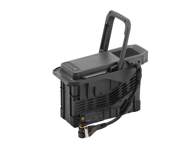
The Matrice 400 introduces DJI’s new TB100 battery system, replacing the dual-battery setup of earlier models with a single high-capacity unit. This streamlines operations while delivering over 20,000 mAh of power, and supports tethered flight with the TB100C station for continuous aerial support.
For advanced computing needs, the drone is compatible with the Manifold 3 onboard computer, enabling real-time data processing, AI tasks, and custom application development through DJI’s SDK. Together, these systems offer more flexibility and scalability for complex missions.
The Matrice 400 isn’t just an upgrade—it’s a rethinking of what enterprise drones should be. From its rugged IP55-rated build and all-weather performance to its modular design and support for evolving payloads, it’s ready to adapt to the demands of tomorrow’s missions.
Whether you’re flying over infrastructure, coastlines, or emergency sites, the Matrice 400 offers the tools and reliability to get the job done safely and efficiently every time.
DJI Matrice 400 Technical Specifications
| Max Takoff Weight | 15.8 KG |
| Dimensions | |
| Max Payload | 6 kg |
| Max Horizontal Speed (at sea level, no wind) | 25 m/s |
| Max Flight Time (no wind) | 59 minutes |
| Max Flight Distance (no wind) | 49 km | 30 miles |
| Max Wind Speed Resistance | 12 m/s | 26 Mph |
| Global Navigation Satellite System (GNSS) | GPS + Galileo + BeiDou + GLONASS (GLONASS is supported only when the RTK module is enabled) |
| Airborne ADS-B In | Equipped with standard airborne ADS-B In receiver and dual antennas, supporting reception up to 20 km. |
| Maximum Payload for Single Gimbal Connector | 1400 g |
| Maximum Payload for Dual Gimbal Connector | 950 g |
| Maximum Payload for Third Gimbal Connector |
| Sensing Type | |
| Forward | |
| Backward | |
| Lateral | |
| Downward | |
| Operating Environment | Forward, Backward, Left, Right, and Upward: Delicate texture on the surface, adequate light. |
| Rotating LiDAR | |
| Upper LiDAR (3D ToF) | 0.5-25 m at night (reflectivity > 10%) The FOV to the up and down is 60° and 60° to the right and left. |
| Downward 3D Infrared Range Sensor | Measurement Range: 0.3-8 m (reflectivity > 10%) The FOV to the front and rear is 60° and 60° to the right and left. |
| mmWave Radar | Measurement Range for Power Line:
|
| Resolution | 1080p |
| Field of View (FOV) | |
| Frame Rate | 30fps |
| Night Vision | Starlight Grade |
| Model | TB100 |
| Capacity | 20254 mAh |
| Standard Voltage | 48.23 V |
| Max Charging Voltage | 54.6 V |
| Cell Type | Li-ion 13S |
| Energy | 977 Wh |
| Charging Temperature | 5° to 45° C (41° to 113° F) |
| Discharging Temperature | -20° to 75° C (-4° to 122° F) |
| Battery Heating | |
| Max Charging Power | 2C |
| Low-Temperature Charging | Supports low-temperature self-heating charging |
| Cycle Count | 400 |
| DJI Products Compatible With Matrice 400 |