commercial-drones-hero

Guide

Best Commercial Drones & Professional Drones of 2025 [New Guide]

A commercial drone—also called a professional drone—is any drone that is used for work.

This means that commercial drones include both those professional-grade drones that are made for specific types of jobs, like Flyability’s Elios 3 made for flying in confined spaces, and drones that are made for general consumers but can also be used in professional settings, like DJI’s Mavic 3 Enterprise.

Here are the top commercial drones on the market:

  1. Skydio X10—Autonomous drone/remote operations
  2. DJI Matrice 350 RTK—Heavy-duty outdoor inspections
  3. DJI Mavic 3 Enterprise—Outdoor inspections
  4. Voliro T—Ultrasonic NDT Drone
  5. Flyability Elios 3—Indoor inspections

In this article, we’re going to cover the latest drone technology, look at all the different ways that drones are being used for work, and then go over regulatory requirements for the use of commercial drones.

Have a specific topic in mind? Use the menu to the right to jump straight to it.

The Top 5 Commercial Drones for Sale in 2025

Drones are being used for lots of different kinds of work these days, from inspections, to mapping, to precision agriculture.

Here is our list of the top five commercial and professional drones on the market, with specs and details included.

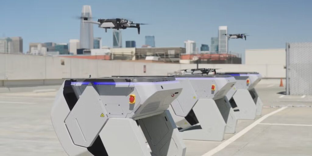
1. Skydio X10—Autonomous Drone/Remote Operations

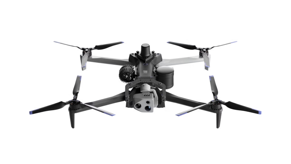
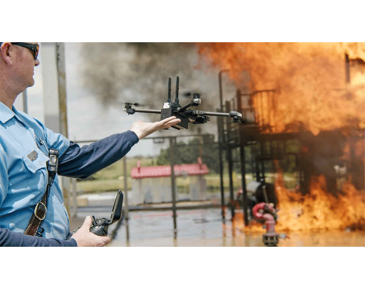
The Skydio X10 is a cutting-edge autonomous drone designed for high-precision inspections in challenging environments. With its advanced AI capabilities, thermal and high-resolution cameras, and rugged design, the X10 is ideal for critical infrastructure and emergency response missions.

  • Max flight time: 40 minutes
  • Payload capacity. Supports multiple sensors and accessories
  • AI navigation. Autonomous flight with obstacle avoidance
  • Thermal imaging. Equipped with a FLIR Boson+ thermal sensor for detailed inspections

Learn more about the Skydio X10.

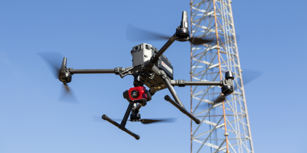
2. DJI Matrice 350 RTK—Heavy-Duty Outdoor Inspections

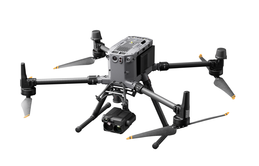
The DJI Matrice 350 RTK provides exceptional performance for heavy-duty outdoor inspections.

With advanced RTK positioning and high-end payload support, it’s perfect for large-scale infrastructure inspections, such as energy, construction, and public safety applications.

  • Max flight time. 55 minutes
  • RTK accuracy. Enhanced positioning for precise operations
  • Payload capacity. Supports multiple cameras and sensors
  • Smart features. Integrated obstacle avoidance, intelligent flight modes

Learn more about the DJI Matrice 350 RTK.

3. DJI Mavic 3 Enterprise—Outdoor Inspections

The DJI Mavic 3 Enterprise is an excellent choice for outdoor inspections, offering long flight times, advanced imaging capabilities, and an intuitive interface for quick deployment. It’s designed for professionals needing reliable performance in various environments like construction sites, energy facilities, and public safety operations.

  • Cameras. Hasselblad camera with 4/3″ sensor, Telephoto camera, and optional thermal camera.
  • Max flight time. 45 minutes
  • Max speed. 47 mph (75 km/h)
  • Transmission range. 9.3 miles (15 km)

Learn more about the DJI Mavic 3 Enterprise.

4. Voliro T—Ultrasonic NDT Drone

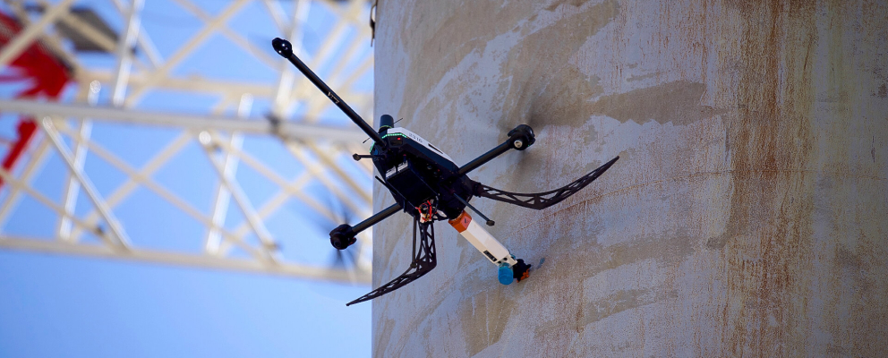
The Voliro T is a specialized drone designed for non-destructive testing (NDT) using ultrasonic sensors. This drone excels in inspecting large industrial infrastructure, including pipelines, tanks, and towers, providing high-quality data for critical industries like oil & gas and power generation.

  • Payload. Ultrasonic sensor for high-quality NDT
  • Flight time. Up to 10-15 minutes
  • Applications. Ideal for inspecting large industrial assets, including tanks and pipelines

Learn more about the Voliro T Ultrasonic NDT Drone.

5. Flyability Elios 3—Indoor Inspections
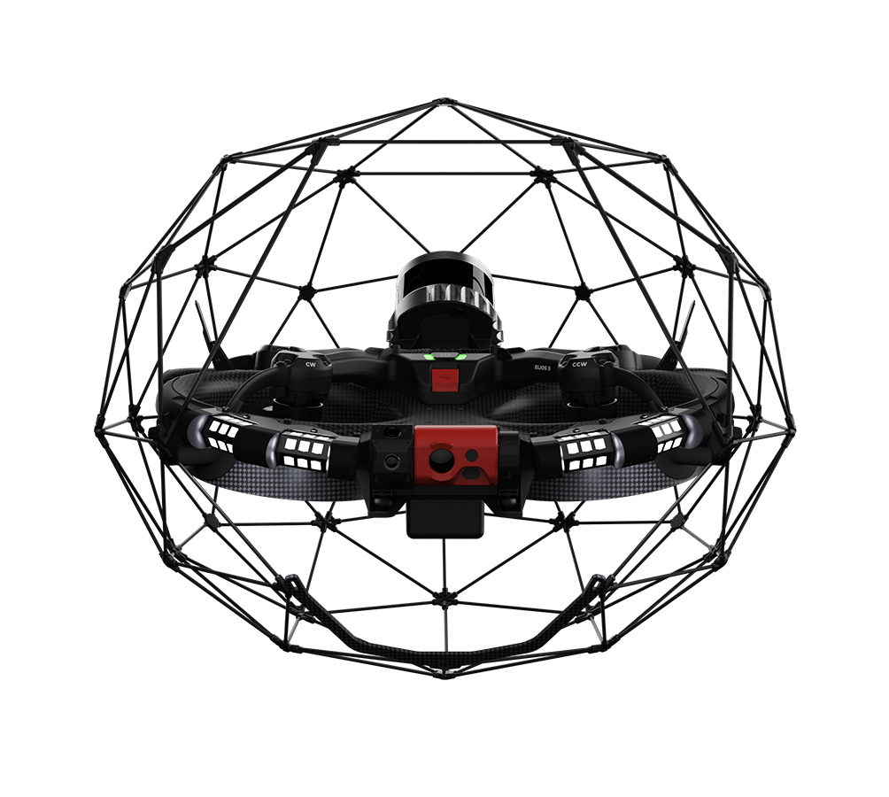
The Flyability Elios 3 is the top drone for indoor inspections, specifically designed to operate in confined spaces. Equipped with a cage for collision resilience, it’s ideal for safely flying in challenging environments like tanks, tunnels, and other confined areas. This makes it the best choice for industries requiring safe and precise indoor inspections.

  • Collision tolerance. Reliable operations in any situation
  • Confined space accessibility. Fly where no other drone can
  • LiDAR equipped. Create 3D maps in real time
  • Inspection features. GPS-free stabilization, distance lock, and full HD
  • Robust inspection lighting. 10K of lumens with oblique and dustproof lighting

Learn more about the Flyability Elios 3.

Commercial Drone Data

Professional drones present a powerful tool for collecting data remotely.

As the drone industry has developed, commercial drones have been used more and more in various industries, and the cameras that come with them have continued to improve as well.

In inspection scenarios, using a professional drone to collect data instead of a person can make a big impact on safety since it reduces the exposure of personnel to potentially dangerous scenarios, such as climbing a cell tower or walking along scaffolding inside a giant tank to collect visual data.

Here are the primary types of data collected by professional grade drones.

Visual Data

visual-data-commercial-drones
A photo taken by the Skydio X10

This is by far the most common type of data a commercial drone is used to collect. By flying over an area or object of interest, a professional drone can be used to help see things that might not be otherwise visible, and collect a record of what is seen.

Thermal Data

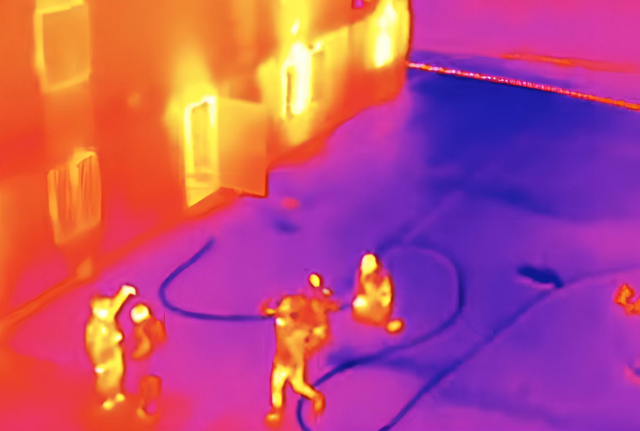
After visual data, thermal data is one of the most common types of data industries collected by drone. Aerial thermal data can help firefighters determine where to focus their efforts during an active fire, or help inspectors identify potential problem areas in a solar array.

LiDAR Data

A LiDAR sensor illuminates a target with a laser light and then measures the reflection to create data points that can be used to make a 3D map of the area. Aerial LiDAR can be used to help companies in various industries create 3D maps, which can be used for project planning or progress tracking.

Since LiDAR can penetrate tree cover and even earth to reveal structures hidden underground, it has also been used by archaeologists to help them discover new sites of interest for excavation.

Gas Leak Data

The MFE Detect LW is made to collect gas data by drone

A gas sensor detects the presence of hazardous gases by analyzing the chemical composition of the surrounding environment. Gas detection drones equipped with gas sensors are crucial for monitoring industrial areas, such as chemical plants, oil rigs, and pipelines, to detect dangerous gas leaks or measure air quality.

These sensors can detect gases like methane, carbon monoxide, hydrogen sulfide, and volatile organic compounds (VOCs), providing real-time data that helps prevent accidents and ensure regulatory compliance.

[Learn more about MFE Detect LW, an OGI camera made to be carried by the Matrice 350 RTK.]

Multispectral Data

multispectral-data-commercial-drones
Credit: DJI

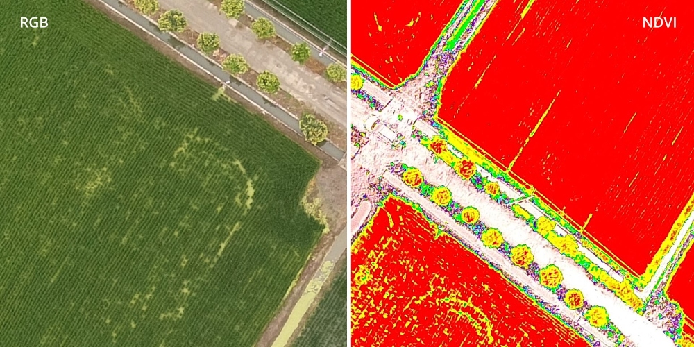
Multispectral data is collected by sensors that measure reflected energy within several specific sections (or bands) of the electromagnetic spectrum. Aerial multispectral data can be used in agriculture and conservation to monitor plant and tree health, and it’s also being used by law enforcement to help find human remains.

Hyperspectral Data

Hyperspectral sensors measure energy in narrower and more numerous bands than multispectral sensors. Aerial hyperspectral data can be used in agriculture for monitoring the health of crops, and in security and defense for detecting the presence of those who shouldn’t be in a given area.

Please note that this list is not meant to be exhaustive, but only to present the most common types of data collected by drone right now.

The reality is that drones can collect whatever data we want, so long as a drone-compatible sensor (i.e., a sensor that can be attached to a drone) exists for its collection.

As drone technology continues to advance, we’ll continue to see more and more sensors developed for drones to be used for new types of data collection, such as radiation for nuclear power plant inspections or thickness measuring for inspecting industrial assets.

Commercial Drone Deliverables

Now that we’ve covered some of the main types of data that professional-grade drones can capture, we need to explore what happens to that data once it’s collected.

Simply sharing raw data in a folder won’t provide much value on its own. What professionals need is that data processed into actionable deliverables that can be used for decision-making, monitoring, and analysis across a range of industries.

Drone data deliverables offer detailed insights, improving operational efficiency, safety, and accuracy.

Here are some of the most common deliverables created from drone data:

Photos and Videos

One of the most common deliverables for commercial drone work are stills and videos. These can range from professional photography and videography for real estate marketing, to high-end cinematography for filmmaking projects. Aerial shots can also be used in surveillance, monitoring events, or assessing damage after disasters.

3D Maps

Across various industries, 3D maps have become essential deliverables that help users visualize spaces and objects in three dimensions. For example, in construction, 3D maps are used to visualize the layout of building sites and plan for new structures. These maps are also crucial for urban planning, disaster response, and land management, providing a high level of detail for accurate planning and monitoring.

Orthomosaics

Orthomosaics are photo representations of large areas created by stitching together multiple images captured by drones. These deliverables are widely used in construction, public safety, and civil engineering. For example, in construction, orthomosaics provide real-time visual updates on building sites, while in public safety, they can document areas with high foot traffic or help map disaster zones.

Actionable Reports

Actionable reports are a key deliverable in many industries.

These reports often go beyond visuals, providing actionable insights for further decision-making.

For example, using Flyability’s Inspector software, inspectors in the oil & gas sector can generate detailed reports on the findings from tank inspections, highlighting potential maintenance issues.

Similarly, Pix4Dfields, used in agriculture, produces actionable reports such as vegetation index maps, helping farmers monitor crop health, plant stress, and irrigation needs. These reports can often be integrated into other systems for predictive maintenance or long-term monitoring to track asset health over time.

Thermal Imagery

Thermal imagery captured by drones allows for the detection of temperature variations in the environment, making it an invaluable tool for inspecting electrical infrastructure, detecting gas leaks, and monitoring industrial equipment.

Thermal sensors can also be used in search and rescue operations to locate individuals in low-visibility conditions, such as in smoke or at night. Drones equipped with thermal cameras offer an efficient way to gather important thermal data without the need for manual inspections in hazardous environments.

LiDAR Data

LiDAR (Light Detection and Ranging) is a remote sensing method used to examine the surface of the Earth. Drones equipped with LiDAR sensors use laser light to measure distances to the ground, generating precise, 3D models of the environment.

LiDAR is essential for creating detailed maps of terrain, monitoring forest health, conducting topographic surveys, and inspecting infrastructure like bridges and power lines. It is particularly effective in environments with dense vegetation, where traditional methods might fail to provide accurate data.

Gas Detection Reports

Gas detection data collected by drones can be processed into detailed reports that identify the presence of hazardous gases like methane, carbon monoxide, or volatile organic compounds (VOCs).

These reports are especially useful in industries such as oil & gas, environmental monitoring, and public safety, where gas leaks or emissions need to be detected quickly and accurately. Drones like the MFE Detect LW are designed specifically for this purpose, providing real-time data and safety-critical reports for operations in hazardous areas. The data can be used to trigger immediate responses or regulatory compliance actions.

With advancements in drone technology, the potential for new and innovative deliverables continues to grow. Whether it’s for data visualization, maintenance planning, or predictive analysis, commercial drones provide a versatile range of deliverables to improve safety, efficiency, and productivity in countless industries.

Industries That Use Professional Drones for Work

Here are some of the top industries and sectors using drones for commercial purposes today, along with the ways that they’re using them.

Inspections

Commercial drones are revolutionizing the inspection industry by providing a safer, more efficient alternative to traditional inspection methods.

Drones are used to perform aerial inspections of infrastructure, industrial equipment, and critical assets in environments that would otherwise be dangerous or difficult for human inspectors to access. With the ability to capture high-quality visual, thermal, and LiDAR data, drones help identify issues such as cracks, corrosion, leaks, and structural damage with greater precision and speed.

Applications of Drones in Inspections

  • Energy infrastructure. Drones are used to inspect power lines, wind turbines, and solar panels, helping to detect wear, corrosion, and other issues without requiring inspectors to climb or use scaffolding.
  • Building inspections. Drones enable building inspectors to safely capture high-resolution images of rooftops, facades, and other hard-to-reach areas, improving the efficiency of the inspection process.
  • Pipeline inspections: Drones are used for inspecting pipelines in remote areas, reducing the need for personnel to conduct inspections in hazardous or inaccessible locations, and offering faster, more cost-effective monitoring of large-scale infrastructure.
  • Bridges and towers. With the ability to capture detailed imagery, drones help inspect bridges, towers, and cell infrastructure without the need for workers to perform dangerous climbing operations.
  • Offshore platforms. Drones are increasingly used to inspect offshore oil rigs and platforms, providing real-time visual and thermal data for maintenance planning, corrosion detection, and safety audits.

With advancements in drone technology, inspections can now be performed with increased accuracy, reduced downtime, and enhanced safety. The data captured by drones can be used for routine maintenance checks, regulatory compliance, and emergency inspections after natural disasters or incidents.

Agriculture

Farmers use commercial drones to collect data on their crops, monitor plant health, and autonomously spray pesticides or fertilizers. This data-driven approach helps improve yields, optimize resource use, and monitor the health of soil and crops in real-time using multispectral and hyperspectral sensors.

Chemicals

Drones are used in the chemicals industry for inspecting large assets such as chemical tanks and processing facilities. They also help monitor emissions and detect leaks in confined spaces, reducing the need for personnel to enter potentially hazardous environments. Drones equipped with thermal and gas sensors are particularly effective for this purpose.

Conservation

Drones in conservation help create detailed vegetation maps, monitor wildlife, and track anti-poaching efforts. They also support reforestation initiatives by autonomously planting seeds in hard-to-reach areas. Drones equipped with multispectral and thermal imaging sensors can monitor forest health and water resources effectively.

Construction

The Skydio X10 flies on a construction site

Drones help speed up construction site mapping, progress tracking, and surveying, providing real-time data for project planning. Drones with LiDAR sensors create 3D models for accurate surveying, while high-resolution cameras are used for building inspections, reducing the need for manual inspections and improving safety.

Delivery

Medical drone delivery is growing rapidly, especially in remote areas of countries such as Rwanda, the U.S., and Switzerland. Drones deliver medical supplies, vaccines, and blood quickly, bypassing road congestion. Autonomous aerial delivery systems are being developed for the commercial delivery of packages, especially in urban settings.

Filmmaking

High-end professional drones are used to capture cinematic aerial shots for movies and commercials. These drones offer cost-effective alternatives to helicopters, providing filmmakers with greater flexibility and high-quality imaging for aerial cinematography.

Mining

The Elios 3 flies in a mine shaft

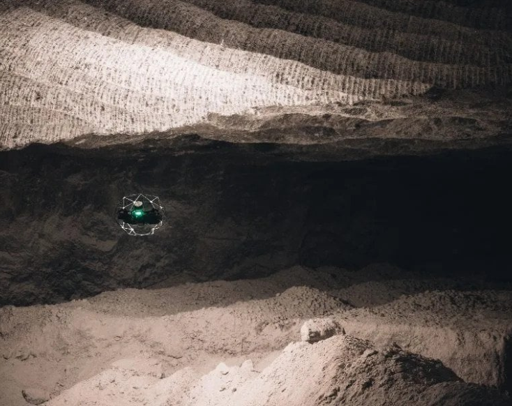
Mining companies use drones to create 3D maps of mining sites, perform geophysical surveys, and inspect hard-to-reach areas in mines. Drones with thermal imaging and LiDAR are increasingly used to monitor ore deposits, improve safety, and enhance efficiency in mining operations.

Insurance

Insurance companies use drones for rapid damage assessment, especially following natural disasters like hurricanes and wildfires. Drones collect visual data to assess roof damage, property loss, and structural integrity, enabling insurance adjusters to process claims faster and more accurately.

Oil & Gas

In the oil and gas industry, drones are critical for inspecting assets such as tanks, risers, and offshore platforms. They help gather high-quality visual data inside confined spaces, reducing the risk to workers and improving efficiency. Drones equipped with thermal and gas sensors are also used to monitor leaks and identify maintenance issues.

Power Generation

Drones are used for inspecting critical infrastructure in power generation, including wind turbines, solar panels, and nuclear power plants. They help ensure that equipment is functioning properly, improve safety by reducing the need for human inspections in hazardous areas, and detect issues such as wear and corrosion in hard-to-reach locations.

Public Safety

A firefighter flies a Skydio drone near a fire

Drones are increasingly adopted by law enforcement, fire departments, and search and rescue teams. They provide real-time situational awareness during emergency responses and are used for mapping disaster zones, conducting thermal imaging for fire mapping, and assisting in search-and-rescue operations, especially in challenging or hazardous environments.

Sewer and Water Department Maintenance

Indoor drones are used by sewer and water departments to perform inspections of underground infrastructure, such as sewer lines and water treatment facilities. Drones help identify blockages, corrosion, and other issues without the need for invasive digging or disruption, improving efficiency and safety during regular maintenance.

Emerging Sectors

Telecommunications

Drones are becoming essential tools for inspecting telecommunications infrastructure, particularly cell towers. They provide detailed visual data to help companies monitor tower conditions and perform maintenance tasks safely and efficiently, reducing the need for workers to scale tall structures.

Forestry

Drones are used to monitor the health of forests, track deforestation, and support reforestation projects. Equipped with multispectral and thermal sensors, drones can assess vegetation stress, monitor soil conditions, and even assist in planting trees in hard-to-reach areas.

Environmental Monitoring

Environmental agencies use drones for real-time monitoring of air quality, water quality, and pollution levels. Drones equipped with specialized sensors provide accurate data, enabling faster response times to environmental hazards and helping agencies to comply with regulations more effectively.

Crime Investigation

Drones with multispectral and thermal imaging are now used in crime investigations to help find human remains, assess crime scenes from the air, and monitor for illegal activities in hard-to-reach areas. These drones are particularly valuable in investigations where traditional methods are difficult or unsafe.

Public Health & Safety

Drones are being tested and used to deliver medical supplies, vaccines, and emergency items to underserved areas. This technology has been especially useful in remote regions, where traditional delivery methods may be slow or impossible.

Just as the list of drone data types is constantly evolving, the industries adopting drone technology continue to expand. As drone technology advances, new sectors will emerge, further increasing the impact of drones on commercial operations and enhancing their ability to save money, improve safety, and increase operational efficiency.

Commercial Drone Regulations

An article on commercial and professional drones would not be complete without a section on the regulations that govern the use of drones for work.

At this point, almost every country in the world has developed regulations regarding the use of drones, with ongoing updates to adapt to technological advancements and increasing commercial use.

Most of these regulations can be divided into two categories: work (i.e., commercial drone operations) and fun (i.e., hobbyist drone operations).

Since we’re talking about commercial drones, let’s take a closer look at the regulatory landscape for commercial drone operations in the U.S.

Commercial Drone Operations in the U.S.

The FAA defines commercial drone operations as any use of a drone for work, including work that you do for barter or trade.

If you plan to fly your drone for work, you must follow the FAA’s Part 107 rules. These regulations ensure safe and legal commercial drone operations in the U.S.

The primary requirements of the Part 107 rules are:

  • Remote Pilot Certificate: You must hold a valid FAA Remote Pilot Certificate by passing a knowledge test.
  • Drone Registration: All commercial drones must be registered with the FAA if they weigh over 0.55 pounds.
  • Visual Line of Sight (VLOS): You must maintain a visual line of sight with your drone at all times during flight.
  • Flight Restrictions:
    • Maximum altitude: 400 feet above ground level.
    • Flights are limited to daylight or civil twilight hours.
    • No flying over people not involved in the operation.
  • Airspace Restrictions: Obtain prior authorization to fly in controlled airspace (near airports) via LAANC.
  • Remote ID: Drones must comply with Remote ID requirements, enabling tracking of the drone’s identity and location.
  • Operational Limitations:
    • Maximum speed of 100 mph.
    • No flying under the influence of drugs or alcohol.
  • Waivers for Certain Operations: You can apply for waivers to fly beyond visual line of sight (BVLOS), at night, or over crowds.

Additional Considerations for Commercial Drone Operations in the U.S.

In addition to the primary requirements outlined by the FAA’s Part 107 rules, there are several important considerations for commercial drone operators in the U.S.

These regulations ensure safe integration of drones into national airspace while allowing for advanced operations. Here are some additional key points to keep in mind:

  • Remote ID. As of 2023, all drones over 0.55 pounds must comply with Remote ID requirements. This allows drones to be tracked in real-time, enhancing airspace safety and enabling authorities to monitor drone flights.
  • Flying at night. Commercial drone operations can now take place at night under specific conditions, without needing additional waivers. However, pilots must ensure appropriate lighting on the drone and maintain proper situational awareness during flight.
  • Beyond Visual Line of Sight (BVLOS). BVLOS operations are possible but require a waiver from the FAA. Pilots must obtain authorization to fly beyond the line of sight of the operator, which is necessary for certain industrial applications such as long-distance inspections.
  • Controlled airspace. If operating near airports or in controlled airspace, commercial drone pilots must seek prior authorization through the LAANC (Low Altitude Authorization and Notification Capability) system or other FAA-approved methods to ensure safe flight operations.

Waivers and Certifications for Commercial Drone Operations

For those involved in more advanced commercial drone operations, such as flying drones with heavier payloads, conducting inspections in hazardous environments, or operating beyond the basic guidelines outlined by the FAA, the agency offers specific certifications and waivers for special operations.

These rules are designed to accommodate more complex and higher-risk drone operations while ensuring safety, efficiency, and compliance with federal regulations.

1. Waivers for Special Operations

While Part 107 provides the foundational rules for most commercial drone operations, certain missions may require more flexibility. In such cases, drone operators can apply for waivers to operate outside of some of the standard restrictions. The FAA reviews these waiver requests on a case-by-case basis, considering factors like operational safety, public safety, and potential risks.

Some common waivers that operators may apply for include:

  • Night operations. Although Part 107 restricts drone operations to daylight hours, a waiver can allow operators to fly drones at night, provided they meet lighting and visibility requirements.
  • Beyond Visual Line of Sight (BVLOS). For missions that require flying a drone beyond the operator’s visual line of sight, such as long-range inspections or mapping large areas, operators can apply for a BVLOS waiver.
  • Flying over people. Typically, drones cannot fly over people who are not directly involved in the operation. A waiver can be granted for specific cases, such as for aerial events or large-scale inspections, as long as appropriate safety measures are in place.
  • Operations in controlled airspace. If you need to fly a drone in controlled airspace near airports, a waiver or approval through the Low Altitude Authorization and Notification Capability (LAANC) system is required.
  • Multiple drones. If operating multiple drones at once, operators can request a waiver to manage and control multiple aircraft simultaneously, improving operational efficiency for large-scale inspections or surveying projects.

To apply for these waivers, drone operators must demonstrate a comprehensive understanding of the risks involved and have a well-defined safety plan. The FAA evaluates these applications carefully to ensure public safety is not compromised.

2. Certifications for Advanced Drone Operations

In addition to the Remote Pilot Certificate required for basic commercial drone operations, the FAA offers various certifications for more advanced drone applications. These certifications help drone pilots enhance their qualifications and expand the scope of their operations. Some certifications and requirements include:

  • Part 107 certification. To fly a drone for commercial purposes in the U.S., operators must hold a Part 107 Remote Pilot Certificate. This certification involves passing a knowledge test covering various topics such as regulations, airspace rules, drone operations, and weather conditions.
  • Specialized certifications for hazardous operations: For operations in hazardous environments, such as inspections in confined spaces or dangerous areas, additional training and certifications may be required. These certifications ensure operators are prepared to handle risks and comply with safety protocols while conducting high-risk inspections.
  • COAs (Certificates of Authorization). In certain cases, commercial drone operations may require a Certificate of Authorization (COA) from the FAA. COAs are typically needed for operations in restricted airspace or specific locations, such as near airports or in government-controlled airspace. These authorizations are granted to ensure that drones can operate safely within these areas while avoiding interference with other air traffic.

3. Applying for Waivers and Certifications

To apply for a waiver or certification, operators typically need to submit their request to the FAA through their online portals or via specific waiver application processes.

The FAA may request additional documentation, such as a risk assessment, detailed flight plans, and proof of insurance or operational capabilities. The approval process can take time, so it’s important for operators to plan well in advance before their intended operations.

4. Maintaining Compliance

Once a waiver or certification is granted, it is crucial for operators to follow all terms and conditions outlined by the FAA.

Violating the terms of a waiver or engaging in unauthorized operations can result in penalties, including the revocation of certifications or legal action. To ensure ongoing compliance, drone operators should stay updated on regulatory changes, renew certifications as needed, and always operate within the approved guidelines.

By acquiring the necessary waivers and certifications, drone operators can legally and safely engage in a wide variety of advanced drone operations, unlocking new capabilities and expanding the potential of commercial drone use in industries such as infrastructure inspections, surveying, and public safety.

Commercial Drone Operations Important Links

Want to learn more about commercial drone operations?

Here’s a list of links where you can dive deeper:

FAQ for Commercial Drone Operations

Here are answers to the most commonly asked questions about commercial drones.

1. What are some of the top commercial drones on the market?

Commercial drones vary depending on the specific needs of an operation. Common types include:

  • Matrice 350 RTK. Used for heavy-duty outdoor inspections.
  • Flyability Elios 3. Ideal for indoor inspections, especially in confined spaces.
  • DJI Mavic 3 Enterprise. A versatile drone for aerial inspections, mapping, and photography.
  • Skydio X10. Known for autonomous flight and inspections in complex environments.

2. What is the FAA’s Part 107 rule for commercial drones?

The FAA’s Part 107 rule outlines the regulatory framework for operating drones commercially in the U.S. It requires drone pilots to be certified by the FAA, ensures that drones are registered, and sets guidelines for safe operation, including restrictions on altitude, airspace, and operational limitations like flying at night or beyond visual line of sight.

3. What kind of drone operations require a waiver from the FAA?

Certain drone operations fall outside the basic guidelines set by Part 107 and require a waiver. These include:

  • Flying at night. Requires specific lighting and safety measures.
  • Beyond Visual Line of Sight (BVLOS). Allows for drone operations beyond the operator’s visual line of sight but requires a waiver.
  • Flying over people. Requires a waiver for operations involving crowds or bystanders.

4. Do I need to be certified to fly a drone commercially?

Yes, to operate a drone commercially under Part 107, you must hold a valid Remote Pilot Certificate issued by the FAA. This certification requires passing a knowledge test on topics such as airspace regulations, weather, and drone operation principles.

5. What is Remote ID, and do I need it for my drone?

Remote ID is a system that allows drones to broadcast their identification and location, enhancing airspace safety. As of 2023, most drones over 0.55 pounds must comply with Remote ID requirements to operate commercially in the U.S.

6. How can I apply for a waiver or certification?

To apply for a waiver or certification, you will need to submit an application through the FAA’s online systems. Waivers are typically for specific operations outside the standard Part 107 guidelines, such as BVLOS or night operations. Certification applications involve passing the FAA’s knowledge test and meeting other operational requirements.

7. Can I fly a drone in controlled airspace?

Yes, but you will need to obtain permission to fly in controlled airspace, such as near airports. This can be done through the FAA’s Low Altitude Authorization and Notification Capability (LAANC) system, which provides near real-time approvals for drone flights in controlled airspace.

8. What types of deliverables can be created using drones?

Drones are used to create various types of deliverables, including:

  • Photos and videos. Common for real estate, filmmaking, and surveillance.
  • 3D Maps: Used in industries like construction, agriculture, and land management.
  • Orthomosaics. High-resolution stitched images for mapping and surveying.
  • Actionable reports. Custom reports generated for specific industry inspections, such as those for oil & gas, agriculture, and infrastructure.

9. What is the maximum altitude I can fly my drone under Part 107?

Under Part 107, drones are restricted to a maximum altitude of 400 feet above ground level unless operating near a structure and staying within 400 feet of that structure.

10. Are drones used in industries other than inspections?

Yes, drones are used in various industries beyond inspections. Some applications include:

  • Agriculture. For crop monitoring and spraying.
  • Public Safety. For search and rescue, firefighting, and law enforcement.
  • Delivery. Drone delivery services, especially for medical supplies.
  • Filmmaking and photography. For aerial shots and high-quality cinematography.

Table of Contents