Ressources / Étude de cas / Elios 3 Drone and Real-Time LiDAR for Detailed Storm Drain Inspection
Étude de cas
Elios 3 Drone and Real-Time LiDAR for Detailed Storm Drain Inspection
Learn how MFE’s client, Cobb Fendley, used the Elios 3 drone with real-time LiDAR to safely inspect a collapsed storm drain in Austin, Texas, providing detailed insights that were previously unattainable with traditional methods.
Avantages
Vitesse
The Elios 3 drone completed six detailed inspections in a fraction of the time it would take to manually assess the storm drain, offering real-time data collection and analysis.
Sécurité
The drone removed the need to send personnel into a potentially unstable storm drain, mitigating the risk of collapse and unseen hazards, and ensuring operator safety.
Épargne
The use of the Elios 3 reduced the costs associated with human inspections, minimized downtime, and allowed for more efficient resource allocation by providing accurate and actionable data faster.
Introduction
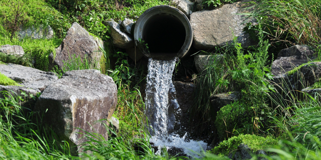
In Austin, Texas, a pressing infrastructure issue was brought to the attention of Cobb Fendley, a renowned company specializing in urban development and planning. A storm drain, located near a busy highway, had become clogged and, in some sections, entirely collapsed. The root cause was unknown, and the prospect of sending humans into the potentially unstable structure raised considerable safety concerns.
Customer Needs
- Pinpoint the cause and extent of the blockage
- Ensure the safety of personnel and remote-operated vehicles during the inspection due to the looming risk of collapse and unseen perils in the drain.
Traditional methods, like visual inspections from outside or terrestrial scanning, were previously deployed but provided only limited data, failing to penetrate the depths or corners of the drain system effectively.
Solution
Led by Ivan Miestchovich, the Unmanned Systems Technical Support Specialist at the Pasadena location, the Elios 3 drone was flown into the storm drain. Assisted by Chance Kirkpatrick, a specialist in unmanned technologies, the team completed six drone runs, meticulously mapping the Y-shaped drain system.
Throughout the inspection, the Elios 3 drone identified several points of interest, including areas where the structure was compromised, showcasing visible damage, corrosion, and debris. This data was tagged in real-time, facilitating subsequent analysis.
Furthermore, the drone’s unique camera orientations, including a front-forward facing camera view and a third-person view, offered comprehensive perspectives of the storm drain’s condition. The Elios 3 drone’s LIDAR system also made it possible to pull accurate measurements from the point cloud data, enabling more precise analysis.
Results
The incorporation of the Elios 3 drone and the innovative Inspector 4.0 software brought about remarkable enhancements in the inspection of the storm drain.
The different viewing modes provided in the software allowed for a comprehensive understanding and analysis of the intricate structures within the storm drain, enabling detailed and cohesive data interpretation. The methodical approach, marked by thorough rotations and distinct markers, ensured extensive and detailed coverage of the entire structure, effectively pinpointing and highlighting areas of concern in real-time.
These identified points allowed for a quick and accurate analysis. This streamlined combination of advanced technology and detailed inspection methodologies sets a new standard in structural analysis, allowing for more effective and informed decisions regarding maintenance and structural integrity.
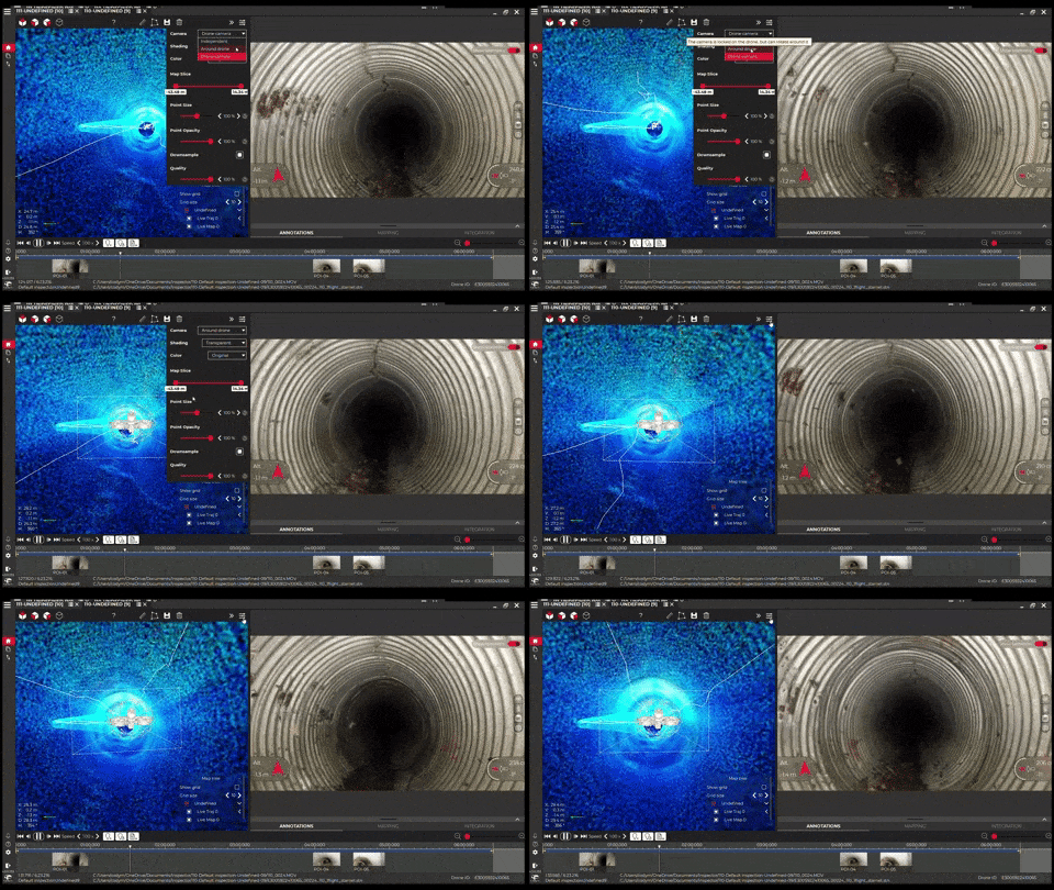
Around the Drone
This mode offers a third-person view of the drone, placed within the point cloud map. This perspective proves essential as it gives inspectors a clearer understanding of the drone’s spatial awareness, helping them pinpoint its location relative to the structure’s features.
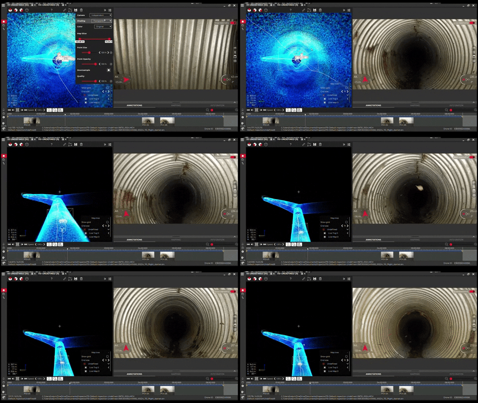
Independent
This mode is not just about the drone but the asset itself. It renders a bird’s eye view of the external layout of the point cloud map, granting a comprehensive visual representation of the entire structure or site. This holistic view allows inspectors to get a better grasp of the entire layout they are assessing, making data interpretation more contextual.
Coverage and Annotation Techniques
The Elios 3 drone elevates the process of data collection in intricate spaces. Adhering to systematic rotations and using specific markers in the point cloud view ensures comprehensive coverage and accentuates critical areas of concern.
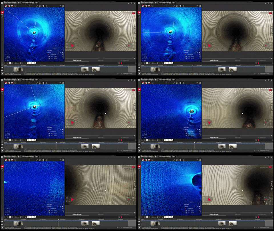
Enhancing Data Coverage with the Elios 3
To maximize coverage with the Elios 3, MFE Inspection Solutions recommends implementing a systematic approach to inspect intricate spaces. for complete coverage, executing a 360-degree rotation every 10-20 feet ensures that every detail is captured visually and in point cloud data.
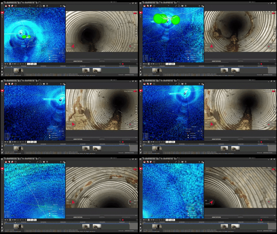
Localization of Points of Interest
Green balls indicate Points Of Interest (POI) within the point cloud view. These annotations help pinpoint signs of corrosion, blockage, or defects.
Conclusion
The Elios 3 drone proof of concept in Austin demonstrated the immense potential of drone technology in urban infrastructure inspection. It ensured the safety of the personnel and provided detailed insights into the storm drain’s condition. This mission highlighted how cutting-edge technology, spearheaded by experts like Ivan, reshapes the infrastructure management and repair approach. For those seeking the best in tech-driven inspection solutions, MFE Inspection Solutions will help lead the way.
Share

