A Division of MFE Inspection Soltuions

Guide

Subsea Positioning Systems: Tools, Methods & How to Choose

Subsea positioning refers to the systems and workflows used to track, navigate, and locate underwater assets like ROVs, AUVs, divers, subsea tooling, and inspection payloads.

Jump to subsea positioning products and tools.

Because GPS signals don’t reliably work underwater, offshore teams rely on a host of technologies to maintain positional awareness below the surface.

These technologies include acoustic positioning systems, inertial navigation systems, Doppler velocity logs (DVLs)—we’ll cover them in more detail below.

The Importance of Subsea Positioning

In offshore inspections, subsea positioning isn’t just about navigation.

It directly affects inspection quality, repeatability, asset localization, and the ability to correlate collected data to real-world locations.

For example, positioning data may be used to:

  • Track an ROV during a subsea inspection
  • Guide an AUV along a survey route
  • Relocate a previously identified anomaly
  • Support diver tracking and safety workflows
  • Correlate sonar, LiDAR, UT, or imaging data to a specific structure or coordinate

The right subsea positioning workflow depends heavily on the environment, required accuracy, deployment constraints, vessel setup, and inspection objective.

For example, a shallow-water harbor inspection may use a very different positioning approach than a deepwater offshore survey or long-range autonomous mission.

Other common terms for subsea positioning include:

  • Underwater positioning system
  • Underwater acoustic positioning system
  • Underwater navigation system
  • Underwater tracking system
  • Underwater GPS

Some of these terms refer to complete positioning workflows, while others refer to specific technologies or positioning methods.

In this guide to subsea positioning we’ll look at how these systems work, where they fit in subsea workflows, and the tradeoffs inspection teams should understand before choosing equipment.

Subsea Positioning Products and Tools

Looking for the top subsea positioning systems or underwater navigation tools on the market?

Below are some of the primary positioning and navigation technologies used across offshore inspections, ROV operations, hydrographic surveys, diver tracking workflows, and autonomous subsea missions.

The right subsea positioning workflow depends on factors like:

  • required positional accuracy
  • water depth
  • vessel setup and deck space
  • ROV or AUV type
  • inspection objectives
  • whether permanent references can be installed

USBL Positioning Systems

USBL (Ultra-Short Baseline) systems are among the most commonly used subsea positioning technologies in offshore operations.

These systems allow operators to track ROVs, divers, and underwater assets from a vessel without deploying a full network of seabed transponders. For many inspection and survey workflows, they offer a practical balance between deployment speed, operational simplicity, and positioning performance.

Here are the top USBL systems on the market:

1. Sonardyne Micro Ranger 2 USBL

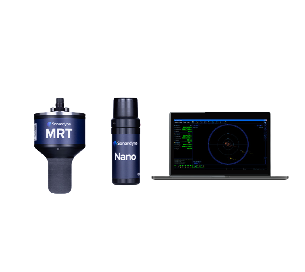
The Sonardyne Micro Ranger 2 is a compact USBL positioning system designed for tracking ROVs, divers, and subsea assets during offshore operations.

Its portable architecture makes it well suited for inspection, intervention, diver support, and light construction workflows where operators need reliable positioning without deploying a full seabed reference network.

Key features of the Sonardyne Micro Ranger 2:

  • Compact USBL architecture. Designed for vessel-based subsea positioning without extensive seabed infrastructure.
  • Multi-target tracking. Supports tracking of ROVs, divers, and other subsea assets.
  • Rapid deployment. Well suited for offshore operations where mobilization speed matters.

Buy or rent the Sonardyne Micro Ranger 2.

2. Sonardyne Mini Ranger USBL

The Sonardyne Mini Ranger is designed for portable underwater positioning workflows where vessel size, mobilization speed, and operational simplicity are priorities.

These systems are commonly used for nearshore inspections, smaller ROV deployments, scientific missions, and support operations where teams need subsea positioning capability without a larger offshore survey spread.

The Mini Ranger is frequently selected when operators need reliable positioning while minimizing system footprint and deployment complexity.

Key features of the Sonardyne Mini Ranger:

  • Portable deployment. Designed for smaller vessels and rapidly mobilized operations.
  • ROV and diver tracking. Supports a range of underwater positioning applications.
  • Operational flexibility. Useful across inspection, survey, and support missions.

3. Applied Acoustics Easytrak Vesta USBL

The Easytrak Vesta USBL system is designed for subsea tracking and positioning workflows involving ROVs, towfish, divers, and underwater assets.

Portable USBL systems like the Vesta are commonly selected for inspection and survey operations where fast deployment and operational flexibility are important.

The system is frequently used in offshore and nearshore environments where operators need real-time positional awareness during underwater operations.

Key features of the Easytrak Vesta:

  • Portable USBL positioning. Supports flexible deployment across multiple vessel types.
  • Multi-asset tracking. Compatible with a variety of underwater platforms and targets.
  • Inspection and survey workflows. Designed for practical offshore operations.

Diver Tracking Systems

Diver tracking systems help offshore teams maintain real-time awareness of diver location and movement throughout underwater operations.

These systems are often used to improve safety, coordinate underwater work, and provide surface crews with better visibility into ongoing dive activities.

Here is the top diver tracking system on the market:

4. Sonardyne DiveTrack

DiveTrack is a diver tracking system designed to improve positional awareness during underwater diving operations.

The system helps support safer and more coordinated subsea work by providing real-time visibility into diver location relative to the support vessel and surrounding assets.

Diver tracking systems are commonly used during offshore inspections, maintenance operations, and underwater intervention projects.

Key features of Sonardyne DiveTrack:

  • Real-time diver tracking. Improves awareness during subsea operations.
  • Operational safety support. Helps coordinate underwater personnel and tasks.
  • Portable deployment. Suitable for a variety of offshore diving workflows.

INS and Navigation Systems

Acoustic positioning systems are often paired with inertial navigation technologies to improve navigation continuity and reduce positional drift.

These systems are particularly important for AUVs, survey platforms, and inspection vehicles operating between acoustic updates or in environments where positioning conditions are challenging.

Here is the top INS systems on the market:

5. Sonardyne Sprint-Nav Mini INS

The Sprint-Nav Mini combines inertial navigation system (INS) functionality with Doppler Velocity Log (DVL) technology to support underwater vehicle navigation and positioning.

INS-based workflows are commonly used when operators need smoother navigation, dead-reckoning support, and improved positional stability between acoustic updates.

The system is particularly valuable for survey, inspection, and autonomous navigation workflows where positional continuity matters.

Key features of the Sprint-Nav Mini:

  • Integrated INS and DVL. Combines navigation and velocity estimation in a single system.
  • Reduced positional drift. Helps maintain navigational continuity underwater.
  • AUV and ROV support. Designed for modern subsea vehicle workflows.

Underwater Communication and Robotics

Modern subsea robotics increasingly rely on wireless communication, navigation support systems, and compact robotic platforms.

These technologies help expand what underwater vehicles can accomplish in confined spaces, difficult-access environments, and emerging autonomous inspection workflows.

Here are the top underwater comms systems on the market:

6. Hydromea LUMA Subsea Modem

The Hydromea LUMA subsea modem supports underwater wireless communication and navigation-related workflows for subsea robotics and autonomous systems.

Wireless underwater communication systems are increasingly being integrated into subsea operations where tether reduction, data transfer, and multi-vehicle coordination are important.

The platform helps support emerging underwater robotics applications and connected subsea workflows.

Key features of the Hydromea LUMA:

  • Wireless subsea communication. Supports underwater data exchange.
  • Robotics integration. Designed for autonomous and remotely operated systems.
  • Multi-vehicle workflows. Supports coordinated subsea operations.

7. Hydromea Wireless ROV Platform

Hydromea’s wireless ROV systems are designed for compact underwater inspection and robotic workflows where traditional tether management may be restrictive.

These systems are particularly relevant for confined spaces, infrastructure inspections, and emerging autonomous or semi-autonomous subsea workflows.

The wireless architecture can simplify operations in environments where tether management presents operational challenges.

Key features of the Hydromea Wireless ROV Platform:

  • Tether-light operation. Reduces reliance on traditional tether management.
  • Compact inspection platform. Designed for difficult-access environments.
  • Robotics-focused architecture. Supports emerging subsea inspection workflows.

Survey and Localization Tools

Positioning workflows often rely on additional survey, localization, and mapping technologies to improve situational awareness and asset documentation.

These systems are commonly integrated with navigation and positioning workflows during offshore inspections, hydrographic surveys, and subsea infrastructure projects.

Here are the top subsea survey and localization tools on the market:

8. TSS 660 E Pipe and Cable Tracking System

The TSS 660 E is designed for subsea pipe and cable tracking applications.

Tracking systems like these are commonly used during subsea infrastructure inspections, burial verification, cable localization, and offshore asset mapping operations.

The system helps operators identify and document the location of critical subsea infrastructure.

Key features of the TSS 660 E:

  • Pipe and cable localization. Designed for subsea infrastructure tracking.
  • Inspection support. Useful for verification and asset documentation workflows.
  • Survey integration. Supports broader subsea mapping operations.

9. Norbit WBMSX Multibeam Sonar

The Norbit WBMSX is a multibeam sonar system used for hydrographic survey, subsea mapping, and underwater localization workflows.

Multibeam systems are frequently paired with positioning and navigation systems to support accurate bathymetric mapping and underwater asset documentation.

The system helps generate detailed spatial data for survey and inspection projects.

Key features of the Norbit WBMSX:

  • Multibeam mapping. Supports bathymetric and subsea survey workflows.
  • Positioning integration. Works alongside navigation and localization systems.
  • High-resolution data collection. Designed for detailed underwater mapping.

10. Geometrics G882 Magnetometer

The Geometrics G882 is a marine magnetometer used for subsea detection, localization, and survey operations.

Magnetometers are commonly used to locate pipelines, cables, debris, and ferrous underwater objects during offshore inspection and survey missions.

The system is frequently deployed when operators need to locate or verify buried or difficult-to-identify subsea assets.

Key features of the Geometrics G882:

  • Subsea object detection. Helps locate ferrous assets and infrastructure.
  • Survey support. Commonly used during offshore localization projects.
  • Infrastructure verification. Useful for pipeline and cable investigations.

What Is Subsea Positioning?

Subsea positioning refers to the technologies and workflows used to determine the location of underwater vehicles, divers, tools, sensors, and subsea assets.

In inspection workflows, positioning data is often just as important as the inspection data itself.

Finding corrosion, damage, marine growth, or an anomaly is only useful if operators can accurately document where it was found and reliably return to that location later.

Because GPS signals don’t reliably penetrate underwater, offshore operators must rely on other methods to maintain positional awareness below the surface.

In practice, this usually means combining acoustic positioning systems, inertial navigation systems, Doppler Velocity Logs (DVLs), sonar data, vessel references, and related technologies to estimate or measure underwater position.

Subsea positioning is used across a wide range of offshore and underwater operations, including:

  • ROV inspections
  • AUV survey missions
  • subsea construction support
  • pipeline and cable inspections
  • diver tracking
  • hydrographic survey
  • underwater mapping
  • asset relocation

Why GPS Doesn’t Work Underwater

Traditional GPS relies on radio-frequency signals transmitted from satellites.

Water rapidly weakens these signals, which means GPS becomes unreliable almost immediately below the surface.

This creates one of the core challenges in subsea operations: maintaining accurate positional awareness without direct satellite connectivity.

To solve this problem, offshore teams typically use acoustic positioning systems that transmit sound signals through the water column instead of relying on radio-frequency communication.

Depending on the workflow, these systems may reference:

  • a surface vessel
  • seabed transponders
  • vehicle-mounted sensors
  • inertial navigation estimates
  • DVL bottom-lock measurements

Different approaches provide different tradeoffs, including:

  • accuracy
  • deployment complexity
  • cost
  • range
  • repeatability
  • operational flexibility

Positioning vs. Navigation vs. Tracking

These terms are closely related in subsea positioning. But they’re not identical.

  • Positioning refers to determining where something is underwater.
  • Navigation refers to guiding or estimating movement from one point to another.
  • Tracking refers to continuously monitoring the location or movement of a target over time.

Many offshore systems perform some combination of all three functions.

For example, a USBL system may track the location of an ROV in real time, while an INS/DVL stack helps the vehicle maintain navigational stability between acoustic updates.

Similarly, an AUV survey mission may rely on multiple overlapping systems simultaneously:

  • acoustic positioning for reference corrections
  • INS for dead reckoning
  • DVL for velocity estimation
  • multibeam sonar for mapping and localization

Understanding these distinctions matters because different inspection and offshore operations require different levels of positional certainty.

A shallow-water visual inspection may tolerate relatively coarse positioning. But deepwater intervention work, subsea construction, or repeatable defect localization may require much tighter positional control.

Main Types of Subsea Positioning Systems

There is no single “standard” subsea positioning system used across all offshore operations.

Different positioning methods exist because different underwater missions prioritize different things:

  • deployment speed
  • accuracy
  • range
  • repeatability
  • mobility
  • cost
  • operational simplicity

Some systems are optimized for rapid vessel-based deployment. Others are designed for high-accuracy subsea construction or long-duration autonomous navigation.

Understanding these tradeoffs is critical when selecting equipment for offshore inspection or subsea operations.

USBL Positioning Systems

USBL (Ultra-Short Baseline) systems are among the most widely used subsea positioning technologies in offshore operations.

A USBL system typically uses a transceiver mounted to a vessel or topside reference point to communicate acoustically with a transponder mounted on the underwater target.

By measuring signal timing and angle information, the system estimates underwater position relative to the surface reference.

USBL systems are popular because they are comparatively fast to deploy operationally.

Unlike LBL systems, they generally don’t require operators to install a full seabed transponder network before beginning work.

This makes USBL workflows attractive for:

  • ROV inspections
  • diver tracking
  • light intervention work
  • mobile offshore operations
  • vessel-based inspections

However, USBL performance can be affected by:

  • vessel motion
  • water depth
  • acoustic interference
  • multipath reflections
  • poor geometry at extended range

As operational complexity increases, positioning accuracy requirements may exceed what a simple USBL workflow can reliably support.

LBL Positioning Systems

LBL (Long Baseline) systems use a network of seabed transponders placed at known reference locations.

The underwater target then determines its position relative to those fixed references.

Because the reference geometry is distributed across the seabed rather than concentrated at the vessel, LBL systems can often achieve higher positional accuracy and stability than USBL workflows.

This makes LBL systems particularly valuable for:

  • deepwater operations
  • subsea construction
  • precision intervention
  • repeatable survey workflows
  • high-accuracy asset localization

The tradeoff is deployment complexity.

LBL operations typically require additional time, calibration effort, seabed infrastructure deployment, and operational planning before subsea work begins.

For smaller inspection campaigns or rapid-response operations, that complexity may not always be justified.

SBL and Underwater GPS-Style Systems

SBL (Short Baseline) systems use multiple reference points mounted to the vessel or structure rather than a single compact USBL reference.

These systems occupy a middle ground between USBL and LBL approaches in terms of geometry and deployment complexity.

Meanwhile, many portable systems marketed as “underwater GPS” solutions are not true GPS systems in the traditional sense.

Instead, they usually combine acoustic positioning with surface GPS references to estimate underwater position relative to the topside system.

These workflows are often used for:

  • smaller ROV inspections
  • tank inspections
  • ship hull inspections
  • aquaculture operations
  • nearshore subsea work

The portability and ease of setup for SBL systems can make them operationally attractive, especially for lighter inspection missions where ultra-high positional accuracy is not required.

DVL and INS Navigation Systems

DVL (Doppler Velocity Log) and INS (Inertial Navigation System) technologies support underwater navigation differently than acoustic positioning systems.

Rather than directly calculating underwater position from external acoustic references, these systems estimate movement over time.

DVL systems measure vehicle velocity relative to the seabed or surrounding water.

INS platforms use accelerometers and gyroscopes to estimate orientation, acceleration, and movement.

Together, they help underwater vehicles maintain navigational continuity between acoustic updates.

These systems are especially important for:

  • AUV missions
  • long-duration subsea operations
  • autonomous navigation workflows
  • survey-grade mapping operations
  • operations with intermittent acoustic coverage

However, inertial systems accumulate drift over time.

Because of this, DVL and INS workflows are commonly paired with acoustic positioning systems that periodically correct or validate the navigation estimate.

How Subsea Positioning Systems Work

Most subsea positioning systems work by estimating underwater position relative to known reference points.

Because satellite positioning is unavailable underwater, subsea systems must instead build positional awareness using acoustic measurements, inertial calculations, velocity estimates, or combinations of these approaches.

In many offshore operations, multiple positioning technologies work together simultaneously rather than operating as isolated systems.

The appropriate level of positioning complexity will ultimately depend on the specific mission.

A confined-space tank inspection, for example, may require a very different positioning strategy than a deepwater pipeline survey or subsea construction operation.

Keep reading for more information on the most commonly used types of subsea positioning technology.

Acoustic Ranging and Triangulation

Acoustic positioning systems use sound waves transmitted through the water column to estimate underwater location.

In simple terms, the system measures how long it takes an acoustic signal to travel between known reference points and the underwater target.

That timing information is then used to estimate position.

Different acoustic positioning systems use different geometries and reference strategies.

For example:

  • USBL systems typically reference a surface vessel
  • LBL systems reference fixed seabed transponders
  • SBL systems use multiple hull-mounted references

The more stable and well-defined the reference geometry is, the more accurate the resulting position estimate can become.

However, higher positional accuracy often comes with greater deployment complexity.

For example, LBL systems can provide very high positional accuracy, but they require deploying and calibrating a network of seabed transponders before operations begin.

On the other hand, USBL systems are generally faster to deploy operationally, but positional performance may vary more depending on vessel movement, geometry, water conditions, and range.

Surface References, Seabed References, and Vehicle-Mounted Sensors

Subsea positioning workflows may rely on references located:

  • on the vessel
  • on the seabed
  • on the underwater vehicle itself

Surface-referenced systems are operationally simpler because they avoid deploying subsea infrastructure.

This is one reason USBL systems are widely used for offshore inspections, diver tracking, and vessel-based ROV operations.

Seabed-referenced systems typically require more setup effort but can improve positional consistency and repeatability during demanding operations.

Vehicle-mounted sensors add another layer of positional awareness.

For example, DVL systems estimate vehicle movement relative to the seabed, while inertial navigation systems estimate movement using accelerometers and gyroscopes.

These systems help maintain navigational continuity between acoustic updates.

Combining Multiple Systems

No single subsea positioning technology solves every underwater navigation problem on its own.

Acoustic systems can be affected by multipath interference, acoustic shadowing, vessel motion, water conditions, and environmental noise.

Meanwhile, inertial systems gradually accumulate positional drift over time if they are not periodically corrected.

As a result, offshore operators frequently combine multiple positioning technologies into layered navigation workflows.

A modern subsea navigation stack may include:

  • USBL or LBL positioning
  • DVL velocity estimation
  • INS dead reckoning
  • multibeam sonar
  • pressure and depth sensors
  • vehicle heading references

This layered approach helps improve overall positional reliability during real-world offshore operations where environmental conditions and operational constraints constantly change.

USBL vs. LBL vs. DVL/INS: Which Approach Fits the Job?

The best subsea positioning system is usually not the one with the highest theoretical accuracy.

It’s the system that provides sufficient positional confidence while fitting the operational realities of the mission.

That distinction matters a lot in offshore work.

A positioning workflow that performs extremely well during controlled testing may become impractical if it requires excessive deployment time, vessel space, calibration effort, or subsea infrastructure for a relatively simple inspection campaign.

Here’s an overview of how operators typically navigate the USBL vs. LBL vs. DVL/INS question:

When USBL Is the Practical Choice

USBL systems are often selected because they balance capability with operational simplicity.

They are widely used for:

  • ROV inspections
  • diver tracking
  • light intervention work
  • mobile vessel operations
  • rapid offshore mobilizations

For many inspection workflows, USBL positioning provides sufficient accuracy without the complexity of deploying a full seabed transponder network.

This can significantly reduce mobilization time and simplify offshore logistics.

However, USBL performance becomes more challenging as:

  • water depth increases
  • acoustic interference grows
  • vessel motion worsens
  • required positional precision tightens

For general inspection support, USBL is often the operationally practical choice.

But for high-precision subsea construction or repeatable engineering workflows, additional positioning layers may be needed.

When LBL Is Worth the Additional Setup

LBL systems are commonly used when positional accuracy and repeatability are more important than rapid deployment.

Because the reference geometry is distributed across the seabed, LBL workflows can provide highly stable positioning performance during demanding offshore operations.

LBL systems are frequently used for:

  • deepwater subsea construction
  • precision intervention work
  • high-accuracy engineering surveys
  • repeatable infrastructure localization

The tradeoff is operational complexity.

Deploying, calibrating, and validating a seabed transponder network takes time and planning.

That effort may be justified for long-duration or high-value offshore projects, but not necessarily for smaller inspection campaigns or fast-response operations.

When DVL and INS Matter Most

DVL and INS systems become increasingly important as subsea workflows become more autonomous, longer-range, or operationally disconnected from continuous acoustic references.

These systems help underwater vehicles maintain navigational continuity between acoustic updates.

They are especially important for:

  • AUV operations
  • long survey lines
  • autonomous navigation
  • intermittent acoustic environments
  • complex mapping workflows

However, DVL and INS systems are typically not standalone replacements for acoustic positioning.

Instead, they’re usually integrated into a layered navigation stack where acoustic positioning systems periodically correct accumulated drift.

In modern offshore operations, the most effective subsea positioning workflows are often hybrid systems that combine multiple technologies rather than relying on a single sensor or positioning method alone.

Subsea Positioning for ROV, AUV, and Diver Operations

Different underwater operations place very different demands on subsea positioning systems.

A compact inspection ROV working near a pier may require a relatively lightweight tracking workflow.

But a deepwater AUV survey mission may rely on a far more sophisticated navigation stack involving acoustic positioning, INS, DVL, sonar mapping, and autonomous guidance systems.

The underwater platform itself often determines which positioning technologies make operational sense.

ROV Inspection and Tooling Support

ROVs are among the most common platforms used in subsea inspection workflows.

They’re widely deployed for:

  • pipeline inspections
  • ship hull inspections
  • offshore structure inspections
  • subsea asset verification
  • confined-space underwater inspections

In many ROV workflows, subsea positioning supports more than simple navigation.

Operators often need positioning data to:

  • document defect locations
  • return to previous inspection points
  • correlate sonar or imaging data
  • support intervention workflows
  • maintain awareness relative to nearby infrastructure

USBL systems are commonly used for vessel-based ROV positioning because they can provide relatively fast deployment without installing a seabed transponder network.

However, positioning requirements increase significantly during:

  • deepwater operations
  • complex intervention work
  • high-current environments
  • repeatable engineering inspections

In these cases, operators may combine acoustic positioning with INS, DVL, sonar, or additional navigation references.

AUV Survey and Navigation

AUVs (Autonomous Underwater Vehicles) place different demands on subsea positioning systems because they often operate with limited or intermittent communication to the surface.

Unlike tethered ROVs, AUVs frequently rely on onboard navigation systems to estimate position throughout the mission.

This makes DVL and INS technologies especially important for AUV operations.

AUV navigation workflows commonly combine:

  • DVL velocity estimation
  • INS dead reckoning
  • acoustic positioning corrections
  • multibeam sonar mapping
  • depth and heading references

These systems help the vehicle maintain navigational continuity even when acoustic updates are unavailable or infrequent.

AUV workflows are commonly used for:

  • hydrographic survey
  • pipeline route surveys
  • bathymetric mapping
  • long-duration inspection missions
  • offshore wind and energy surveys

Because positional drift accumulates over time, most long-range AUV workflows still rely on periodic external corrections or reference updates to maintain confidence in vehicle position.

Diver Tracking and Safety

Diver tracking systems help offshore teams maintain positional awareness during underwater diving operations.

These workflows are often used to improve operational coordination and support diver safety during complex subsea work.

Diver tracking systems may be used during:

  • offshore inspections
  • subsea maintenance
  • construction support
  • search operations
  • scientific diving missions

Unlike AUV navigation workflows, diver positioning systems are typically focused on real-time tracking and operational visibility rather than autonomous navigation.

Operational simplicity is often extremely important in diver workflows.

Offshore teams generally want systems that can be deployed quickly, remain stable during vessel movement, and provide reliable positional awareness without adding unnecessary complexity to the dive operation itself.

Field Conditions That Impact Subsea Positioning Accuracy

Subsea positioning performance is heavily influenced by real-world offshore conditions.

This is one reason positioning specifications alone rarely tell the full story.

A positioning system that performs well in controlled testing may behave very differently in high-current offshore environments, congested subsea infrastructure, shallow-water harbors, or deepwater operations.

Understanding these operational constraints is critical when selecting and deploying subsea positioning equipment.

Here are the biggest factors that affect the accuracy of subsea positioning:

Water Depth, Range, and Geometry

Water depth and operational range significantly impact acoustic positioning performance.

As operational distance increases, acoustic geometry often becomes less favorable, which can reduce positional confidence.

For example, USBL systems may experience decreasing positional precision as:

  • water depth increases
  • slant range grows
  • vessel movement increases
  • acoustic signal paths become less stable

Positioning geometry also matters.

Systems with stronger geometric separation between reference points generally produce more stable position estimates than systems relying on narrow or unstable geometries.

This is one reason LBL systems can often achieve higher positional accuracy during demanding offshore operations.

Multipath, Structures, and Acoustic Line of Sight

Acoustic positioning systems depend on reliable signal propagation through the water column.

In complex offshore environments, sound signals may reflect off:

  • subsea structures
  • platform legs
  • ship hulls
  • tank walls
  • seabed features

These reflections can create multipath interference, where the system receives reflected signals in addition to the direct acoustic path.

Multipath conditions can reduce positional stability and complicate acoustic calculations.

Acoustic line of sight also matters.

If subsea structures, terrain, or operational geometry block the acoustic path between the transceiver and target, positioning reliability may degrade significantly.

This becomes especially important during:

  • confined-space inspections
  • under-platform operations
  • complex subsea construction
  • operations near dense infrastructure

Bottom Lock, Currents, and Sensor Drift

DVL systems depend on bottom lock to estimate vehicle velocity relative to the seabed.

If bottom lock becomes unreliable due to excessive altitude, soft seabed conditions, or operational geometry, navigation performance may degrade.

Meanwhile, inertial navigation systems accumulate drift over time.

Even highly capable INS platforms gradually accumulate positional error if they’re not periodically corrected using external references.

Currents add another layer of operational complexity.

Strong current environments may affect:

  • vehicle stability
  • acoustic geometry
  • tether behavior
  • navigation estimates
  • inspection repeatability

This is why modern offshore positioning workflows often rely on layered navigation approaches rather than depending on a single sensor or positioning method alone.

In practice, achieving reliable subsea positioning usually depends as much on operational planning and deployment strategy as it does on the positioning hardware itself.

How to Choose a Subsea Positioning System

Selecting a subsea positioning system is rarely just about choosing the “most accurate” technology.

In offshore operations, the best positioning workflow is usually the one that provides enough positional confidence while fitting the operational realities of the mission.

That includes:

  • deployment complexity
  • vessel limitations
  • water depth
  • inspection objectives
  • vehicle type
  • environmental conditions
  • project timeline


Positioning systems should be evaluated as part of the broader offshore workflow, not as isolated pieces of hardware.

Here are simple steps to follow when choosing subsea positioning equipment:

1. Start with the Asset, Environment, and Required Accuracy

The first step is understanding what level of positional certainty the operation actually requires.

Some inspection workflows only require general positional awareness.

Others require highly repeatable subsea localization with tight positional tolerances.

For example:

  • a quick visual inspection may tolerate relatively coarse positioning
  • a repeatable engineering inspection may require far tighter localization
  • subsea intervention work may demand highly stable positioning throughout the operation

Environmental conditions also matter.

Teams should evaluate factors like:

  • water depth
  • currents
  • acoustic interference
  • subsea infrastructure density
  • vessel motion
  • line-of-sight limitations

These operational realities often determine whether a lightweight USBL workflow is sufficient or whether a more sophisticated navigation stack is justified.

2. Match the System to the Inspection Workflow

Different subsea positioning technologies fit different operational styles.

Teams often select USBL systems for mobile offshore inspections because they can be deployed relatively quickly without installing seabed infrastructure.

LBL systems may make more sense when operators need highly repeatable positioning during longer or more demanding offshore operations.

DVL and INS technologies become increasingly important during:

  • AUV missions
  • long-duration navigation
  • autonomous workflows
  • survey-grade mapping

In many cases, the most effective approach is not a single positioning technology but a layered workflow that combines multiple systems together.

This is especially true in modern offshore operations where positioning, navigation, sonar, mapping, and inspection data increasingly overlap.

3. Consider Mobilization and Operational Complexity

Operational simplicity matters offshore.

A positioning system that requires extensive calibration, seabed deployment, or specialized infrastructure may not make sense for a short-duration inspection campaign.

Meanwhile, a lightweight positioning workflow may become insufficient if the project requires high-confidence localization or repeatable engineering measurements.

Operators should consider:

  • mobilization time
  • deck space requirements
  • vessel integration
  • deployment personnel
  • training requirements
  • environmental limitations

These operational factors often influence system selection just as much as technical specifications.

When to Ask for Help Selecting Equipment

Subsea positioning workflows can become complex quickly, especially when multiple navigation, acoustic, and survey systems need to work together reliably offshore.

Many operators work with offshore technology providers during the evaluation process to help determine:

  • which positioning architecture fits the mission
  • whether USBL, LBL, or hybrid workflows make sense
  • how positioning systems integrate with ROVs or AUVs
  • what level of accuracy is operationally realistic
  • which environmental constraints may affect performance

Need help? We created MFE Offshore to help operators navigate the complexities of subsea and offshore technology.

Learn more and request a quote here.

Subsea Positioning FAQ

Here are answers to some of the most commonly asked questions about subsea positioning and the technology that supports it.

What is subsea positioning?

Subsea positioning refers to the technologies and workflows used to determine the location of underwater vehicles, divers, sensors, and subsea assets.

Because GPS signals don’t reliably work underwater, offshore operators typically rely on acoustic positioning systems, inertial navigation systems, DVLs, sonar, and related technologies to maintain positional awareness below the surface.

How does underwater positioning work without GPS?

Most underwater positioning systems use acoustic signals instead of radio-frequency satellite signals.

These systems estimate underwater position by measuring acoustic signal timing, geometry, and movement relative to known reference points such as a vessel, seabed transponders, or vehicle-mounted sensors.

Many subsea navigation workflows also combine DVL and inertial navigation technologies to maintain positioning continuity between acoustic updates.

What is the difference between USBL and LBL positioning?

USBL systems typically position underwater assets relative to a vessel-mounted acoustic reference.

LBL systems use multiple seabed transponders placed at known reference locations.

USBL systems are generally faster and simpler to deploy operationally, while LBL systems can often provide higher positional accuracy and stability during demanding offshore operations.

The right choice depends on the mission, required accuracy, deployment complexity, and operational environment.

What is underwater GPS?

“Underwater GPS” is commonly used as a marketing or shorthand term for portable underwater positioning systems.

These systems are usually not true underwater GPS in the traditional sense because satellite GPS signals do not reliably penetrate water.

Instead, most underwater GPS systems combine acoustic positioning with surface GPS references to estimate underwater location relative to the topside system.

How accurate are subsea positioning systems?

Subsea positioning accuracy depends heavily on the positioning method, operational geometry, water depth, environmental conditions, and deployment quality.

Factors like vessel movement, acoustic interference, multipath reflections, current, and sensor drift can all affect real-world performance offshore.

Because of this, positioning accuracy is usually best evaluated within the context of the full operational workflow rather than from specifications alone.

What positioning systems are commonly used for ROVs?

ROV workflows commonly use USBL positioning systems because they support relatively fast vessel-based deployment.

More advanced operations may combine USBL with DVL, INS, sonar, and additional navigation references depending on the required positional confidence and operational complexity.

Can GPS signals work underwater?

Traditional GPS signals become unreliable almost immediately below the water surface because water rapidly attenuates radio-frequency transmissions.

This is why subsea positioning systems rely on acoustic and inertial technologies instead of direct satellite navigation.

What is a DVL used for underwater?

A DVL (Doppler Velocity Log) measures underwater vehicle velocity relative to the seabed or surrounding water.

DVL systems are commonly used to support underwater navigation, dead reckoning, and autonomous vehicle workflows.

They are frequently integrated with inertial navigation systems and acoustic positioning systems as part of a larger subsea navigation stack.

Table of Contents