Resources / Case Study / Elios 3 Passes Rigorous US DOT Testing in Chicago Subway System with Enspect Engineering and MTRI Inc.
Case Study
Elios 3 Passes Rigorous US DOT Testing in Chicago Subway System with Enspect Engineering and MTRI Inc.
MFE’s client Enspect Engineering helped MTRI Inc. with a demonstration of remote sensing technologies for the U.S. Department of Transportation, which included tests of the Elios 3 for inspections in Chicago’s transit tunnels and found it made them safer, easier, and produced higher-quality data.
Benefits
Improved Safety
Using the Elios 3 helped inspectors avoid the need to send people into potentially dangerous transit tunnel environments to collect inspection data.
Made for Underground Operations
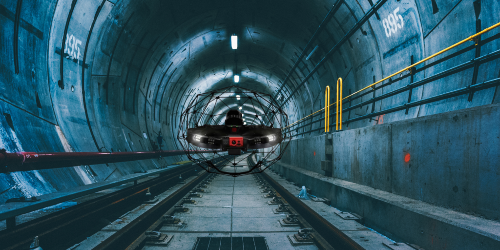
The Elios 3’s ability to create 3D maps in real time, fly without GPS, operate in low light conditions with its onboard 16K-lumen lights, and tolerate collisions in confined spaces with its unique “drone in a cage” design made it ideally suited for subway inspections.
3D Maps in Real Time
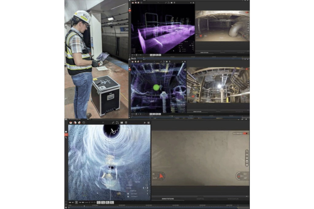
The Elios 3 comes with software that allows it to create 3D maps in real time using SLAM (Simultaneous Localization and Mapping). These maps showed the location of the drone as it flies, allowing pilots to fly even when they couldn’t see the drone and to capture the location of georeferenced defects on a 3D map that could be reviewed later.
Introduction
The U.S. Department of Transportation (US DOT) Volpe Center is focused on advancing transportation innovation for the public good.
In furtherance of that mission, the Volpe Center, in collaboration with the Federal Transit Administration, commissioned a Phase III SBIR demonstration of UAV use cases in transit work. The project was led by MTRI Inc., a small business that levels the intellectual property and innovations that arise from research funded by Michigan Technological University.
MTRI Inc. began its work for the Volpe Center by investigating the ways drones can be used to automate assessments for highway-rail grade crossings.
The third phase of the UAV transit project went underground, taking inspectors into the Chicago subway to test drones in the uniquely challenging environment presented by transit tunnels and related infrastructure.
This case study shares the findings from the tests conducted for the third phase of the project, in which structural engineering company Enspect Engineering helped MTRI Inc. perform tests of the Elios 3 indoor drone and two other drones in subway tunnels to see if they could meet the needs of the US DOT.
Customer Needs
Can a drone fly underground? And, if so, how can it be used, and what kinds of data can it collect?
These questions were the primary focus for the US DOT’s underground testing.
The three main use cases the US DOT wanted to test were:
- Using drones for emergency response in a subway transit system.
- Using drones for person detection in a subway transit system.
- Using drones for safety and structural assessments (i.e., inspections) in subway tunnels.
For all three use cases, the DOT had two main goals:
Goal 1: To Develop and Test Underground Drone Technology
Flying a UAV underground presents several challenges, including low lighting, confined space operations, unforeseen obstacles, and the need to fly with little to no GPS.
The US DOT wanted to see if cutting edge professional drone technology could support drone operations in these harsh conditions.
Goal 2: Collect LiDAR and Thermal Data to Inform Inspection Efforts
Thanks to breakthroughs in drone technology, inspectors can now collect several types of data by drone, not just visual data.
Project leaders wanted to test LiDAR and thermal sensors mounted on a UAV to see what kinds of data they could collect, and what its quality would be, for transit use cases in an underground environment.

Solution
To find a location for its subway drone tests, MTRI Inc. partnered with the Chicago Transit Authority (CTA), which provided two out-of-service subway tunnels. Both tunnels were located in central Chicago, one near the UIC-Halsted entrance and the other near a closed section of the CTA Old Incline tunnel entrance.
In addition to finding the location for the tests, MTRI Inc. needed to identify the right drones for the job. Based on past experience, MTRI Inc. personnel knew that Flyability’s Elios 3 would be best suited for the environment. They also wanted to test two other drones, which they did not expect to perform as well as the Flyability platform.
In total, here are the three drones that MTRI Inc. selected to fly in the Chicago subway system as part of these tests:
- Flyability’s Elios 3*—drone expected to perform
- DJI’s Mavic 2 Pro
- DJI’s Mavic 2 Enterprise Advanced (with dual optical thermal camera)
*The Elios 3 was tested with and without a FLIR Vue Pro R thermal camera
To source the drones and get skilled pilots who could fly them and who were familiar with inspections in confined spaces, MTRI Inc. partnered with Enspect Engineering, a structural engineering firm based in Merrillville, Indiana known for its expertise not only in drone inspections, but a wide range of projects, including industrial and commercial buildings, industrial and manufacturing structures, retrofits, repairs, component design, facility and building assessments as well.

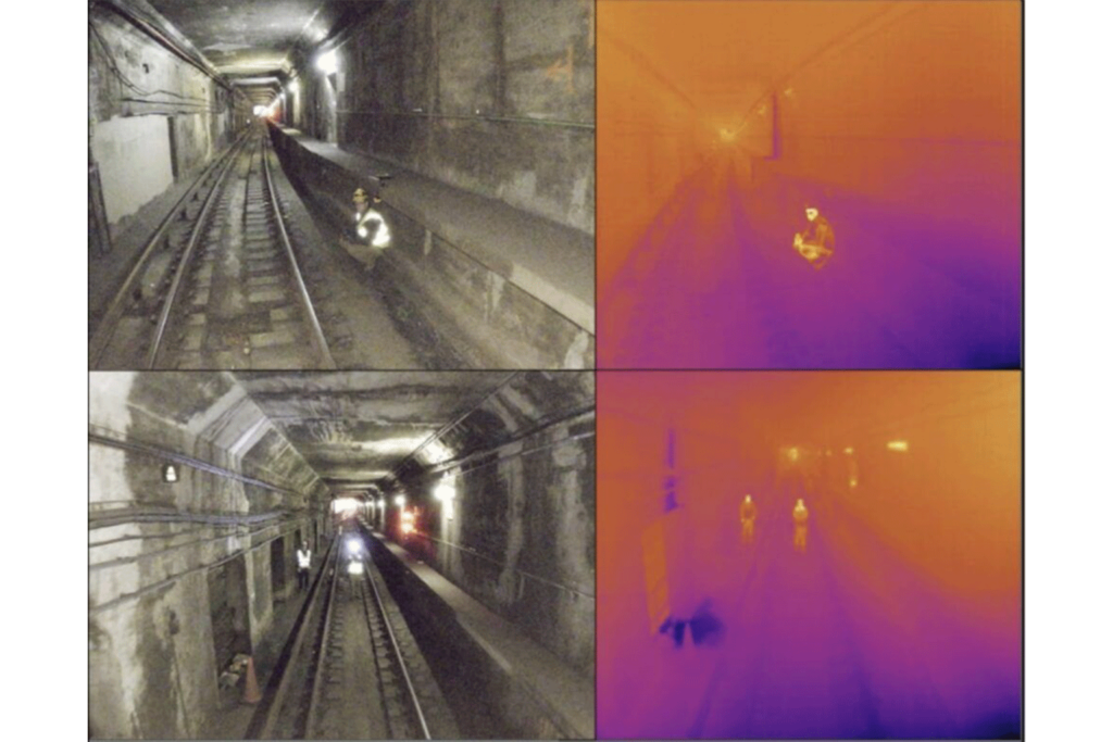
Visual and thermal images collected by the Elios 3 in the underground environment
Enspect Engineering is a long-standing client of MFE Inspection Solutions, and has trusted our team for years for help with finding the best inspection technology available, including Flyability’s Elios 3 and other drones and inspection tools.
“MFE Inspection Solutions is our trusted partner for finding the best inspection tools on the market. They always know about the most cutting edge technology, especially when it comes to finding the right inspection tool for a specific use case—and that’s especially true for finding the right drone technology for individual inspection scenarios.”
Stephen C. Taylor, Associate Principal/Drone Technology Lead at Enspect Engineering
Results
The tests were a success. The Enspect Engineering team demonstrated that drones could support all of the use cases the US DOT wanted to investigate, including inspections, finding missing people, and emergency response work.
Of the three drones tested, the Elios 3 was a standout, allowing the US DOT to perform all of the types of work it wanted to with ease.
“The findings underscore the potential of drones, especially the Flyability Elios 3, to provide valuable data while minimizing risks to humans. The project demonstrates the feasibility of using drones for emergency response, person detection, and structural assessment in subway tunnels, indicating a significant step forward in enhancing transit safety and operational efficiency.”
Enspect Engineering Report on the US DOT UAV Transit Tests
Here’s how the Elios 3 met the two main goals for the project:
Goal 1: To Develop and Test Underground Drone Technology
The Elios 3 exceeded expectations for the tests in multiple test scenarios, including detection of uninspected hot objects, hiding or obscured individuals, electrical infrastructure, wet locations and seeps, and damage to walls and ceilings.
Because the Elios 3 was designed to operate in underground environments, it was able to overcome all of the challenges found in the subway system, including flying without GPS, flying in confined spaces with obstructions present, and flying where there is little to no light.
Goal 2: Collect LiDAR and Thermal Data to Inform Inspection Efforts
The Elios 3 comes with a visual camera for visual data collection and a LiDAR sensor from Ouster. It can also carry sensors from third parties, allowing the field team to attach a FLIR Vue Pro R thermal sensor to it for thermal data collection.
The team found the quality of all three types of data it collected with the Elios 3—visual, LiDAR, and thermal—was of high-quality, and could be used to perform all of the tasks they needed.
- Visual data was used for defect detection in tunnel infrastructure and to identify wet locations and seeps that could indicate condition defects in tunnel walls.
- LiDAR data was used to create 3D models in real time, allowing pilots to fly even when they couldn’t see the drone and showing the precise location of defects in three dimensions review after completing data collection.
- Thermal data was used for heat mapping and thermal anomaly detection, including in test equipment, subway electrical infrastructure.
Why Did the Elios 3 Stand Out?
Here’s what made the Elios 3 a clear winner among the three drones Enspect Engineering helped the US DOT test:
- Made for underground operations. The Elios 3’s ability to create drone 3D maps in real time, fly without GPS, operate in low light conditions with its onboard 16K-lumen lights, and tolerate collisions in confined spaces with its unique “drone in a cage” design made it ideally suited for subway inspections.
- Made for inspections. Inspectors can store, measure, and identify points of interest (POIs) in the Elios 3’s data using Flyability’s proprietary Inspector software, making it “a very useful tool for subway inspection, including safety assessments.”
- 3D maps in real time. The Elios 3 comes with software that allows it to create 3D maps in real time using SLAM (Simultaneous Localization and Mapping). These maps showed the location of the drone as it flies, allowing pilots to fly even when they couldn’t see the drone and to capture the location of georeferenced defects on a 3D map that could be reviewed later.
- High-quality data. The Elios 3 collected LiDAR and visual data with its onboard sensors and thermal data with a mounted FLIR Vue Pro R, demonstrating its ability to execute a variety of subway inspection tasks, including 3D modeling, defect detection, and heat spot mapping.
- Ease of use. Elios 3 proved to be easier to fly and generally easier to use for conducting safety assessments in an underground environment than the two other drones tested.
What’s Next?
Additional testing of the Flyability Elios 3 platform in the subway environment is currently being considered.
This testing may include testing in smoke-filled tunnels, which would mimic a subway derailment.
Testing for operations during a possible subway derailment would also include using the Elios 3’s new Survey Payload in order to more accurately map the condition of a derailment, and to identify blocked entries to the subway to support the work of first responders.
Share
